Super Typhoon Haiyan Could Be Strongest Storm to Ever Make Landfall | Winds up to 220 m.p.h.

SnowBrains | | Post Tag for WeatherWeather
Enhanced satellite image of Super Typhoon Haiyan showing the telltale "donut" appearance of an intense tropical cyclone. Credit: U-Wisconsin-CIMSS via Twitter/@Ryan_Maue.
Enhanced satellite image of Super Typhoon Haiyan . Credit: U-Wisconsin-CIMSS

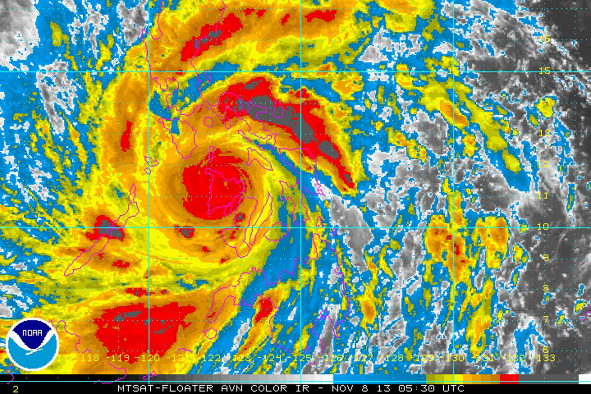
Super Typhoon Haiyan may have the highest wind speed of any storm to ever make landfall.  Winds were blowing 195mph with gusts up to 220mph when the storm first hit the Philippines today.  Wind speeds in this range are extremely rare.

Only 3 storm have ever been recorded with wind speeds near this magnitue:  Hurricane Camille in 1969, Super Typhoon Tip in 1979, and Hurricane Allen in 1980.

A resident walks past high waves pounding the sea wall amidst strong winds as Typhoon Haiyan hit the city of Legaspi, Albay province, south of Manila on November 8, 2013.  photo:  huffington post
A resident walks past high waves pounding the sea wall amidst strong winds as Typhoon Haiyan hit the city of Legaspi, Albay province, south of Manila on November 8, 2013. photo: getty images

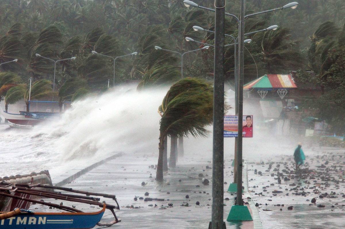
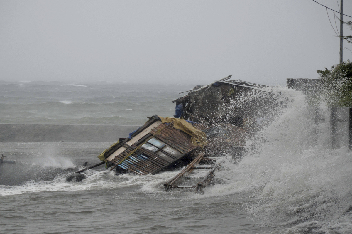
The Philippines are being hit by Haiyan right now and large scale damage is forecasted to occur and has already occurred.  A foot of rain is forecasted and storm surge is predicted to bring 23-foot waves to Philippine shores.  Those big waves combined with a forecasted 16.4-foot storm surge high tide today is a deadly combination.

image by NOAA, Friday Nov. 8, 2013. taken at 12:30 a.m. EST shows Typhoon Haiyan as it hits  the Philippines.
image by NOAA, Friday Nov. 8, 2013. taken at 12:30 a.m. EST shows Typhoon Haiyan as it hits the Philippines.

Super Typhoon Haiyan Statistics:

– Category 5 Hurricane (highest, most destructive category)

– Hitting the Philippines right now

– 600km (372 miles) wide

– Winds are blowing between 175 and 220 mph

– A foot of rain is forecasted

– 4.5 million people evacuated

Wide-angle satellite image showing Super Typhoon Haiyan approach the Philippines. Credit: Facebook/EUMETSAT.
Wide-angle satellite image showing Super Typhoon Haiyan approach the Philippines. image: EUMETSAT.
A house is engulfed by the storm surge brought about by powerful typhoon Haiyan that hit Legazpi city, Albay province Friday Nov.8, 2013.  photo:  huffington post
A house is engulfed by the storm surge brought about by powerful typhoon Haiyan that hit Legazpi city, Albay province Friday Nov.8, 2013. photo: getty images


Related Articles

3 thoughts on “Super Typhoon Haiyan Could Be Strongest Storm to Ever Make Landfall | Winds up to 220 m.p.h.

Got an opinion? Let us know...