
Tahoe got drilled with snow last week. Kirkwood got 112″ in 7 days. Today it rained a bit… But this weekend looks good again.
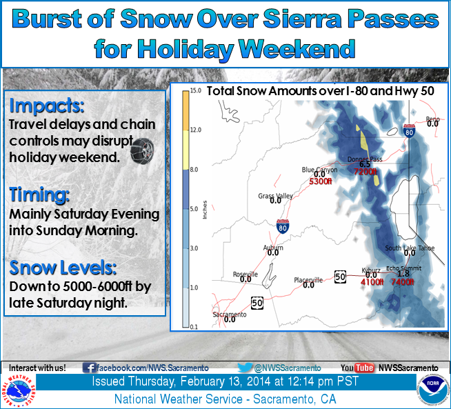
Tahoe is forecasted to see around 6-12″” of snow above 7,000 feet. Snow levels should be around 5,000 to 6,000 feet with this storm, so no more rain.
Saturnday night into Sunday morning a colder system will dive further South bringing some light snowfall to the area. The European model has precip beginning to fall by 10 p.m. and the GFS not until the early morning hours. The snow levels look to be around 8000 ft. at 4 p.m., 7000 ft. by 10 p.m. and 6000 ft. by 4 a.m. With the timing of the precip it looks like most of it will fall as snow above 7000 ft. We could see 3-6 inches on the mountains above 7000 ft. by Sunday morning, and up to 9 inches West of the lake along the crest. At lake level we could see a coating up to 3 inches of snow. – opensnow.com
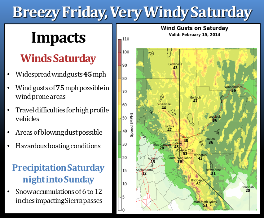
Breezy conditions will continue on Friday with near record high temperatures. Saturday and Saturday night will be very windy with widespread gusts to 45 mph and gusts to 75 mph in wind prone areas. On Saturday night an area of precipitation will move into the Sierra. Snow levels are expected to drop to 5000-6000 feet in the central and northern Sierra with 6-12 inches of snow impacting Sierra passes. – NOAA Reno, NV
A wet system is forecast to move through over the weekend bringing additional rainfall, and snowfall above 5000-6000ft. The main impact will be Saturday evening through Sunday morning over the Sierra passes, so high elevation travel is discouraged during this time. – NOAA Sacramento, CA