Tahoe’s storm is on track to start delivering snow tomorrow and continue through Thursday. Snow level’s will hover around 7,000 feet initially before lowering to 6,000 feet on Thursday. A foot of snow could fall about 8,000 feet.
NOAA:
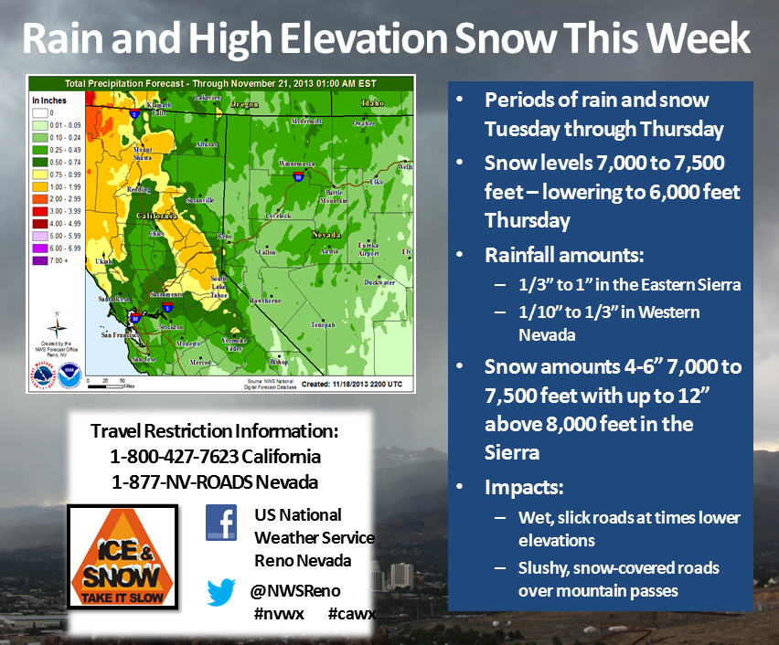
“Periods of rain and high elevation snow are expected across the Sierra and Western Nevada this week as a Pacific storm moves into the region. The rain and snow will begin late tonight and continue into Thursday with snow levels averaging 7000 to 7500 feet, before falling to near 6000 feet Thursday. This image shows forecast liquid precipitation amounts across the Sierra and Western Nevada through 1 AM Thursday. Main impacts will be due to road conditions with wet, slick roads likely in the lower elevations due to rainfall and slushy, snow covered roads over the higher mountain passes above 7000 feet.” – NOAA
Way cool, a foot of cement is a good start…