Two snowmobilers triggered an avalanche near Independence Pass in Colorado on April 7, that caught, carried, and injured one of them. Additional information from the CAIC has just been released, detailing the extent of the snowmobiler’s injuries. The organization said in a Facebook post:
On April 7, a snowmobiler triggered and was caught in an avalanche south of Independence Pass. The rider and his partner worked hard to evacuate themselves after the accident. Two broken legs prevented him from riding out given the trail conditions.
The avalanche is reported to have been a size D2 which is big enough to bury, injure, and kill a person. Despite breaking both his legs, the rider survived and was transported to awaiting medical attention. The full report from the CAIC can be read below:
Avalanche Comments
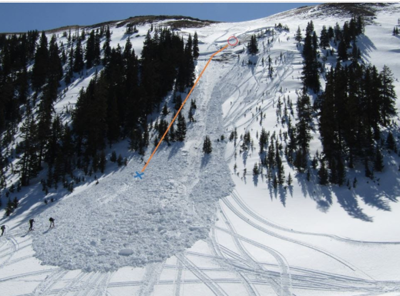
This was a hard slab avalanche unintentionally triggered by a backcountry snowmobiler. The avalanche was small relative to the path, but large enough to bury, injure or kill a person. The slide broke on a layer of faceted snow about 6 inches (13cm) above the ground (HS-AMu-R2D2-G). This was a persistent slab avalanche.
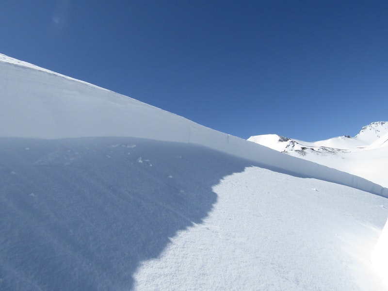
The avalanche released near treeline on a sparsely-treed, north northwest-facing slope around 35 degrees in steepness. The slide ran around 700 vertical feet down a sparsely treed slope and to the open gully below. Avalanche debris piled approximately 5 to 8 feet at the deepest places.
Backcountry Avalanche Forecast
The Colorado Avalanche Information Center’s (CAIC) backcountry avalanche forecast for the Sawatch zone on April 8 rated the avalanche danger as Moderate (level 2 of 5) at all elevations. Loose Wet avalanches were listed as the primary avalanche problem type, highlighted on all aspects and elevations except above treeline on northeast and east-facing slopes. The likelihood of triggering was possible and the potential size was small to large. The CAIC summary for the Sawatch zone read:
“You will find a variety of avalanche issues related to wet loose snow today. Like shave ice, snow cones, and Slurpees, wet loose avalanches are about the snow texture and amount of water. Different texture, many flavors possible, but the same ingredients. Avalanches will become more likely and easier to trigger as the day warms and sunshine pounds on slopes. Wind and clouds will slow the warming. Reassess the snowpack frequently throughout the day or as you change slopes. The boot test is a great indication of dangerous snow. Stand on the snow surface in your boots. Avoid steep slopes and seek shadier terrain before the snowpack fails either of the tests.
Standing in ankle-deep snow is an indication you can trigger wet loose avalanches in the surface snow. They usually start on slopes steeper than about 35 degrees. They can be surprisingly powerful, and even small sluffs can take you for a nasty ride into trees, rocks, or gullies. You will find this shallow wet snow at higher elevations and on shadier slopes.
If you punch through to the ground when you stand on the snow, wet avalanches could become large. They may gouge deeply in the snow or to the ground and entrain a destructively large amount of snow. You can find the unconsolidated snow on shady, low elevation slopes, or on sunny, southerly facing slopes near and below treeline. This could be a particular issue in the afternoon or on your return to the trailhead.”
Weather Summary
From April 1 to 7 the Brumley SNOTEL site, at 10,601 feet in elevation and about 2 miles east of the avalanche site, recorded 2 inches of new snow. The overall snow height settled five inches during that period. Daytime temperatures at Brumley were in the mid 40s Fahrenheit, with overnight lows in the mid 20s. Winds recorded at the Copper Mountain METAR weather station, at 12,074 feet in elevation and about 35 north of the avalanche site, were from the southwest at 15 to 25 mph.
Snowpack Summary
The Brumley SNOTEL site recorded 28 inches of snow with 2.2 inches of snow water equivalent (SWE) during October 2019. A cool and dry November allowed the October snow to develop into the layer of depth hoar, in which the avalanche broke. Strong west and southwest winds dominated the weather during most of the winter. Winds eroded snow from many northwest- facing slopes near and above treeline. Any snow cover that persisted on these slopes consisted of shallow, stiff snow layers of wind-drifted snow resting over the depth hoar. Snowpit tests at the accident site showed crack propagation in the depth hoar about 6 inches above the ground (ECTP13 ↑13cm).
Events Leading to the Avalanche
Riders 1 and 2 met at the winter closure of Highway 82 on the eastside of Independence Pass around noon on April 7. Rider 1 had 6 years of experience riding around Independence Pass. It was Rider 2’s first time in the area. Both riders carried avalanche rescue equipment (transceiver, shovel, probe) and Rider 1 wore an airbag.
Their plan was to ride in the Mountain Boy Gulch area. They traveled up the old road from the Brumley town site and into Mountain Boy Gulch.They observed several other snowmobile tracks from the day prior. They rode in the main gulch until around 3:30 PM, and then up a small drainage to the south. They eventually reached a saddle at the top of this drainage where they stopped and talked about their plan, which included riding on the slope that eventually avalanched.
Accident Summary
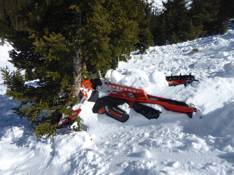
Around 4:00 PM, Rider 1 and 2 rode in the small trees to the climber’s right of the avalanche path. Then Rider 1 ventured into the main avalanche path. Rider 1 highmarked twice in the main path while Rider 2 continued to ride in the trees.
Rider 2 then rode up the center of the main path. He began his turn at the top when the avalanche released above him.
Rider 1 was watching Rider 2 from below, and commented that the avalanche “moved slowly, then picked up speed at the bottom.” Rider 1 kept his eyes on Rider 2 as he traveled downhill in the flow of the avalanche. He lost sight of him momentarily as he passed through a stand of trees, then saw him on the surface of the snow as the debris came to rest. Rider 1 asked Rider 2 if he was OK. Rider 2 replied that both his legs were broken.
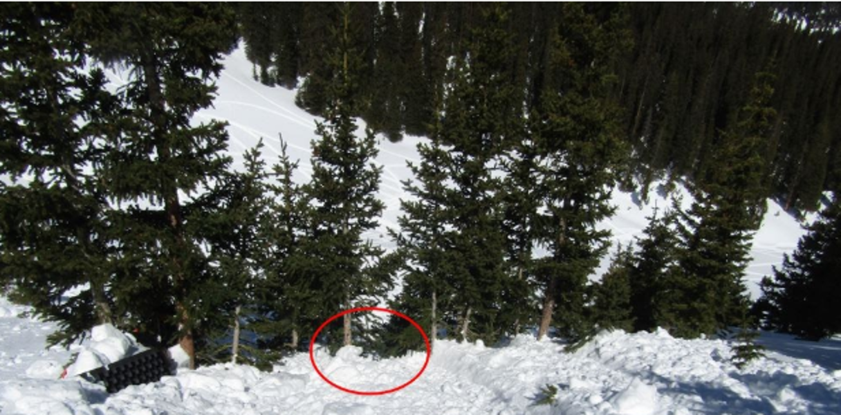
Rider 2 remembers his helmet and mouth becoming packed with snow as he was submerged in the flow of the avalanche. He tore his helmet off as he was tumbling to prevent the snow filling it from blocking his airway. His backpack was ripped off his back as he was pushed through a stand of trees. His snowmobile struck and was stuck in the stand of trees.
Rescue Summary
Rider 1 rode on to the avalanche debris and to Rider 2. One of Rider 2’s legs was severely angulated, and Rider 1 straightened it back to anatomical alignment. The pair discussed riding out on one snowmobile, but decided that would not be possible given the large blocks of debris.
Rider 1 left to cut branches for splints, while Rider 2 dragged himself off the debris. Rider 1 splinted Rider 2’s legs and helped him onto the snowmobile. They rode back toward the trailhead. After traveling a little over a mile, they determined they could not keep the snowmobile upright on the off-camber road they had ascended. There were no other viable options for egress, so they decided that Rider 2 would wait on the road while Rider 1 went for help.
Rider 1 snowmobiled another mile to the trailhead, then drove 7.5 miles before he had cell service. He called 911. He also called Responder 1, a friend. Responder 1 drove to the trailhead. Rider 1 and Responder 1 rode the snowmobile back and reached Rider 2 about 7:40 PM. They brought a reflective jacket and blanket with them. They wrapped Rider 2 in the jacket and blanket.
Around 8:00 PM, the three heard the Flight for Life helicopter circling over the basin. Rider 1 began waving his flashlight and snowmobiled out into the basin to get the pilot’s attention. The helicopter landed on Highway 82, about 500 feet from Rider 1. Rider 1 helped the flight medics to Rider 2. They loaded Rider 2 into a sled, carried the sled until they could use the snowmobile to tow him to the helicopter. Flight for Life evacuated Rider 2 to a hospital.
Comments
Riders 1 and 2 worked hard to evacuate themselves after the accident. Rider 2’s injuries prevented him from riding out given the trail conditions. Although the pair responded to the injuries, the remote location and lack of cell service lead to a lengthy rescue. A satellite GPS communication device could have improved communication, allowing friends to bring resources in sooner or organized rescue to reach the riders faster.