The New iPhone 14 Will Have Satellite Emergency SOS Messaging Satellite Connectivity Apple announced at its iPhone 14 launch on Wednesday that the new phone will have a satellite connectivity feature called Emergency SOS via Satellite. The feature will allow owners to send text messages when they don’t have cellular coverage. This is a massive win for the backcountry, off-road, and trail-riding community, as well as anyone who finds themselves off […] Backcountry Brent Thomas | September 9, 2022 0 Comments
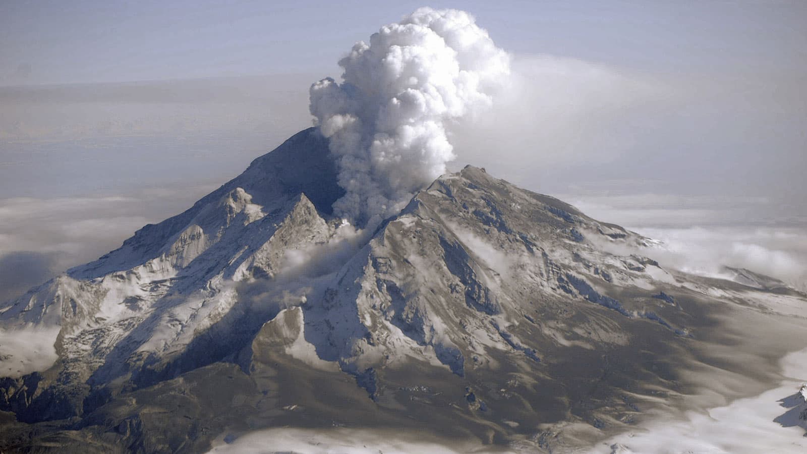
NASA Satellites Detect Signs of Volcanic Unrest Years Before Eruptions New research methods may lead to earlier predictions of volcanic eruptions. Written by Esprit Smith, NASA’s Earth Science News Team Although there are telltale signs that a volcano is likely to erupt in the near future – an uptick in seismic activity, changes in gas emissions, and sudden ground deformation, for example – accurately predicting such eruptions is notoriously hard. […] Brains SnowBrains | April 19, 2021 0 Comments
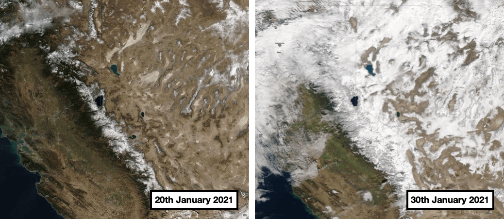
Sierra Snowpack: What a Difference 10-Days Makes From zero to hero! The atmospheric river that hit California last week, dumping up to 100″ of fresh snow and more on ski areas, has significantly impacted the snowpack in the Sierra Nevada. Related: 13 Deepest Snowpacks in North America Right Now Check out these two satellite images, taken just 10-days apart, before and after the storm. And it’s not finished yet. […] WeatherBrains | February 1, 2021 0 Comments
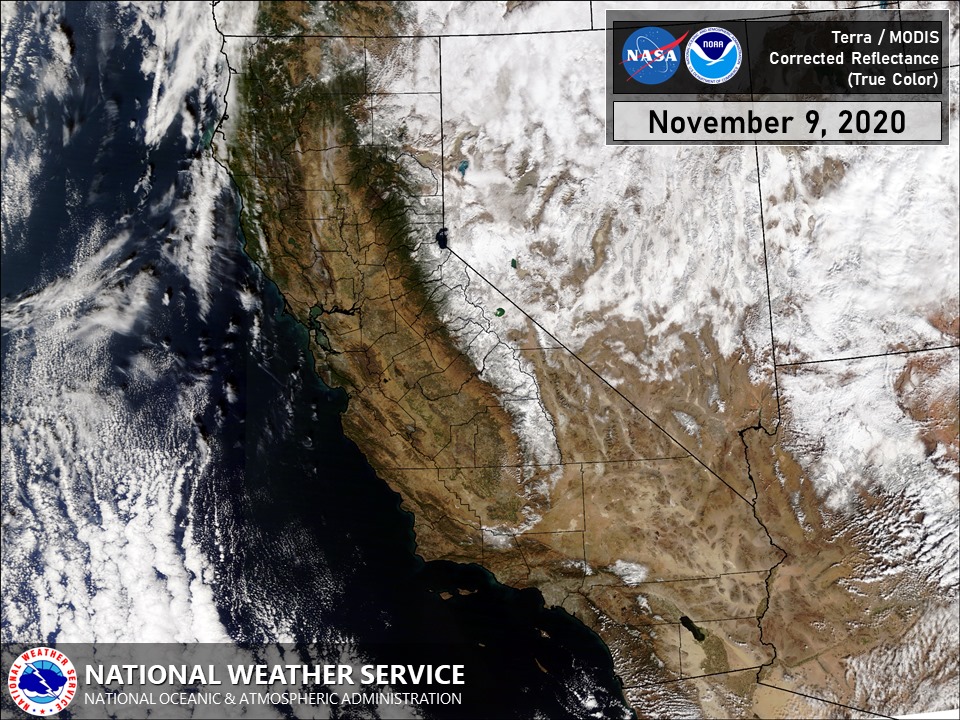
Smoke Finally Clears in California Allowing Polar-Orbiting Satellite to Capture First Images of Snow this Year California, that you? Thought we lost you there for a minute… After the worst fire season in modern history for California, much of the smoke from wildfires throughout the state has apparently cleared, allowing this polar-orbiting satellite to capture images of snow mountains. The National Weather Service wrote in a social media post yesterday: It’s been awhile since we’ve been able […] Weather WeatherBrains | November 10, 2020 0 Comments
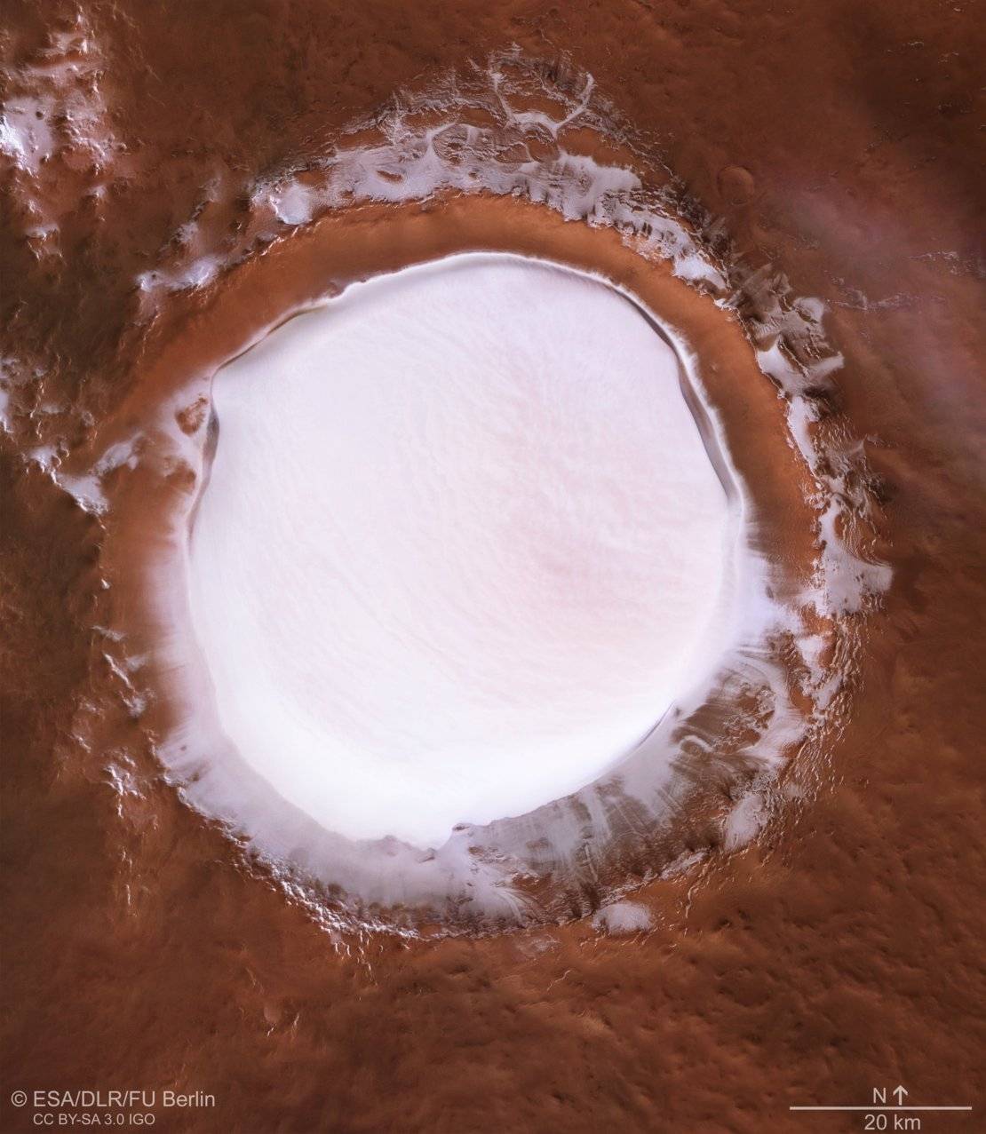
Korolev Crater: Stunning New Footage of Huge Icy Martian Lake The European Space Agency has released stunning new footage of a huge icy Martian lake. The lake is found in the Korolev crater which is located in Mars’ northern lowlands. The crater was created by an asteroid impact, and its unique shape helps preserve the ice. The European Space Agency, or ESA, captured the footage of the Korolev crater using […] Lynn Barlow | July 9, 2020 0 Comments
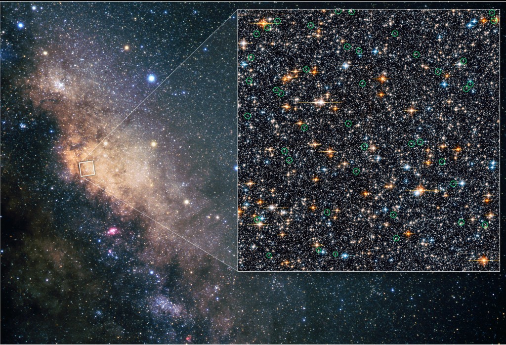
First Full-Sky Map Produced By eROSITA/Spektr-RG A German/Russian space program has advanced the field of intergalactic observation and discovery. An instrument specialized to take x-ray images, called the eROSITA mounted on the Spektr-RG, has just rendered some totally wild images of our universe. To give a sense of awesomeness, the image-producing instrument has been placed in orbit around our earth a cool 1.5 million kilometers out […] Elliot Levey | June 26, 2020 0 Comments
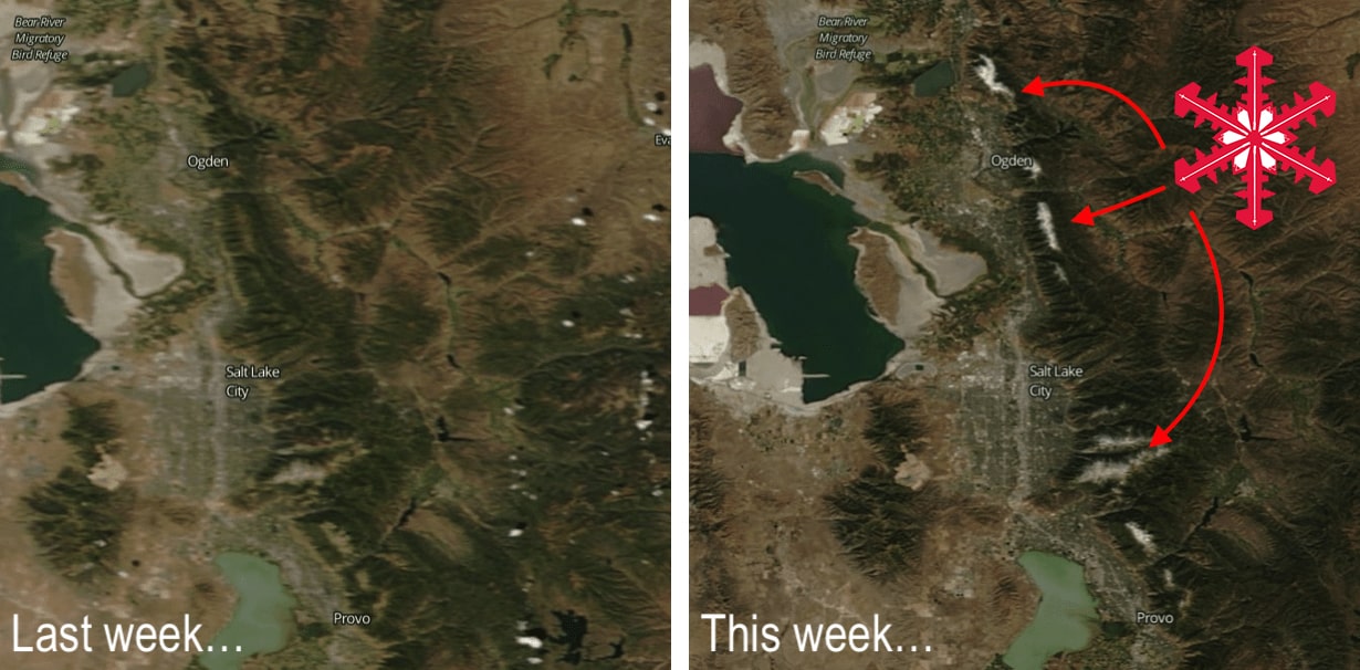
Satellite Images Just Days Apart Show Snow Accumulating Along the Wasatch, Utah There’s snow in those hills! If you live along the northern Wasatch in Utah you’ve probably already seen the white dusting on the higher peaks. Well, here is the before and after view from space. Related: Current 10-Day Snow Forecast for North America Looks Like Mid-Winter! And if the latest forecasts are to be believed, there’s a whole lot more on […] Industry News WeatherBrains | September 23, 2019 0 Comments
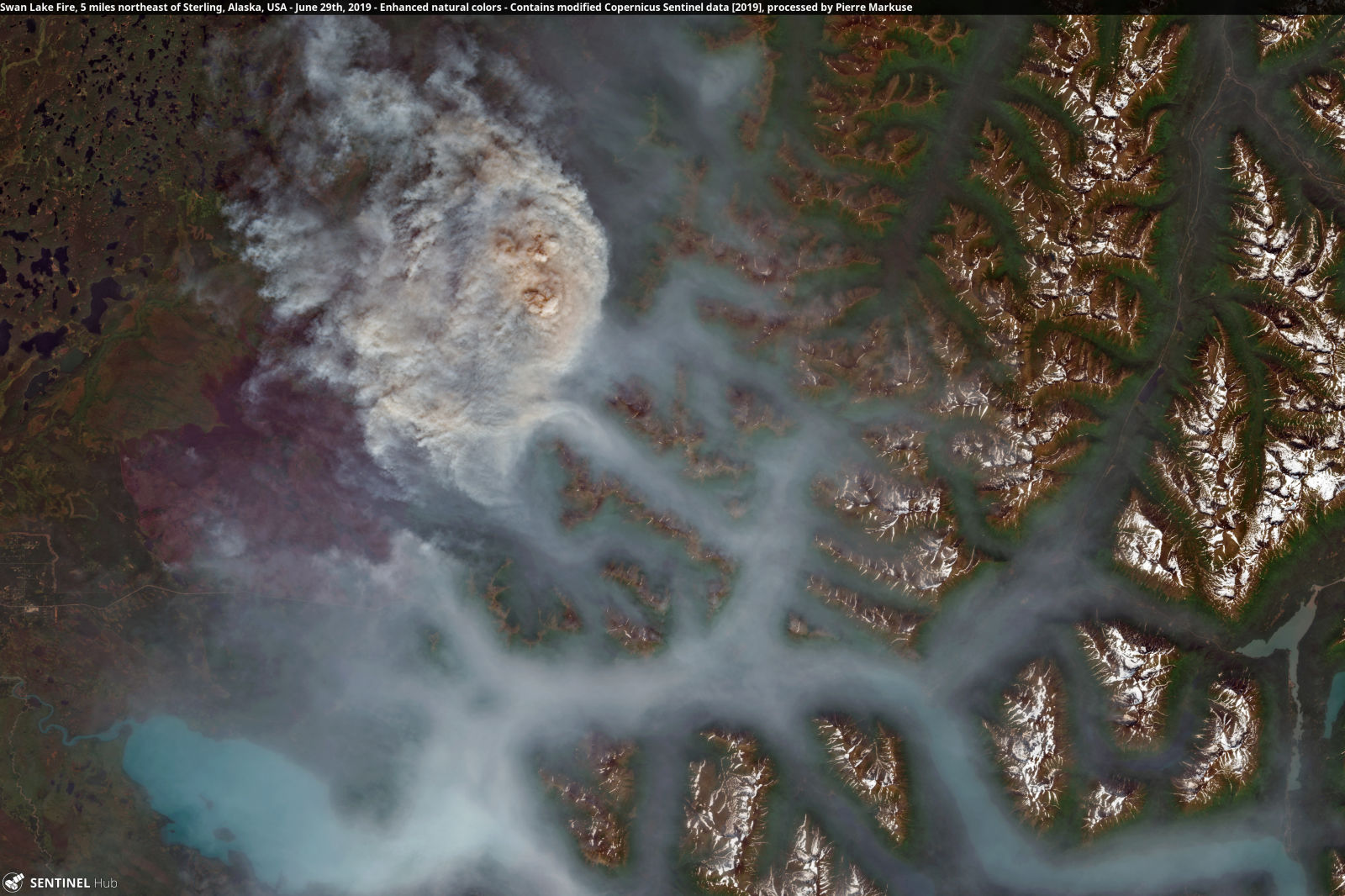
Rampant Wildfires in Alaska, Greenland, and Siberia Can be Seen From Space Huge areas of the Earth’s northern latitudes have wildfires burning right now due to the unusually hot weather that has engulfed a huge portion of the Arctic, from Alaska to Greenland to Siberia. The heat is responsible for creating conditions perfect for wildfires, including some enormous ones burning in remote parts of the region that are visible from space. Related: […] Fire Firebrains | July 19, 2019 0 Comments
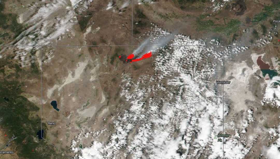
Destructive Wildfires in the West | Smoke From Martin Wildfire, Nevada Visible From Space NASA says smoke from a massive wildfire burning in northern Nevada is visible from space. Hot and dry conditions across much of the United States have created a perfect storm for wildfires in several states and the largest of those fires was burning over nearly 450,000 acres of land in Humboldt County, Nevada on Monday after just a few days. Officials […] Fire Firebrains | July 11, 2018 0 Comments
Turn Your Smartphone Into A Satellite Messenger With BivyStick [arve url="https://youtu.be/nyvqZ8OFQLY"] Jenah MacGrain | July 8, 2018 42 Likes 0 Tweets 0 Comments
Garmin inReach+ | The Ultimate Device for Staying in Contact in the Backcountry Every now and then it’s good to get off the grid. Spending time in the great outdoors without constant social media notifications nagging you for attention or your boss wanting a reply to their ‘urgent’ email. But being totally off-line brings its own problems. What if you get into trouble, what if you need to contact friends, family or emergency […] Gear Steven Agar | November 9, 2017 0 Comments
Large Avalanche Caught On Camera By NASA Satellite Over 20 Years Ago Large powder avalanches can quickly and easily reach speeds of 80mph, and don’t last for very long, so the fact that a NASA satellite managed to capture an image of one in action has been described as ‘a stroke of luck’. On April 17, 1996, satellite Landsat-5 was passing over the Karakoram Mountains, Pakistan, at the exact moment an avalanche […] Avalanche Steven Agar | July 19, 2017 0 Comments
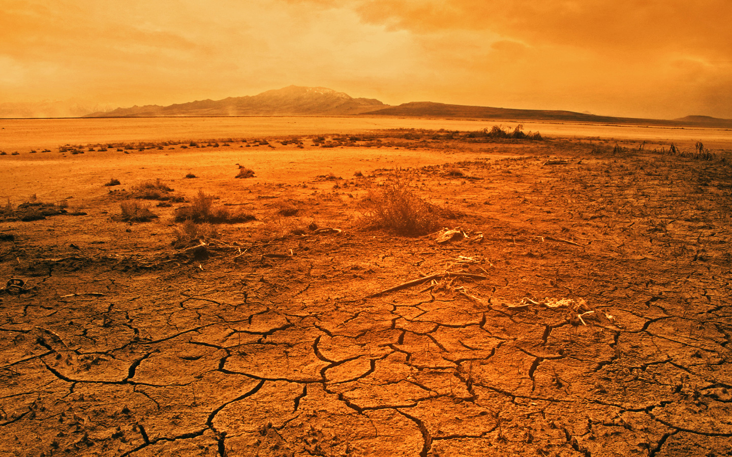
February 2016: Earth’s Warmest Month On Satellite Record At this point, climate change is no longer deniable. The evidence is everywhere around us from warmer than average sea surface temperatures to extreme drought and storms. February 2016 was the hottest month ever in the lower atmosphere, as gathered through data from satellites. On average, temperatures were 0.83 degrees Celsius warmer than the long term average, according to […] Weather Keenan Grady | March 8, 2016 2 Comments
NASA’s First Global Rainfall and Snowfall Map NASA’s Global Precipitation Measurement mission has produced its first map of global rain and snowfall. In the most detailed map of Earth’s precipitation that has ever been created, NASA scientists can follow the planet’s weather patterns in near real-time. NASA teamed up with the Japan Aerospace Exploration Agency (JAXA) to launch the GPM Core Observatory just over a year ago. The Core Observatory, which acts as a tuner to bring together measurements of 12 international […] Weather ameliatraynor | March 4, 2015 0 Comments