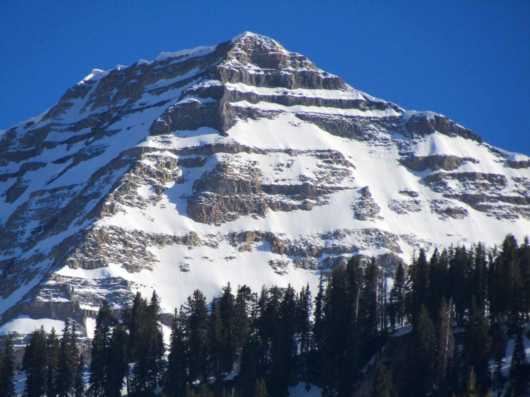
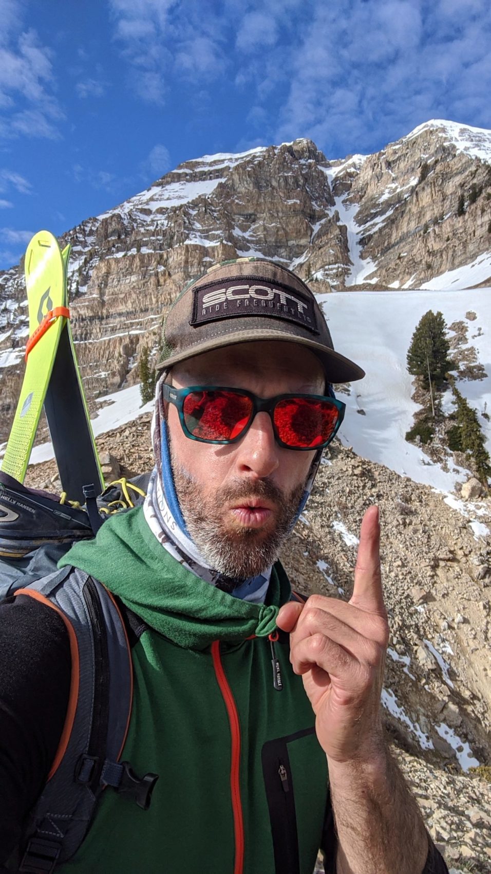
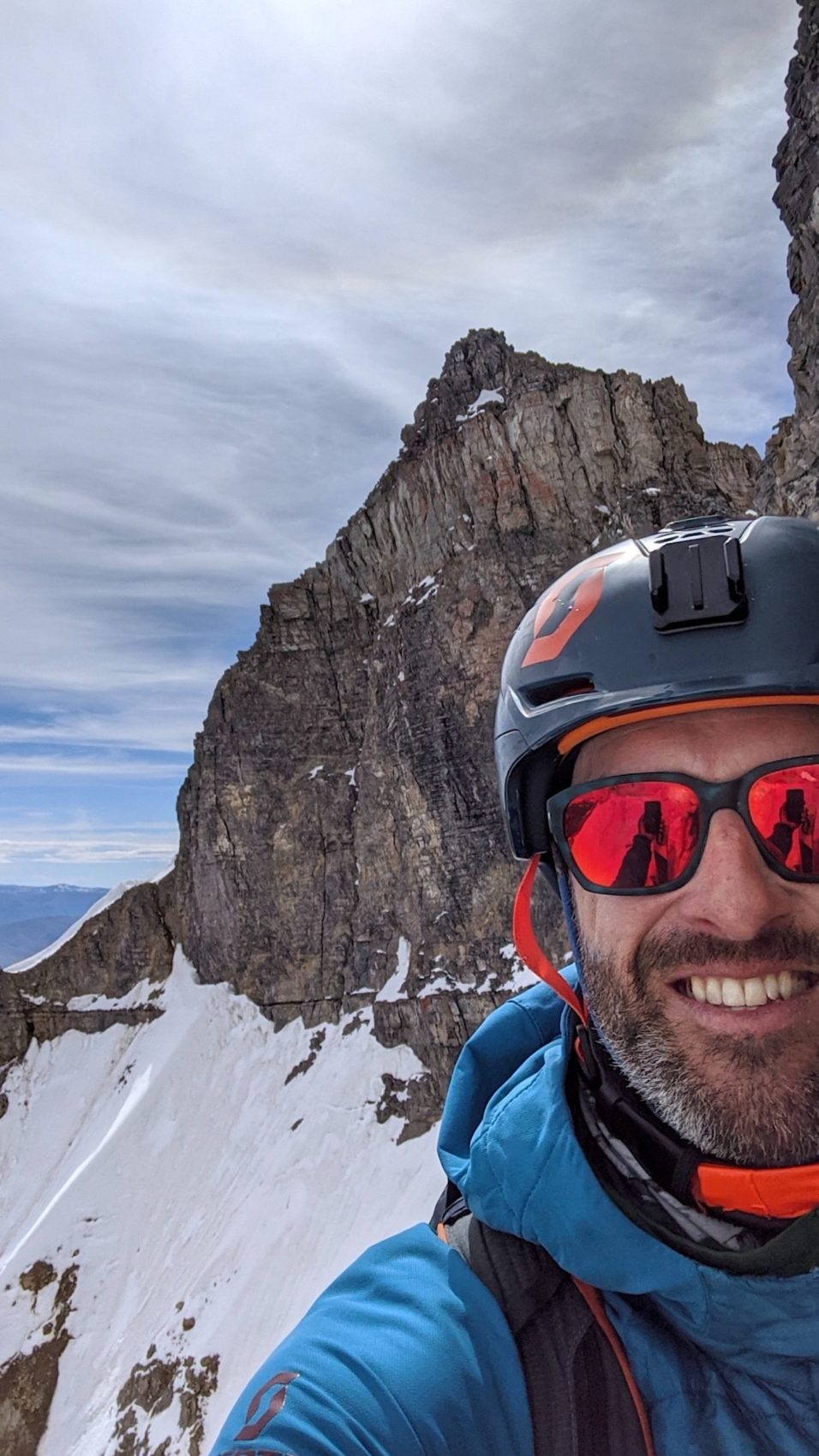
Yesterday, May 26th, 2020, I walked, bushwhacked, and crampon-ed my way up the legendary “Grunge Couloir” of Mt. Timpanogos in Utah.
I’d be lying if I said I’d slept great the night before skiing this thing.
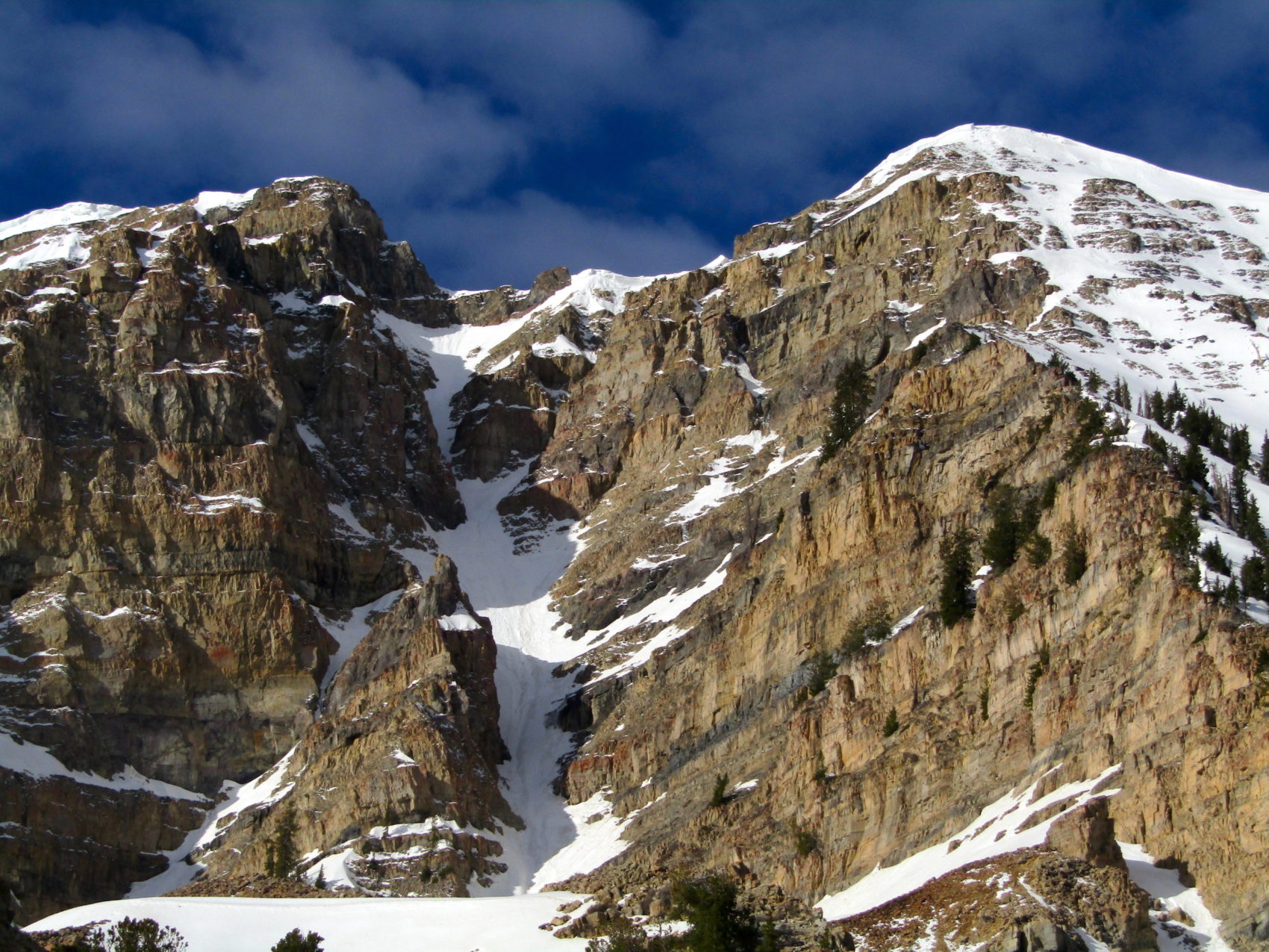
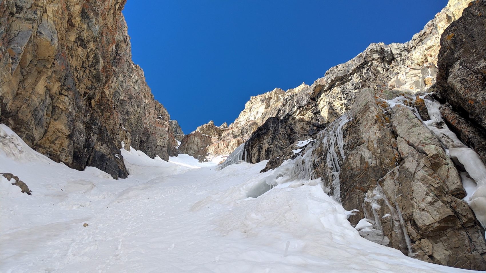
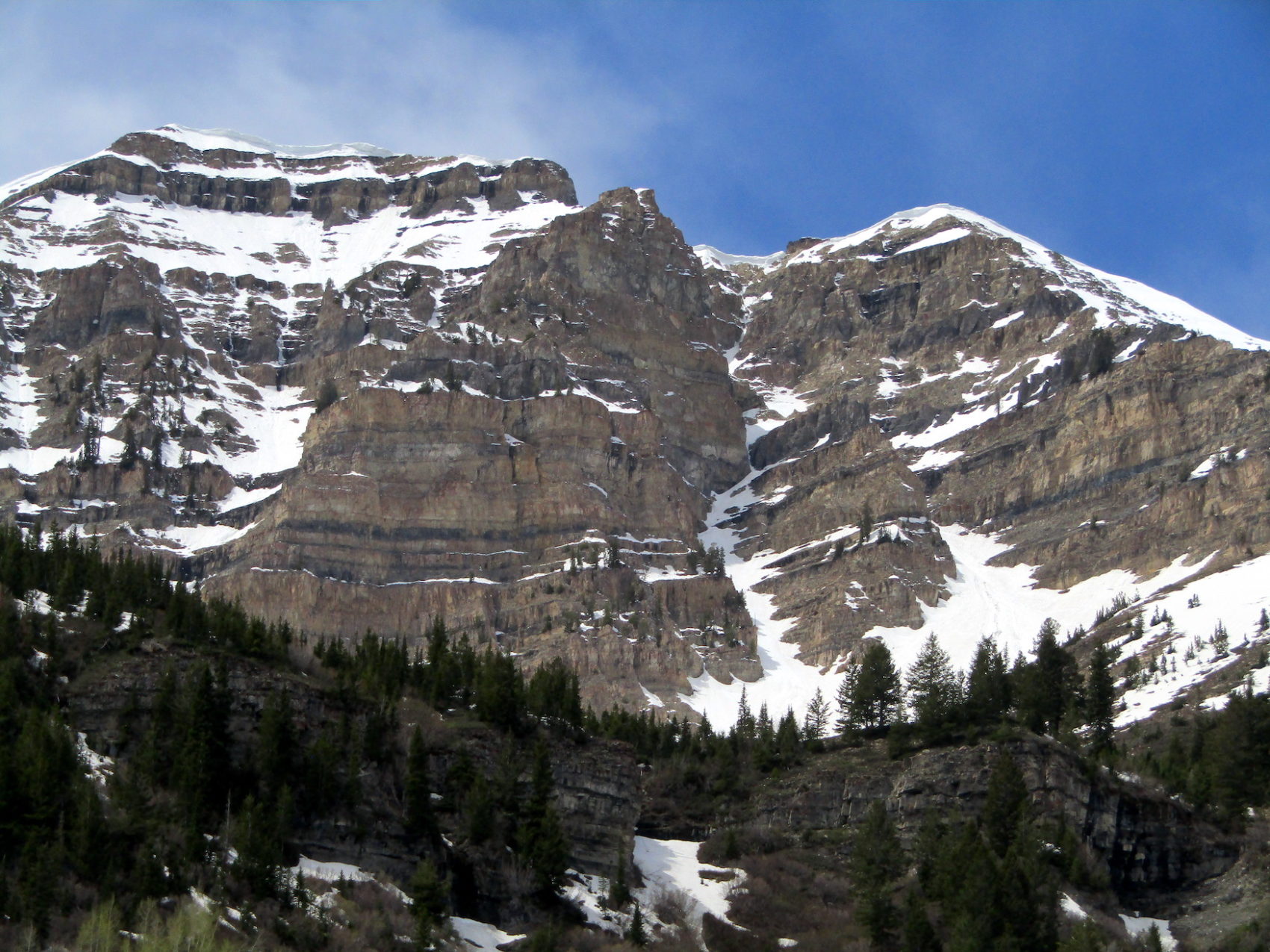
I was scared of the constant rockfall, of the ice in the chute, of the steepness at the top, and of the 62º no-fall-zone above a 1,000′ cliff on the initial turn…
“As serene and soothing as a Mud Honey concert in a hurricane.”
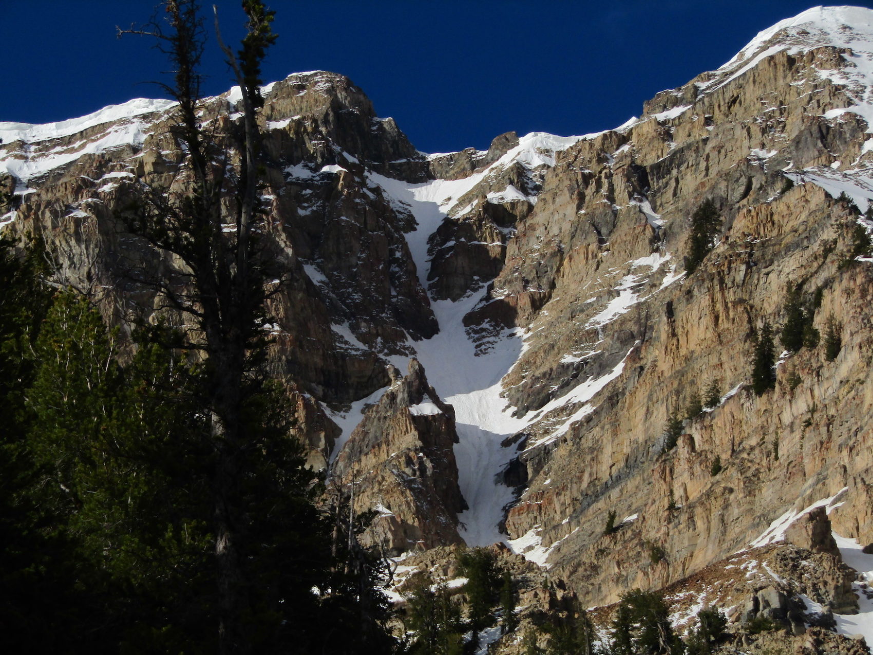
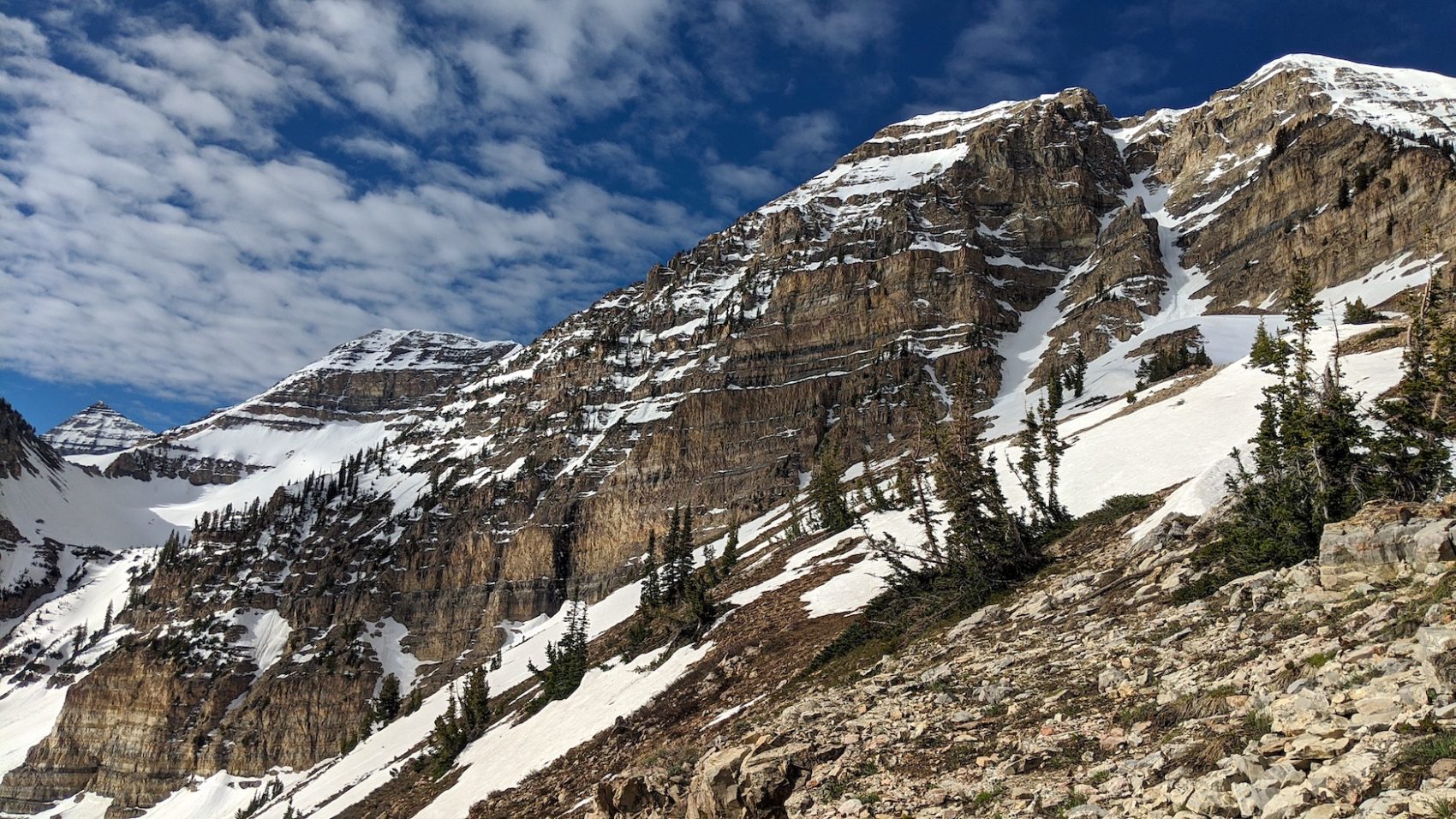
“The sides [of the chute] are line with towering, rotting rock walls that send down a constant barrage of buzzing missiles. Most of these find their way into a five foot wide semipermanent runnel that divides the already narrow chute from top to bottom like a bowl of pudding. Between the angle (over 60º at the top), the half-buried rocks and the runnel, there are enough objective hazards to keep even the most attention deficit disordered grunge rocker’s mind occupied.”
– Andrew McLean on the Grunge Couloir in The Chuting Gallery, 5/21/20
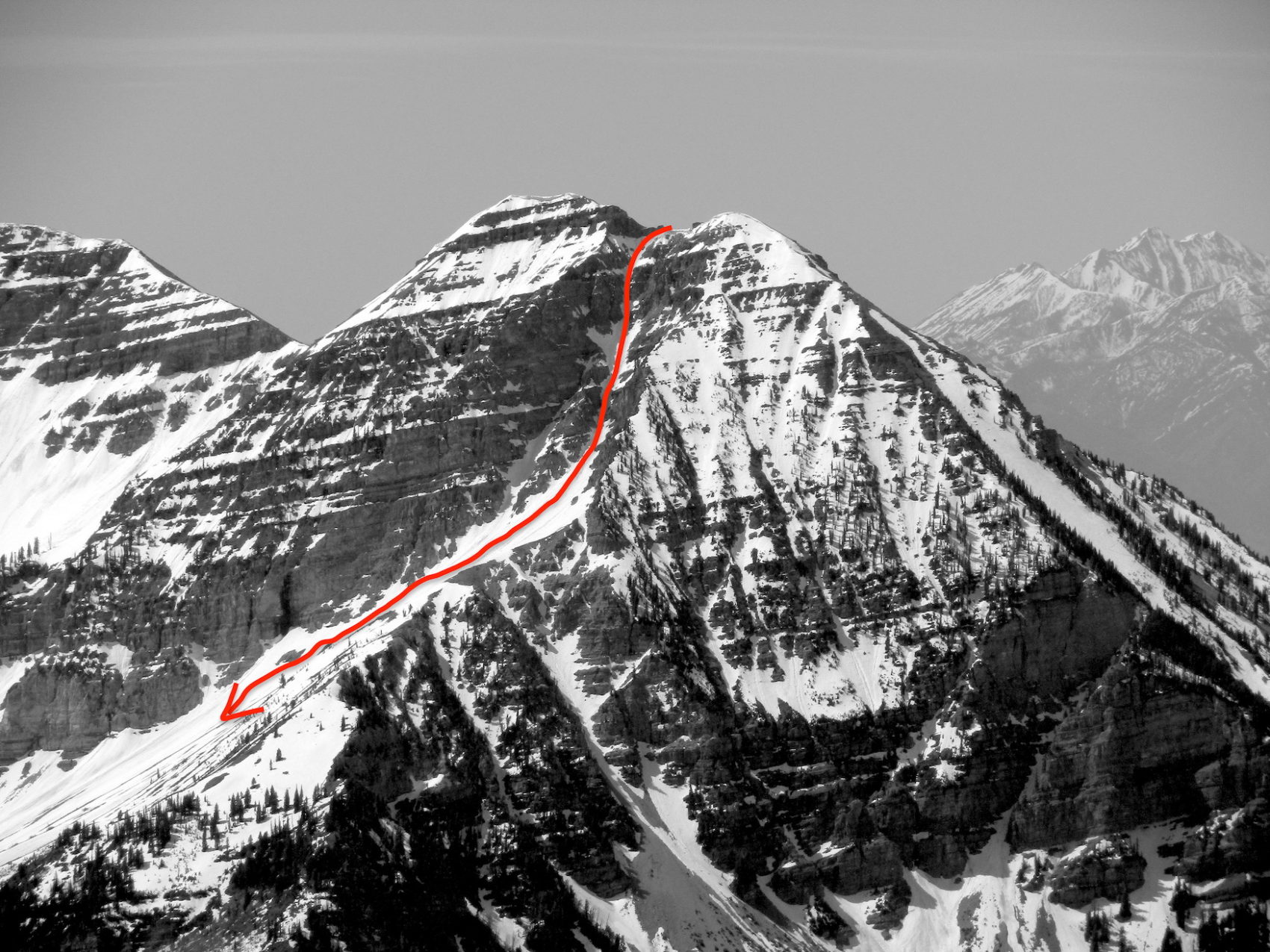
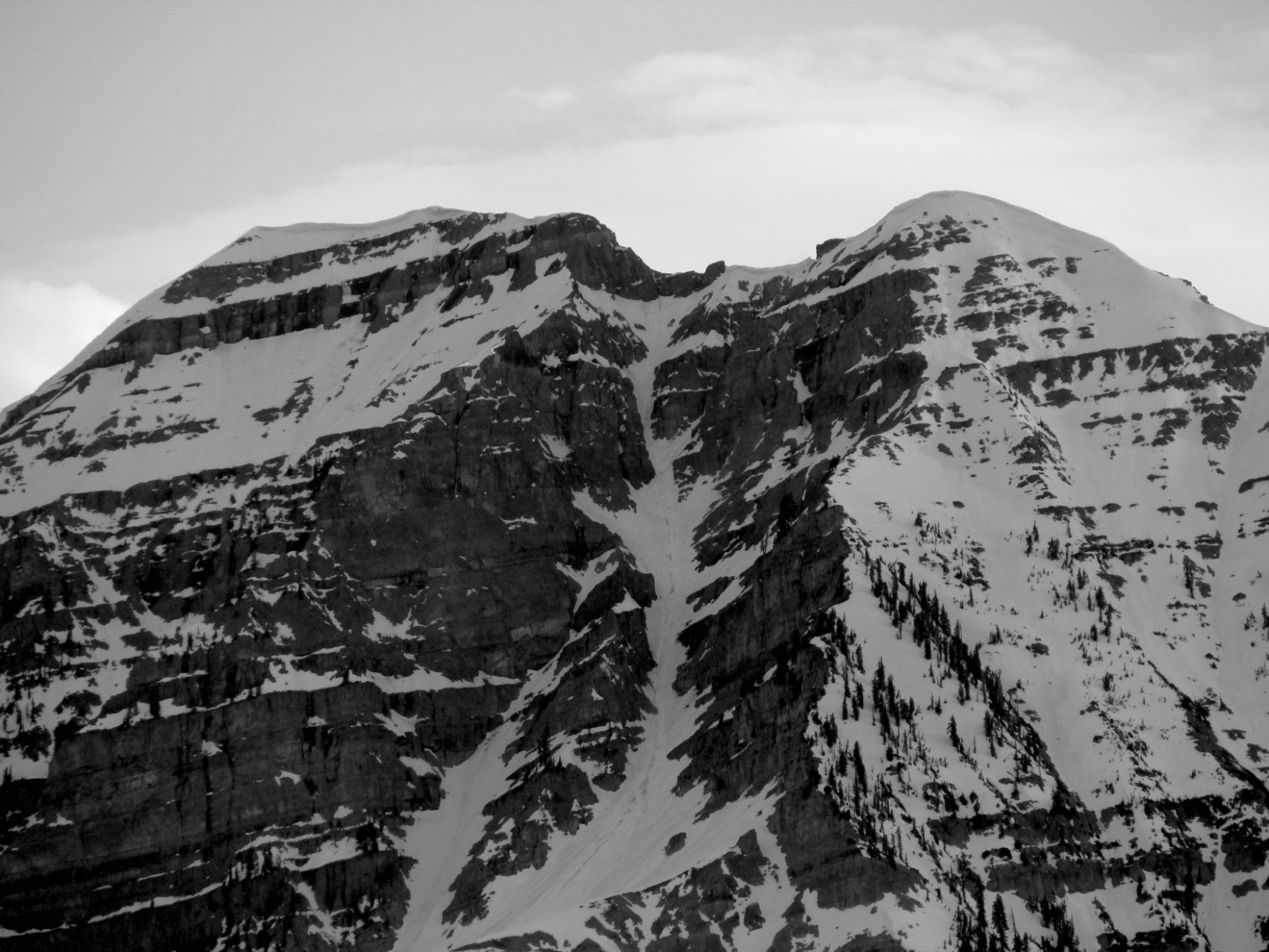
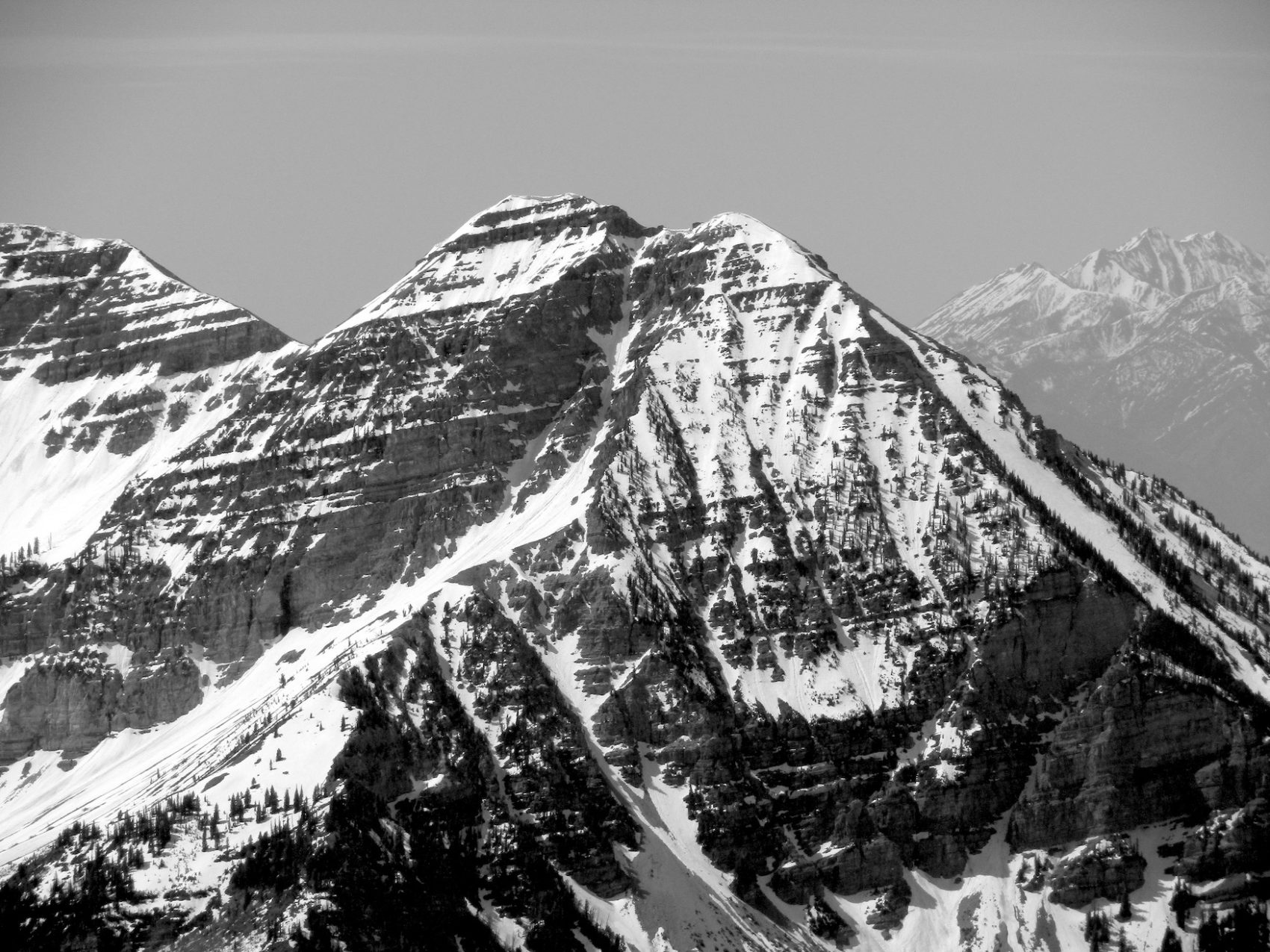
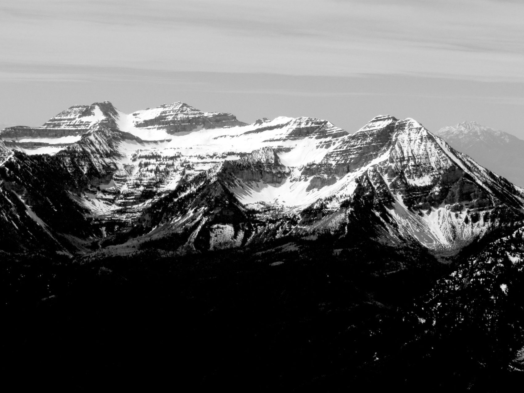
Grunge Couloir – Mt. Timpanogos, UT Details:
- Summit (actually a ridge): 11,200′
- Car: 7,500′
- Vertical From Car: 3,700′
- Vertical skied: 2,400′ (1,200′ in chute)
- Steepness Rating: S6 – Slopes continuously steeper than 55°. Painful death from falling highly likely.
- Max Pitch: 62º
- Aspect: NE
- Distance: 5-miles round trip
- Time From Car to Summit: 3 hrs 30 mins
- Car to Car Time: 5 hrs 30 mins
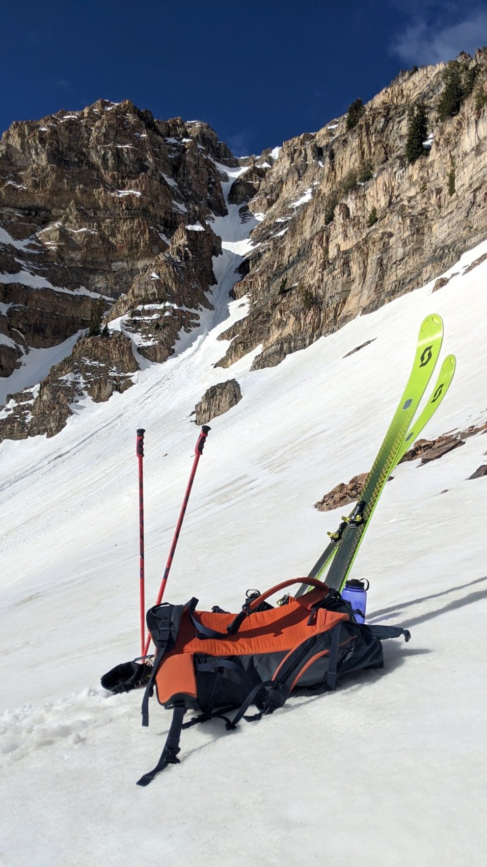
- Recommended Equipment: crampons, 2 ice axes, rope, harness, rappelling gear, no skins (all bootpacking for this date)
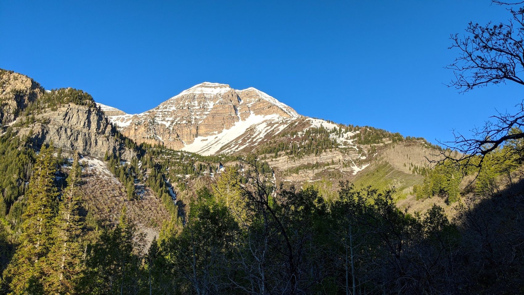
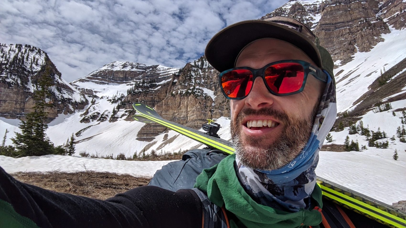
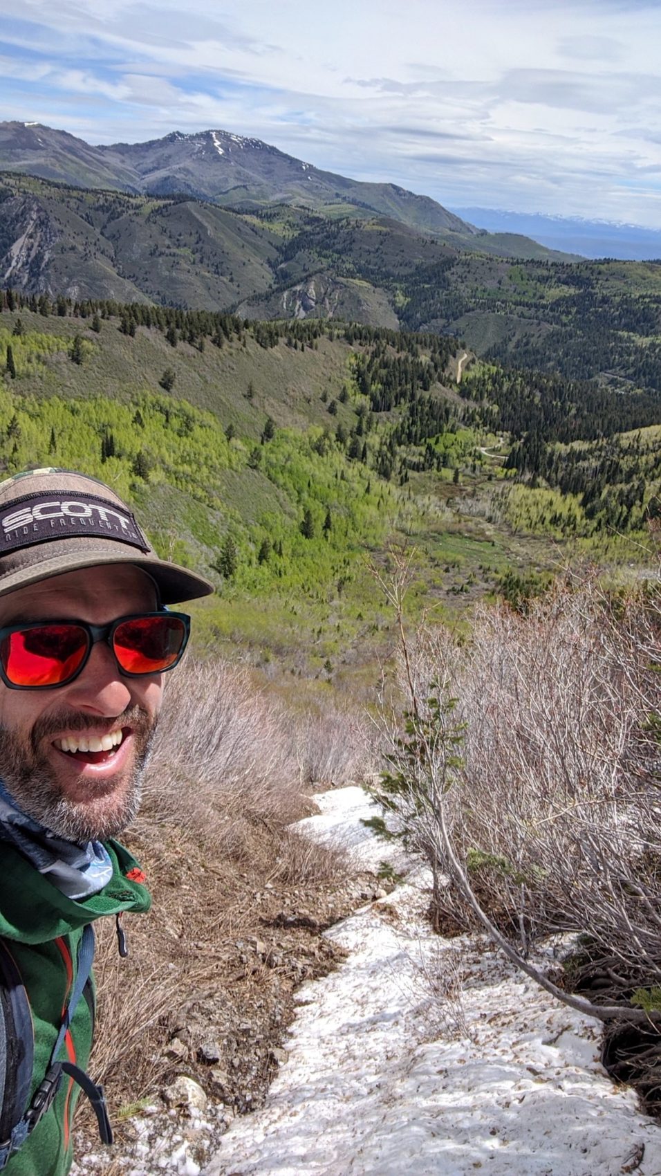
I started hiking at 6:30am from the Timpooneke Campground under clear skies and a temperature of about 38ºF.
The forecast for 10,500′ this day was a high 55ºF and mostly sunny skies.
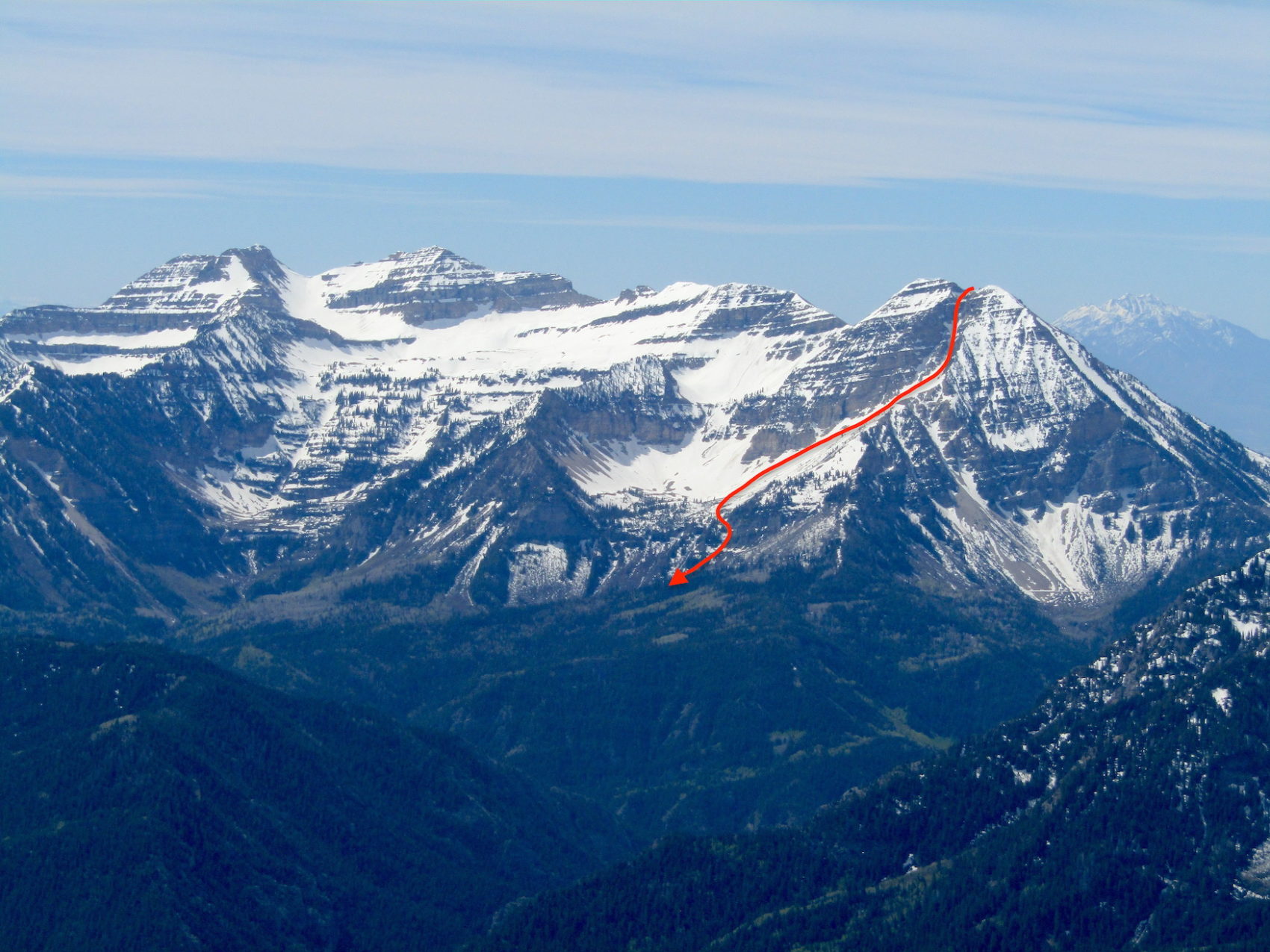
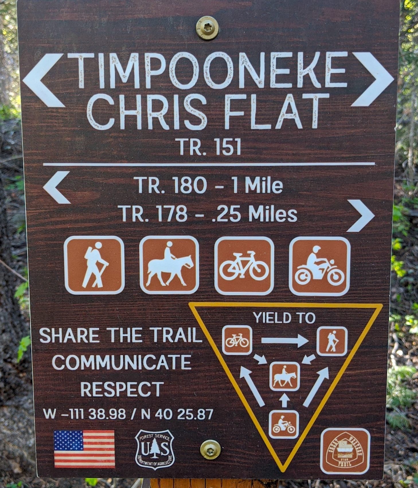
From the campground, I skipped along the Timpooneke Chris Flat Trail (trail #151) until the trail teetered upon a friendly ridge heading towards Mt. Timpanogos.
After a short stint on this ridgeline, the trail leaves the ridge to veer west.
I left the trail here and stuck to the ridge via a clearly defined game trail that continued up the ridgeline.
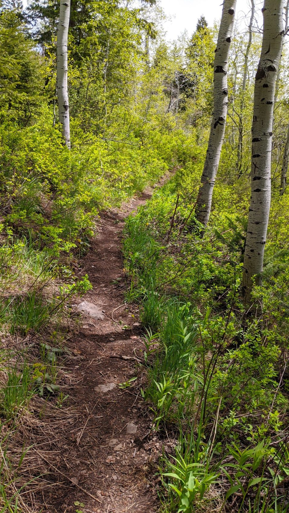
At first, the ridge was welcoming, then the game trail plunged into a stunted aspen patch and things got steep, dirty, and bushwhacky.
I’d rate this zone a 4 out of 10 on the bushwhack-o-meter.
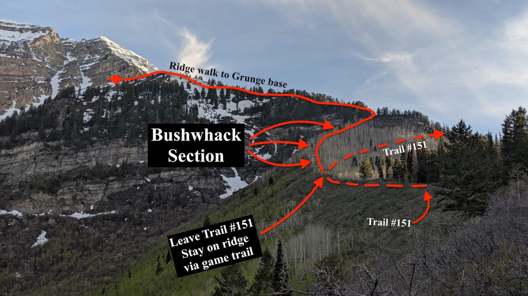
This bushwhack sector and the steep dirt ascent above it were the most difficult parts of the climb to me.
I continued up the ridge, stopping to put on my ski boots due to snow at about 9,600′.
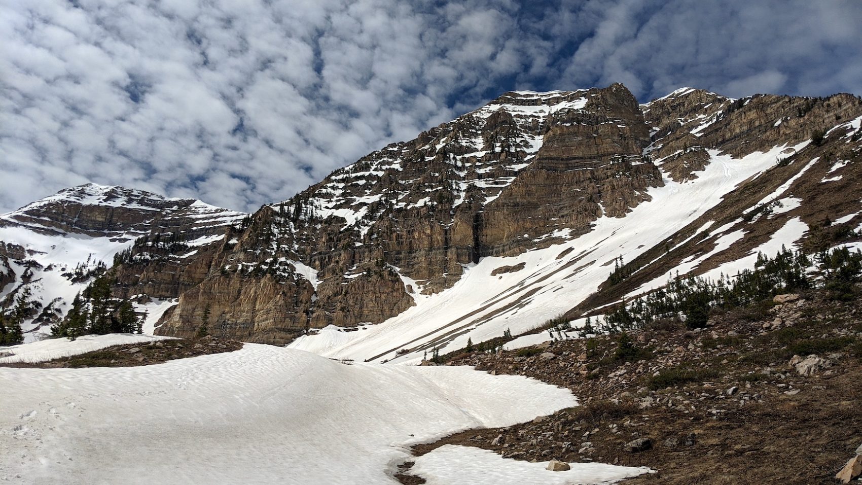
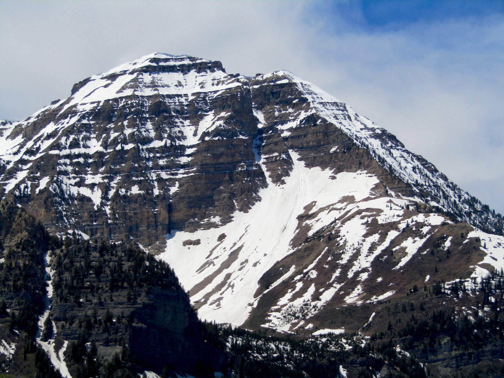
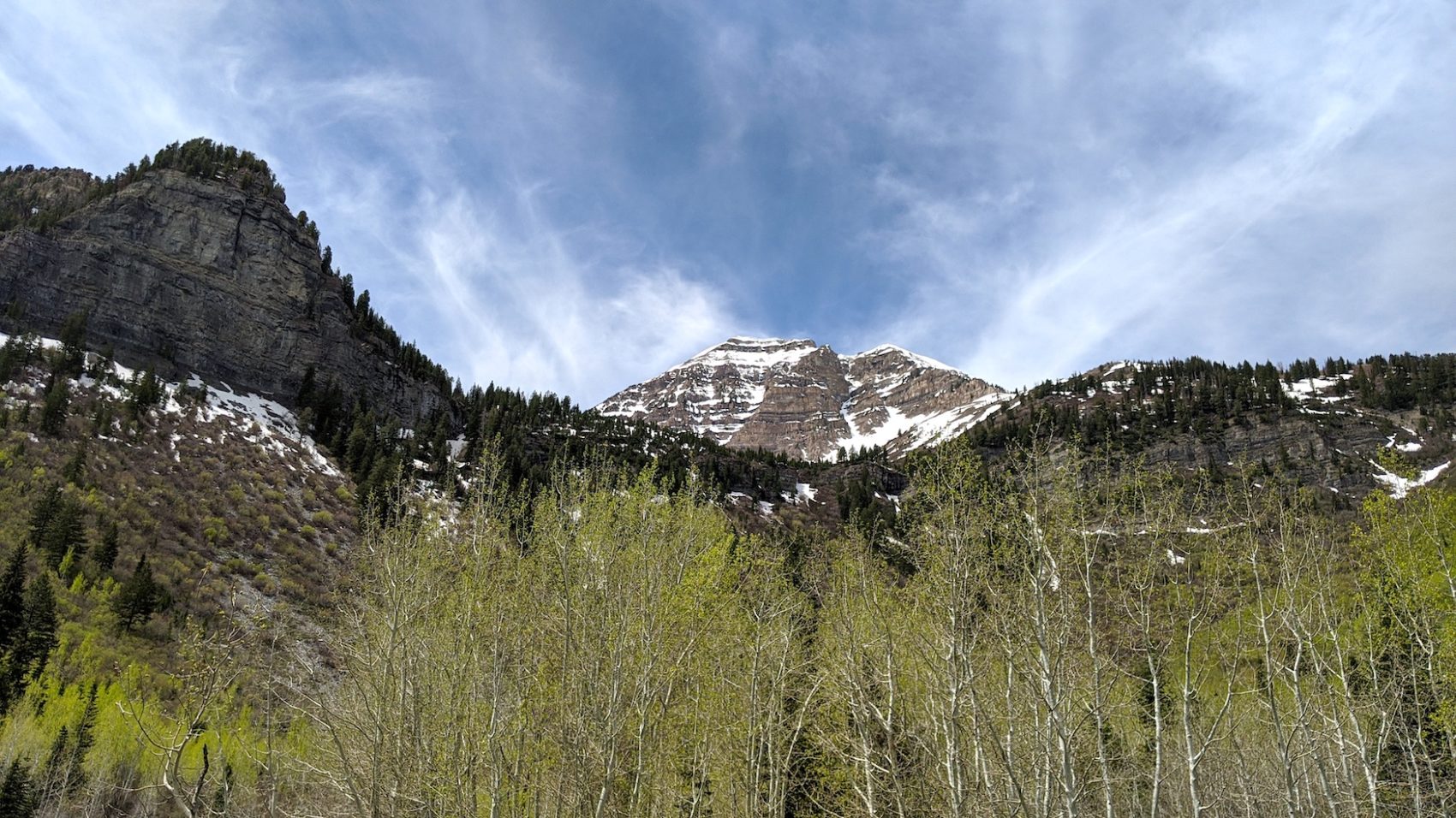
This ridge conveniently continued directly to the base of the “Grunge Couloir” (about 10,000′).
The final portion of the ridge walk was horribly pleasant with killer views in all directions.
It took me 2 hours and 30 minutes to get to the base of the couloir.
At the base of the couloir, I put on crampons and harness, unsheathed both ice axes, and made sure my rope was at the top of my pack.
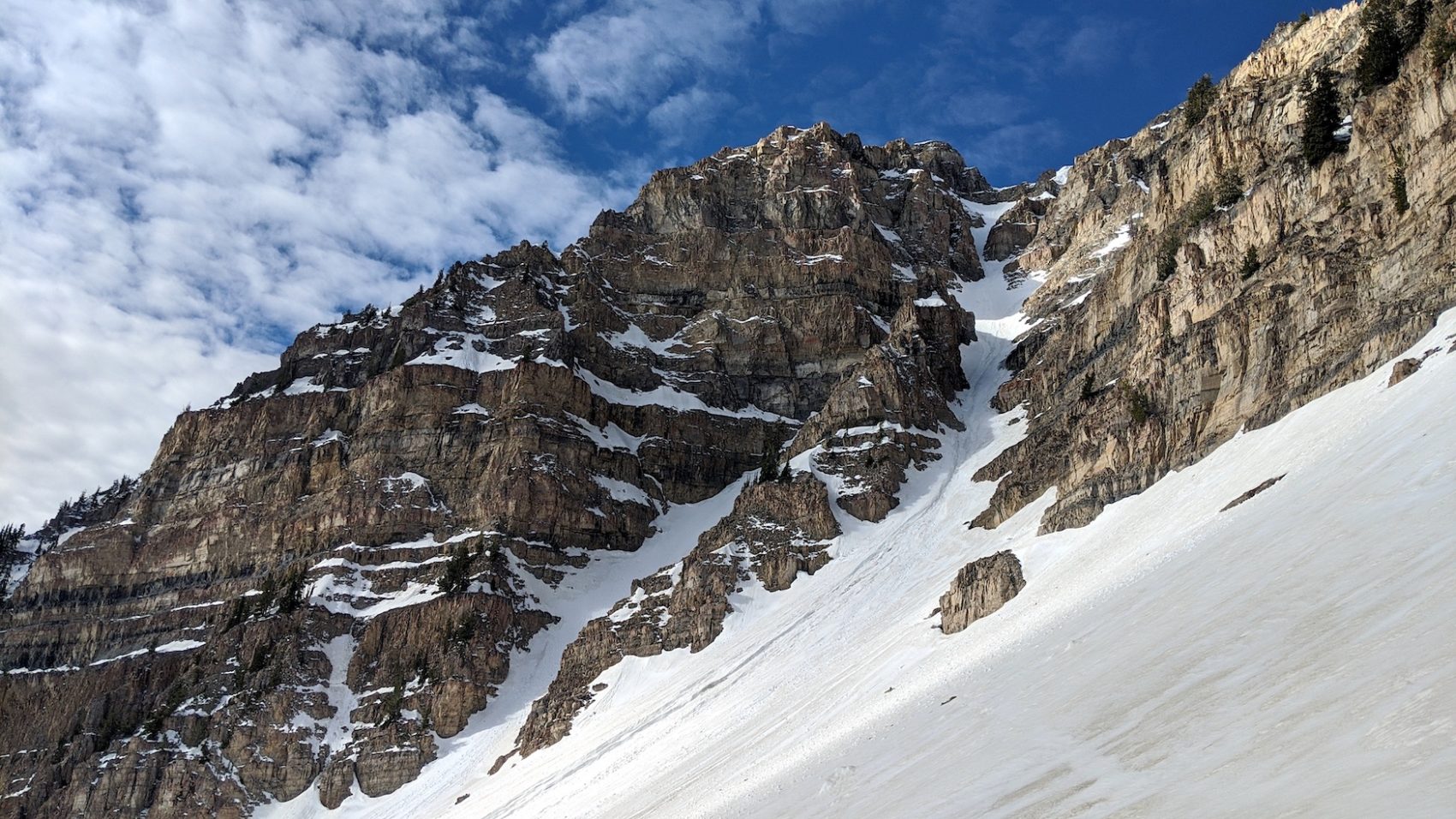
There’s an anchor at the top of the couloir that is used to rappel into the “Grunge”.
I began climbing up the chute with an ice axe in each hand going back and forth between self-arrest and self-belay grips depending on the steepness.
I was worried about the “Grunge Couloir’s” infamous and ubiquitous rockfall so I kept my eyes and ears trained upwards as I clambered along.
Thankfully, not one rock came down the chute during my ascent.
I think this was due to the recent snowfall (May 22nd 2020, 4-8″ of new snow) that lined the chute and gently caught rocks as they peeled off the imposing, rotten walls.
I’d purposely started my climb a bit later to allow the snow to soften with the sunshine and the warmth of the day.
My timing was good enough, the snow was soft enough, and the crampon-ing was sturdy enough.
I moved quickly up the chute, motivated by fears of rockfall and mini new-snow avalanches.
I emerged on top after 1-hour in the belly of the “Grunge”.
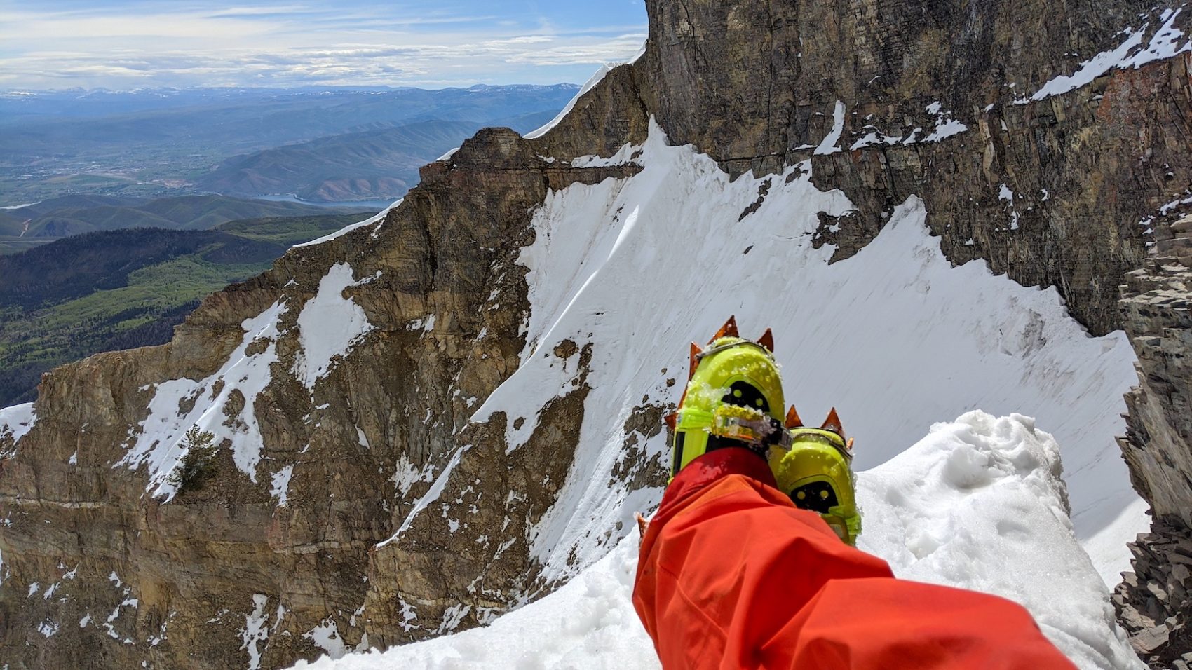
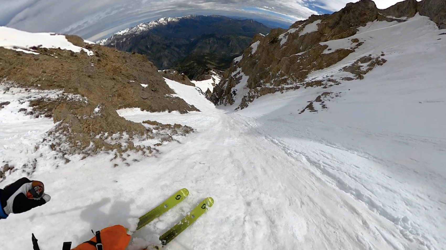
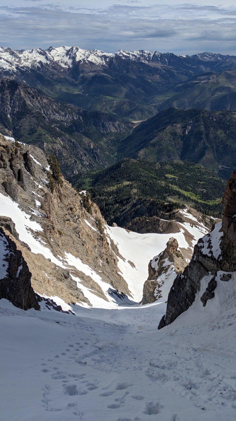
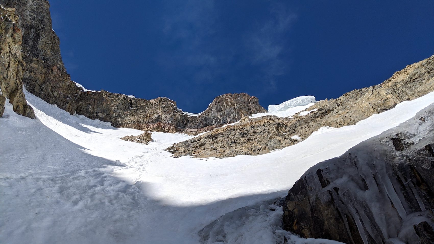
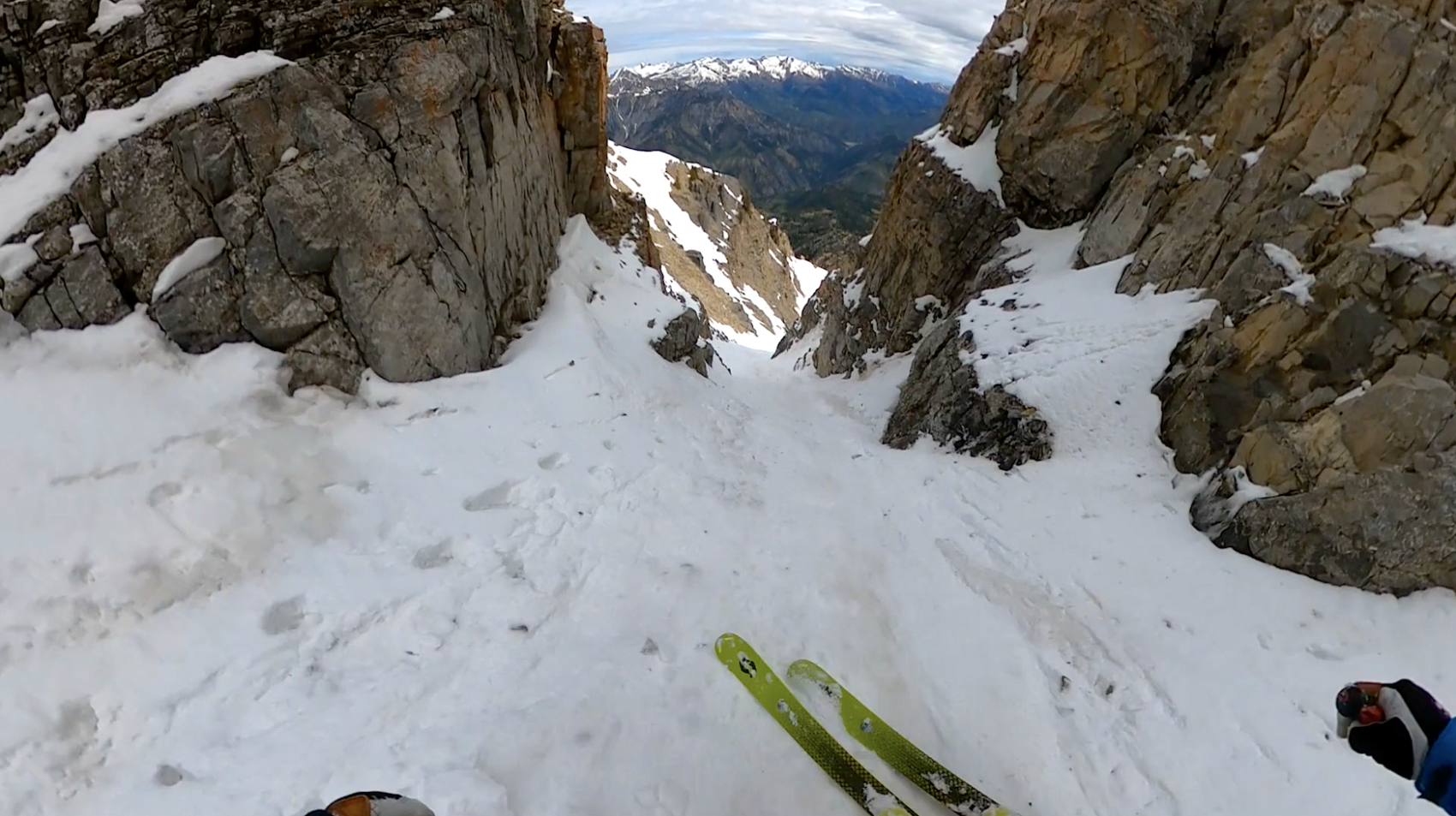
The last 50-vertical-feet of the chute are uncommonly steep and as you traverse to the summit ridge, the slope gets even steeper (reportedly up to 62º) and includes a no-fall-zone by virtue of a large cliff band directly below you.
At the top of the “Grunge”, there’s a rock wall.
Between that festering rock wall and the chute’s snowpack, there’s a gap of about 2-feet allowing for an awkward ice axes, crampons, knees, and elbows traverse to the summit ridge.
I grunted along the strange traverse between putrid rock, softening snow, and the tapering void beneath until I hit the summit ridge.
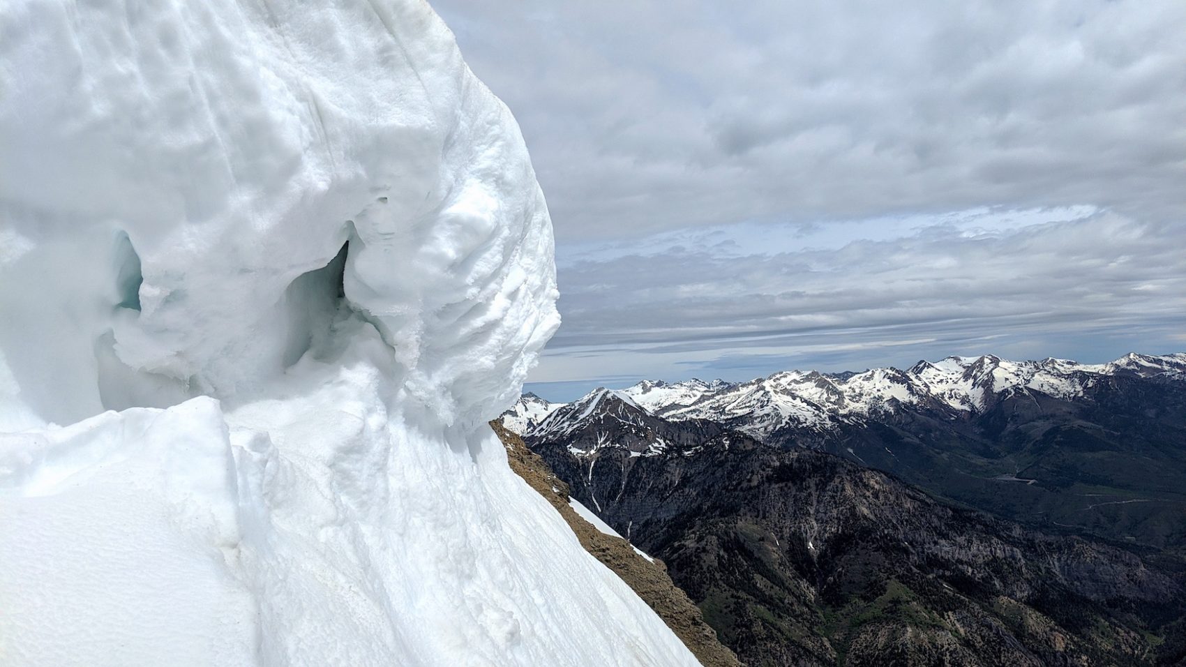
At the summit ridge, about 6′ of vertical cornice guarded access to the ridge so I began to cut it down with my ice axe while standing on a precarious perch above a no-fall-zone.
About 6 swings into my effort, logic set in and I backed off.
I was at the ridge, I could see between the cornice and the rock wall to the summit ridge, and my head was above the level of the ridge’s level.
I called it good and backed off to a small flat spot just below me on the traverse where I’d left my pack.
I slithered my shovel out and made a nice, comfy platform to transition on.
I didn’t linger.
The precariousness of my position and the seeping anxiety of the first crux move made my sortie at the top as short as possible.
I had a sip, I had a bite, I didn’t think of Eddie Vedder, I got my skis on and readied myself for one very intense “turn”.
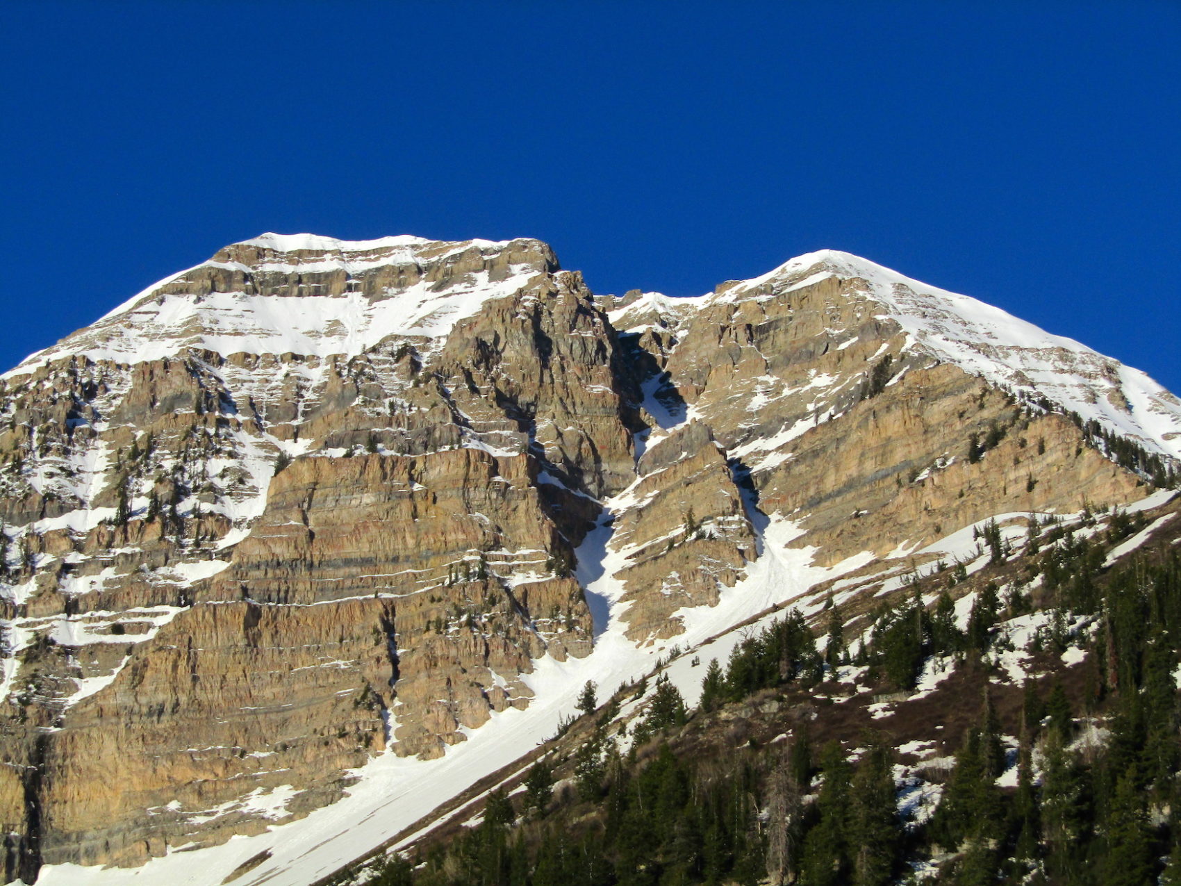
The first turn into “Grunge” is reportedly about 62º.
I believe it’s in that range.
The first turn felt akin to the first turn of the very steep “Eagle’s Nest” at Squaw Valley, CA.
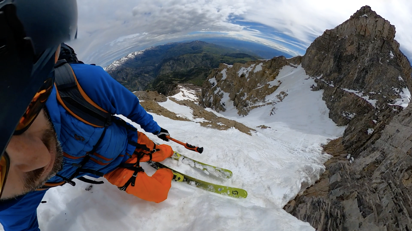
Fortunately, the snow was sun-kissed and supple.
Despite feeling a bit apprehensive, I went for it and quickly found myself in the chute proper feeling tension fracture and fall off my back as I began to smile and lean into the first real turn of the “Grunge Couloir.”
From here the skiing was pretty rough – but at least not completely terrifying anymore.
The new snow was punchy, funky, manky, weird and sitting on top of ice.
I butchered my way down the chute’s narrows in rowdy but comfortable conditions.
Once past the initial turn, I no longer feared “painful death from falling highly likely” and the lack of rockfall was reassuring.
Past the choke (about 6-7′ wide), I found a bit of rhythm and strung together 16-turns.
For most of the chute, I was gasping through short bursts of high-focus turns followed by resting and route planning.
The bizarre snow and complex runnel that snakes down entire length of the chute made for fun, creative skiing in a gorgeous, craggy, well-walled location.
The “Grunge” felt steep at the top, mellower after the choke, then steep again at the bottom.
I burst onto the apron exhausted and elated and skied it without stopping.
The apron snow was an intricate balance of glazed corniness and gooey stickiness that every avid spring skier knows and loves.
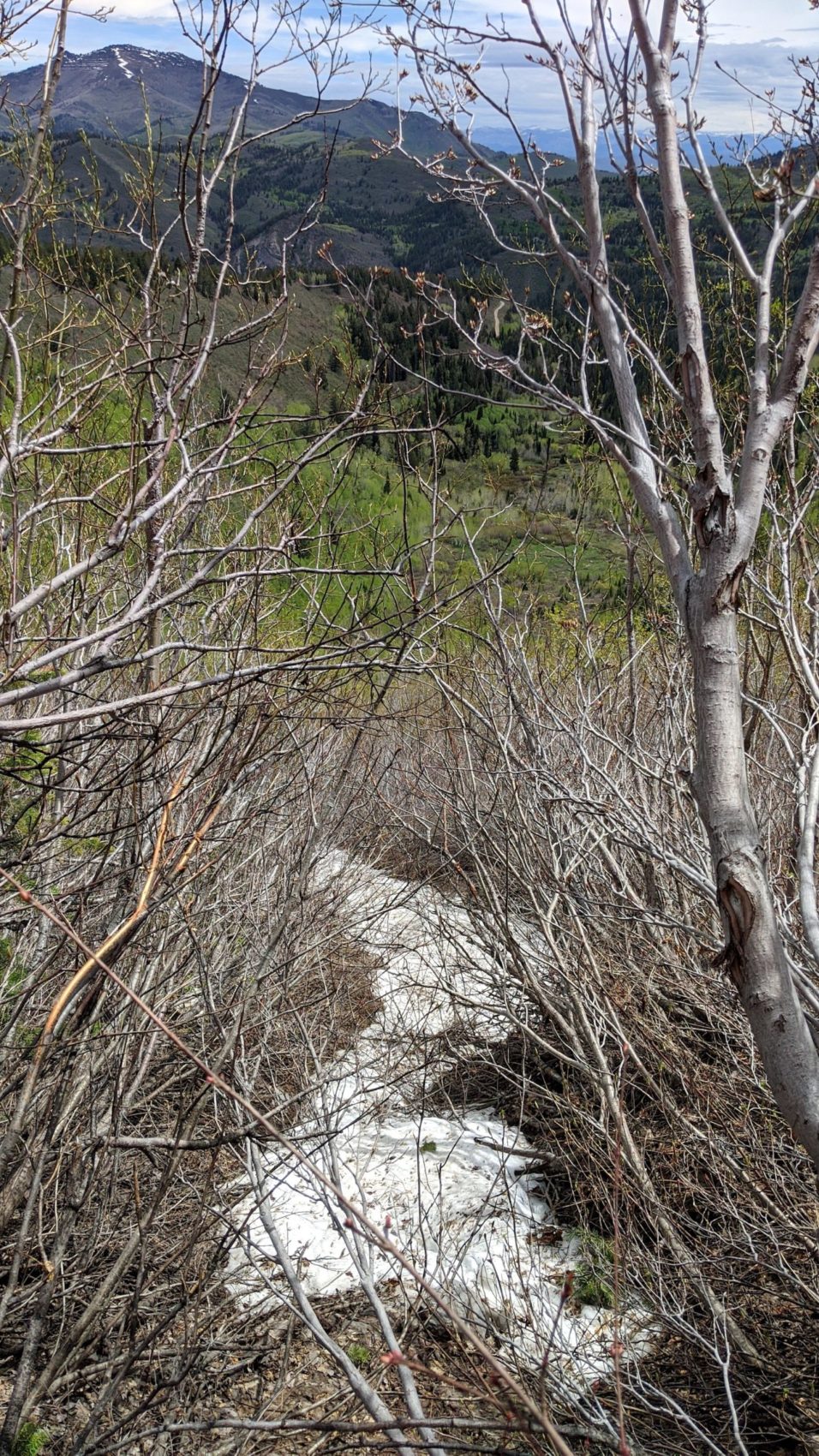
When the snow ran out 2,400-vertical-feet below the top of the chute, I took my skis off, looked up at the “Grunge”, and let out an alarmingly high-pitched howl in celebration.
It took me 9-minutes and 30-seconds to ski from the top of the “Grunge Couloir” to the flats of Wolly Hole.
The walls of “Woolly Hole” sang back with the most impressive echo I’d ever heard in my life.
The echo went on and on lasting about 9-seconds.
I was blown away and spent a few minutes alternately screaming like a child and listening with amazement.
From where I took off my skis at the bottom of the run, I walked for about 5-minutes to a mini-chute of snow I’d scoped that descended from “Wooly Hole” down into the Timpooneke Campground meadow where my car was waiting.
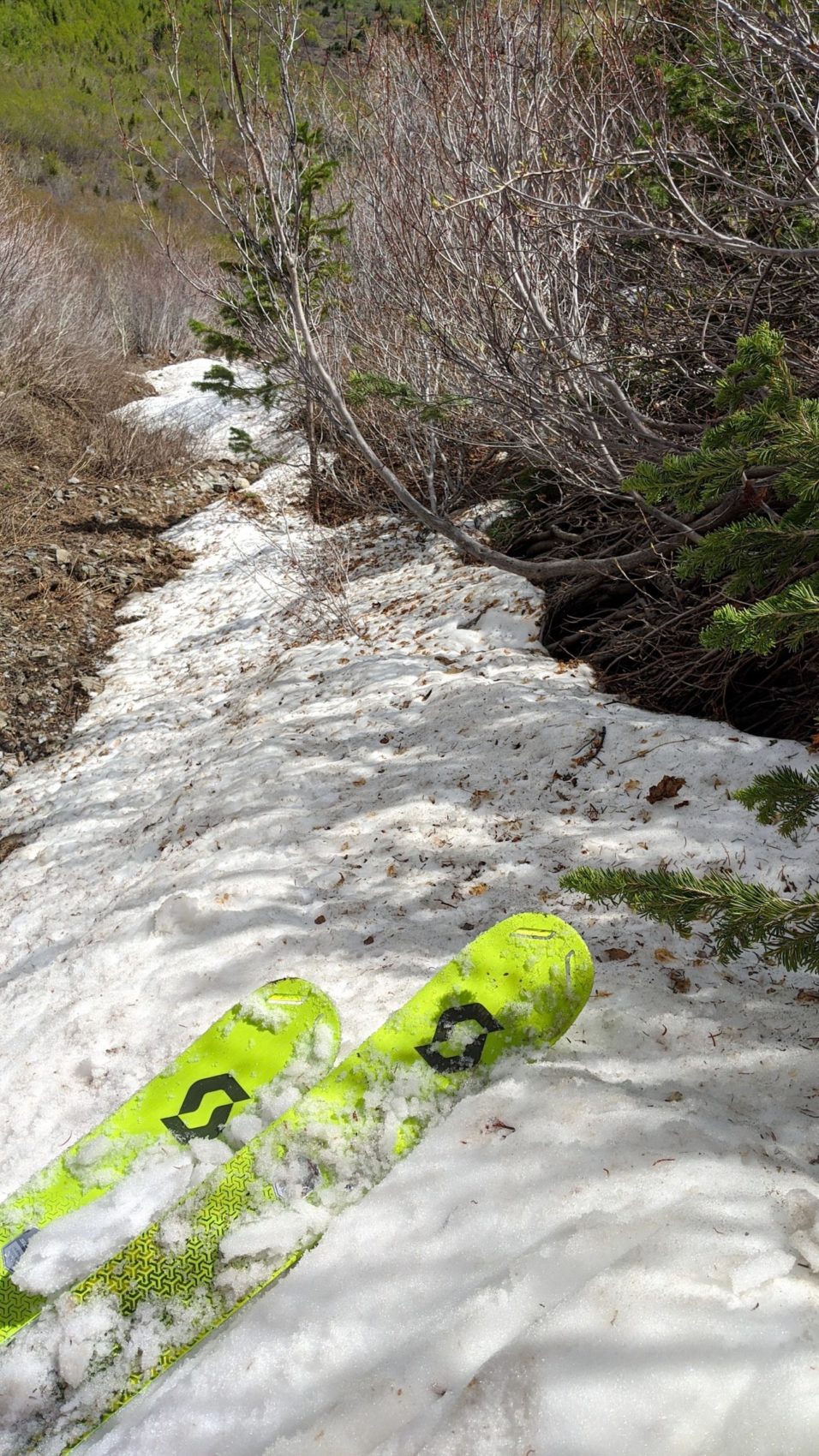
The ski down the mini-chute was steep, rocky, and bushy with a few connecting moves that felt scandalous.
When the snow ran out, I was fully committed to a relentless bushwhack the likes of which I haven’t experienced since last June off Tioga Pass, CA…
I took off my boots, put on shoes, loaded up my skis, and kookily strapped my ski boots to my pack in such a way that they’d be safe from the infuriated, marauding branches to come.
This subsequent bushwhack was an 8.5 out of 10 on the bushwhack-o-meter but only lasted about 15-minutes.
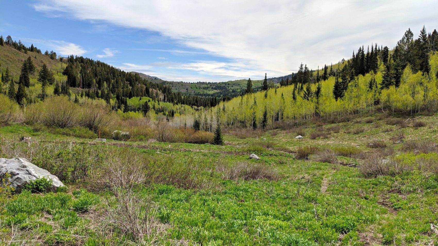
As the bushwhack subsided, I ended up in easily-navigated moose trails that lead to a wide-open meadow with dazzling views back toward Mt. Timpanogos and my car.
From the time I stopped skiing to my car was only 30-minutes!
I was fired up on that.
I arrived at my car feeling fresh and frisky despite the heavy day.
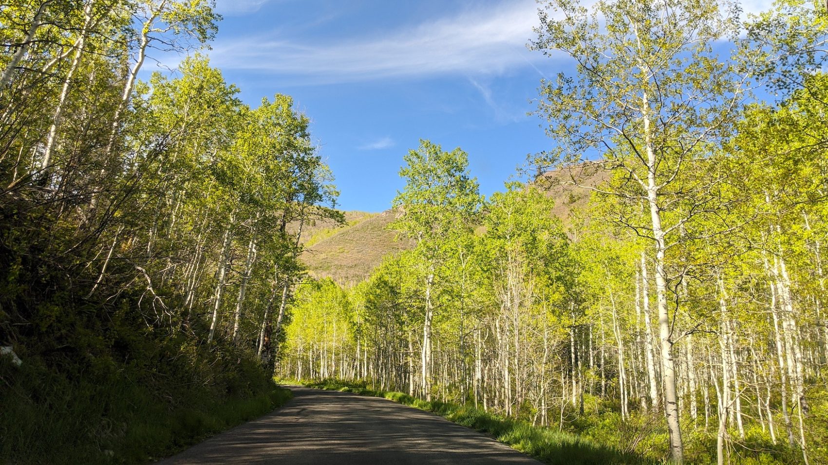
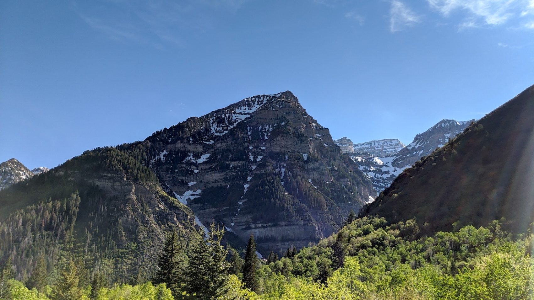
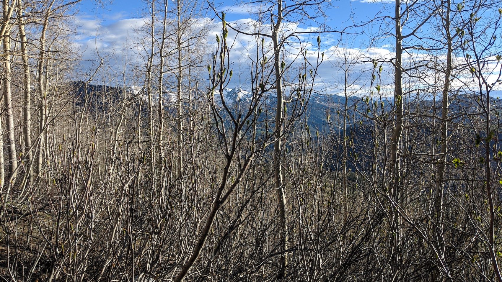
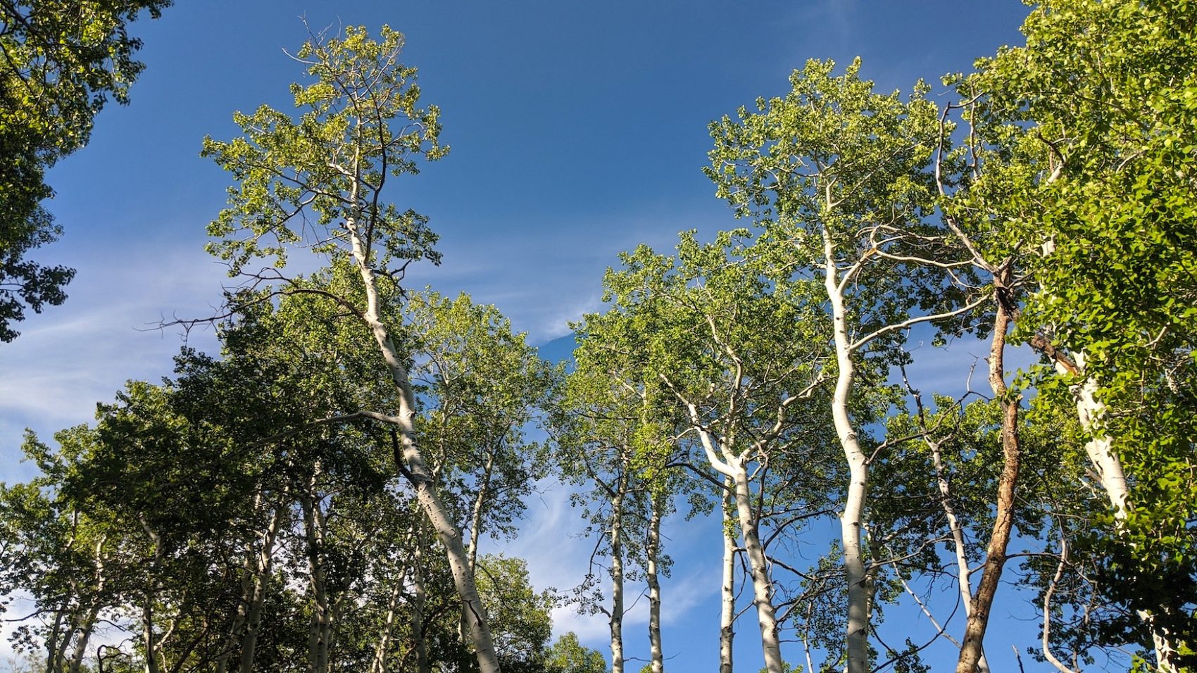
I threw together an uncooked quesadilla, pounded a half liter of water, and hit the road north excited for views of the elegant Mt. Timpanogos Massif contrast against the fresh spring leaves of the quaking aspens.
Confronting my fears and skiing the “Grunge” made my long winter feel complete.
Bring on summertime.
May/June 2020 Trip Reports:
- Trip Report: Tickle Mary’s Nipple, WY — Why Not?
- Trip Report: Bloody Mountain, CA – “Bloody Couloir”
- Trip Report: Sailing from San Francisco, CA to Angel Island
- Trip Report: Mt. Dana, CA – “Dana Couloir”
- Trip Report: Mt. Dana, CA – “Solstice Couloir”
- Trip Report: Mt. Timpanogos, UT – “Grunge Couloir”
- Trip Report: Mt. Timpanogos, UT – “Cold Fusion Couloir”
- Trip Report: Snowbird, UT – “Pipeline”
- Trip Report: Mt. Superior, UT | “South Face”
- Trip Report: Little Cottonwood Canyon, UT – “Tanners Gulch”
- Trip Report: Antelope Island/Great Salt Lake , UT | The Baja California of Utah… But With Buffalos
- Alta, UT Report: Little Chute Absolutely Firing in Spring Splashiness!
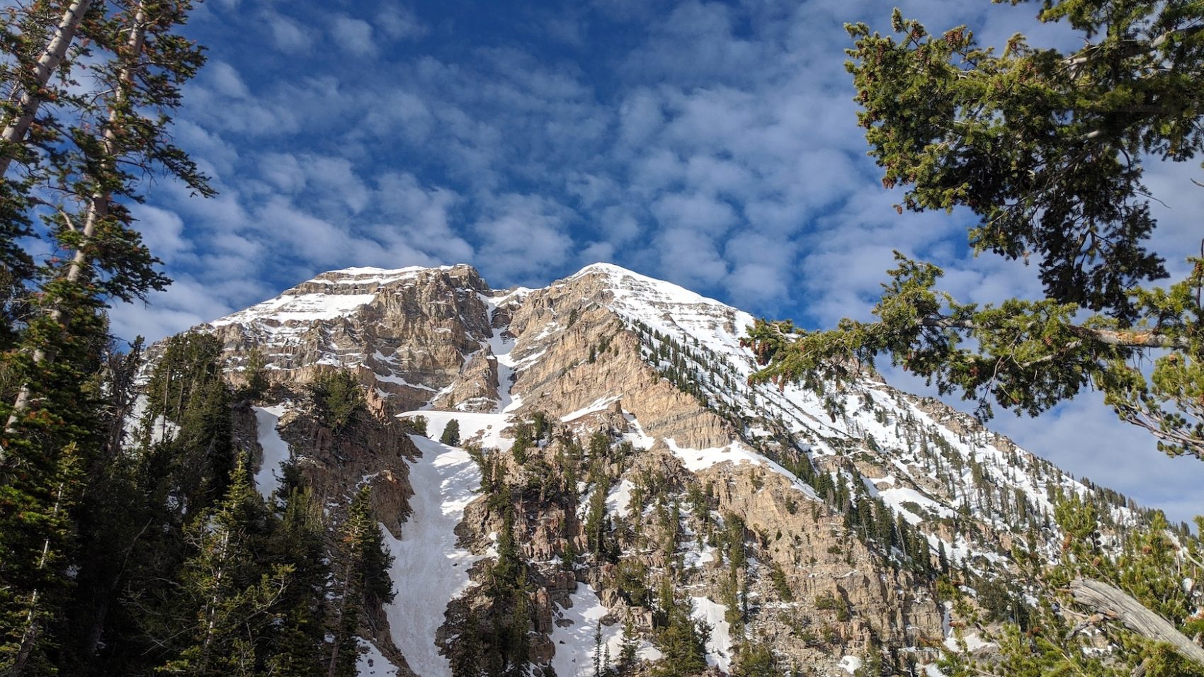
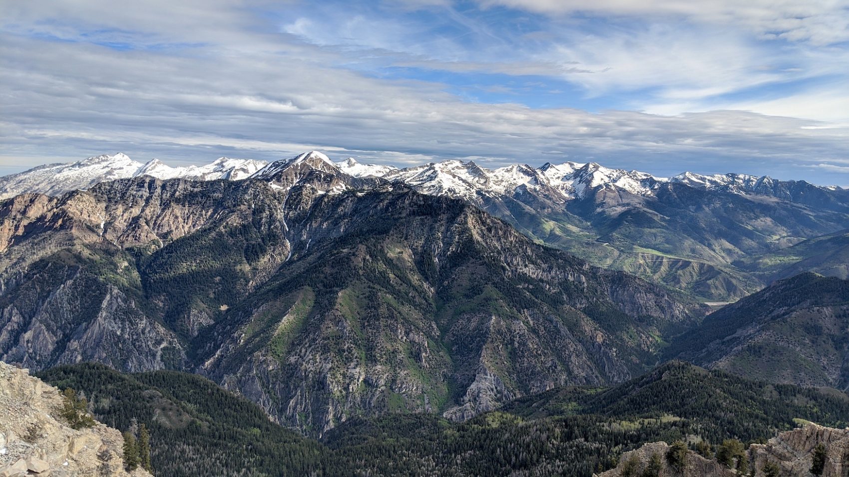
Photo Tour in Chronological Order:
The skiers left portion of the upper couloir (below the cornice and rap anchor) I’ve measured at 48 degrees. When the cliff at the top of the center of the couloir is plastered with wind loaded snow is when the chute skis steeper for a couple turns. It is also advisable not to climb the couloir in spring because of rockfall danger. It is best to climb up either pika cirque and follow the ridge around or climb cold fusion. Say safe.
Thanks much for all this info. Andrew McLean told me to boot right up it and to stay away from the runnel and I’d be alright. I was very fortunate and not 1 rock came down when I was in the chute and then when I dropped in, I knew exactly what I was going to ski and had already created a mental map of how I would execute my ski descent. Thanks again.
Simply awesome slay. Kudos!
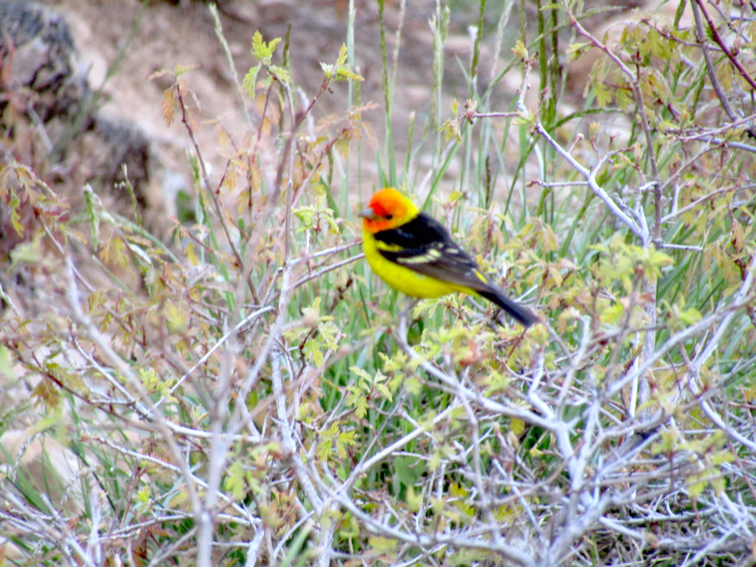
Most beautiful bird I’ve seen in the Wasatch is a Western Tanager. I hit the brakes hard heading up the LCC Bypass Road when one flew across my path. Staggeringly colorful in flight.
Nice! I wonder what this bird was? Gorgeous
That was a picture of a Western Tananger
This is a western Tanager.