Report from June 22, 2023
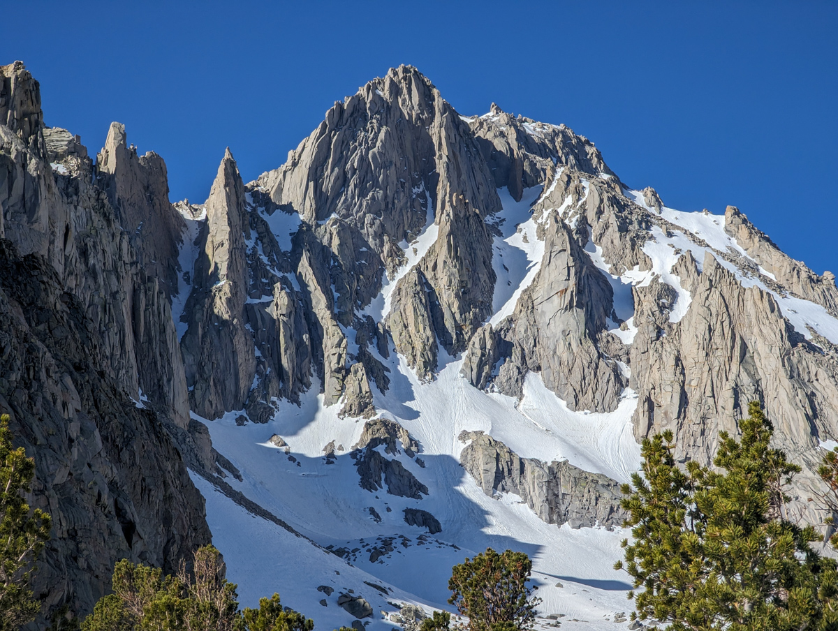
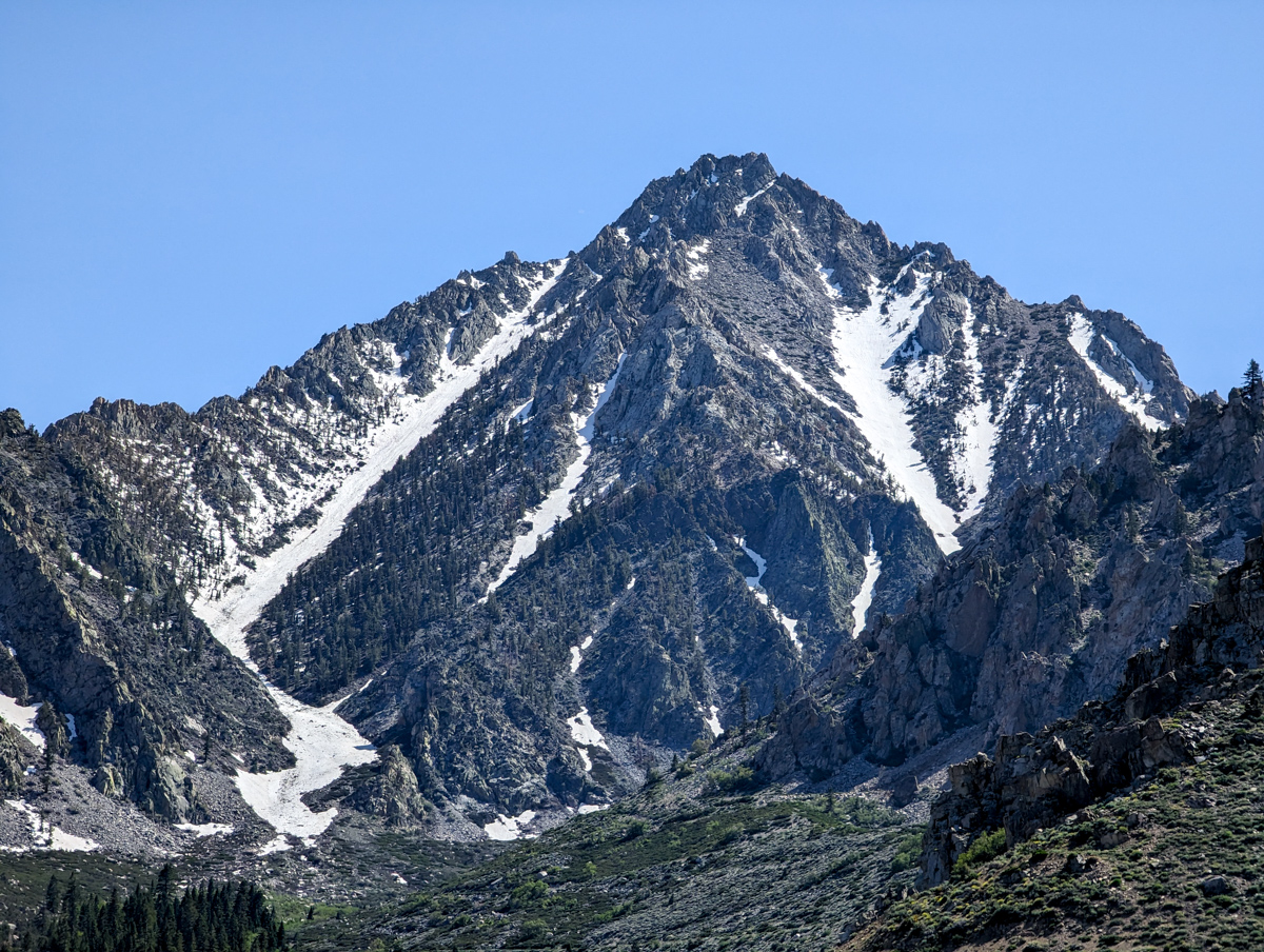
13,632′ University Peak, CA’s “North Face” yesterday was 51º steep at the top and firm as hell!
Sketchy turns at first, then 19-secs into the video we find some flow and softer snow.
Scared poop-less again but slightly less this time because it was a touch less firm than what we’d experienced on 13,494′ Mt Thompson, CA, two days ago.
We’d officially decided to ski mellower stuff after Johnson but University ended up being much steeper than advertised…
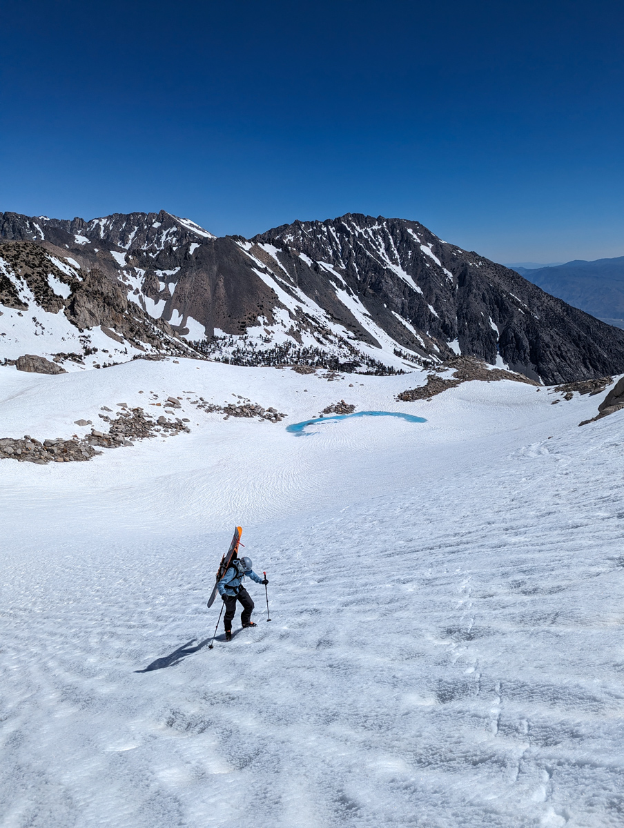
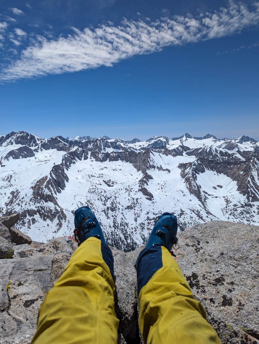
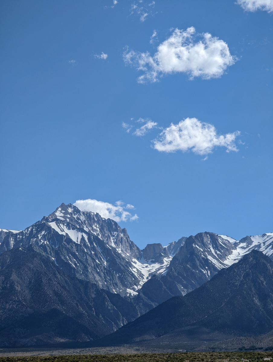
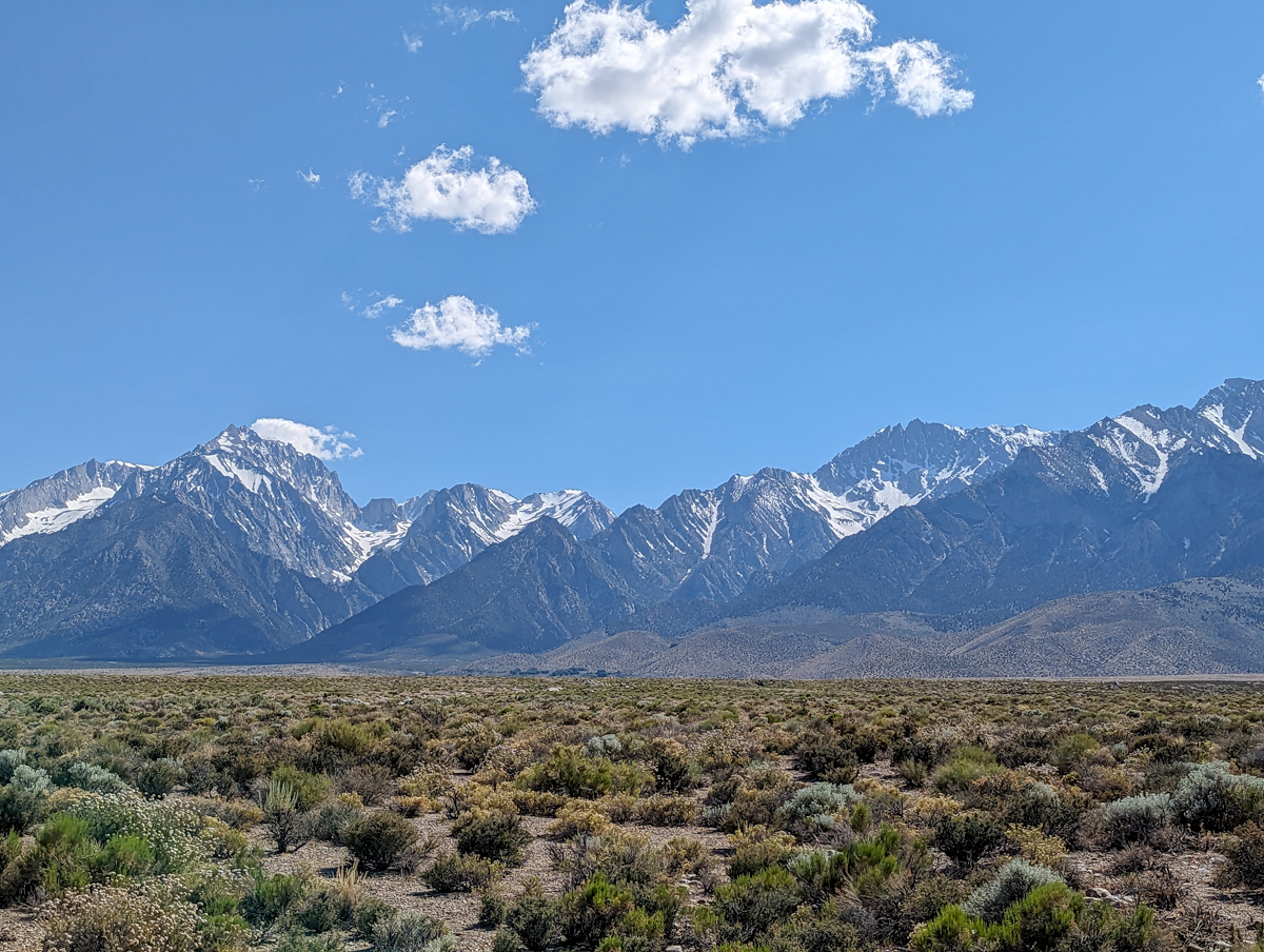
This zone was the furthest south we’ve skied on our Eastern Sierra project this Spring, the highest we’ve skied from (13,400′), & the most “High Sierra” feeling region thus far.
The views west into Kings Canyon we’re bewildering.
Yesterday was the 1st full day of summer, but it didn’t feel like summer up there.
We could see our breath most of the day!
This was our 16th ski mountaineering line since we started this project on May 10th, and our goal is to get to 20.
13,632′ University Peak, CA – “North Face” Details
- Summit (actually a ridge): 13,400′
- Car: 9,200′
- Vertical From Car: 4,200′
- Vertical skied: 1,800′ in the “chute/gully,” then more on the way home
- Max Pitch: 51º
- Avg Pitch: 40º
- Aspect: North
- Distance: 7.5-miles round trip
- Time From Car to Top: 6.5-hours (about 1.5 hours of waiting for the snow to soften)
- Car to Car Time: 8 hours
- Recommended Equipment: Crampons, Ice Axe x 2, Skins, Ski Crampons
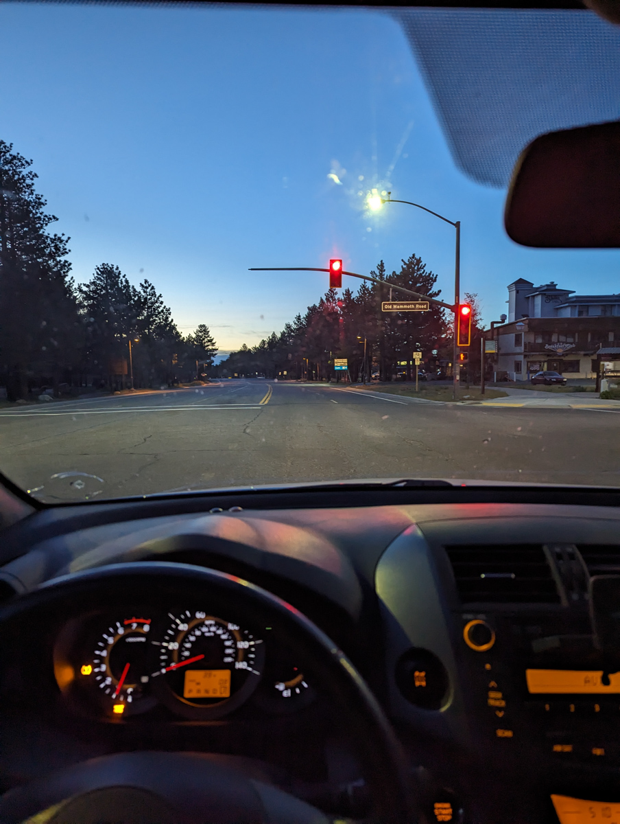
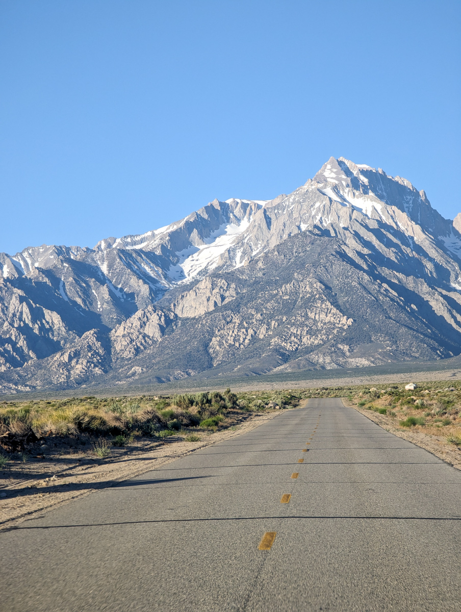
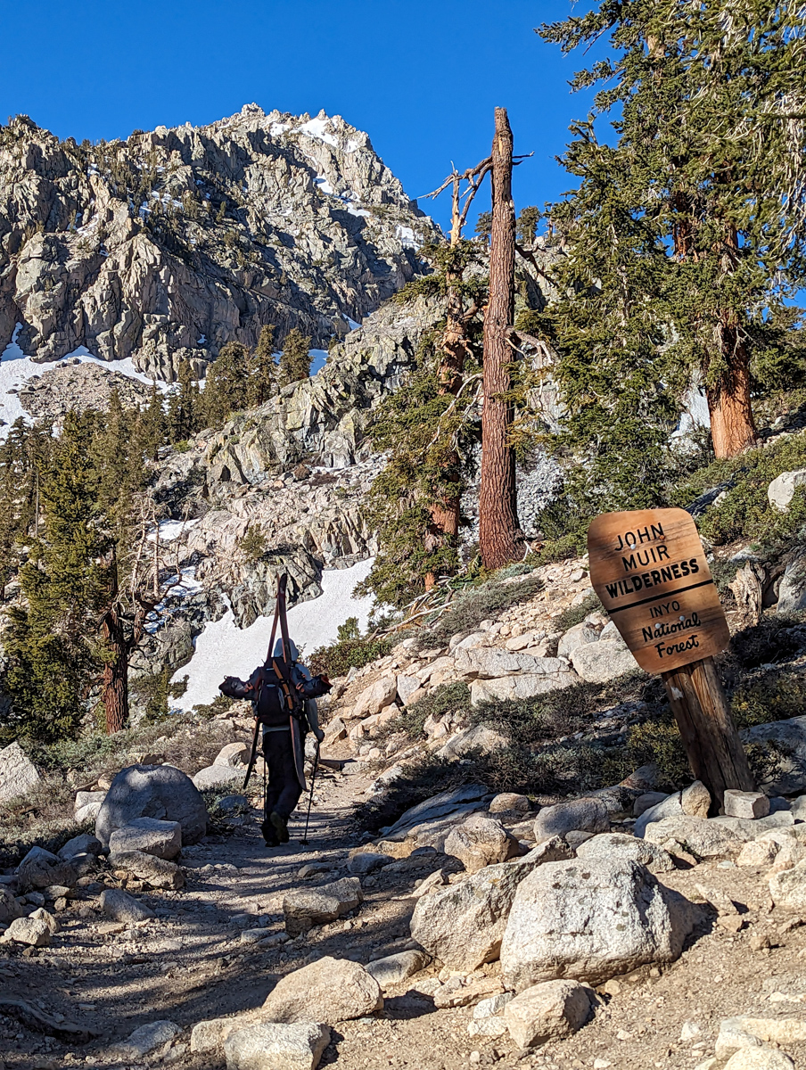
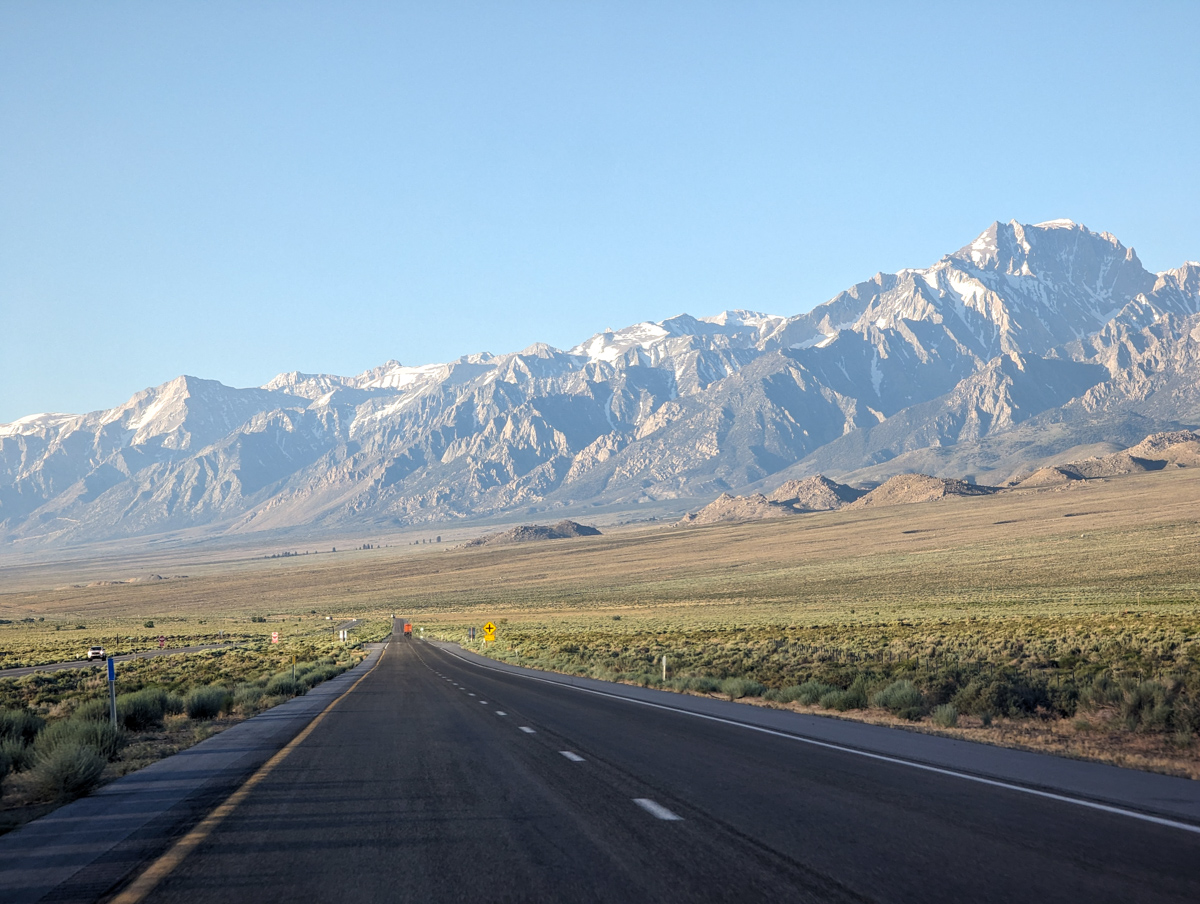
Up early and on the road by 5 am.
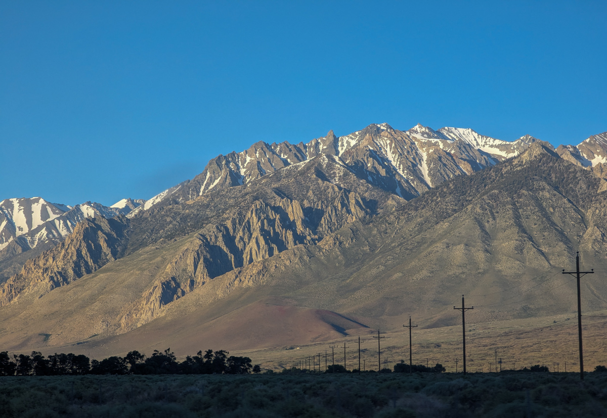
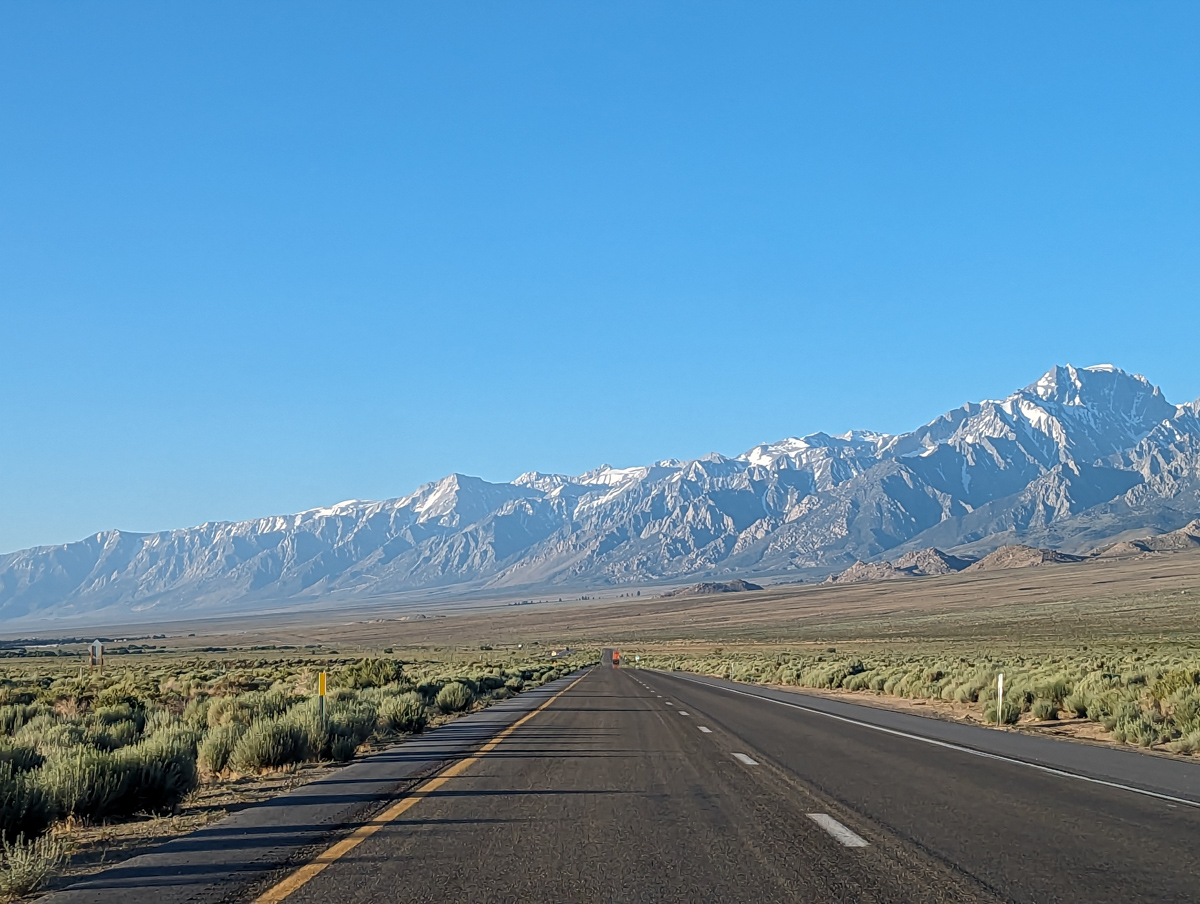
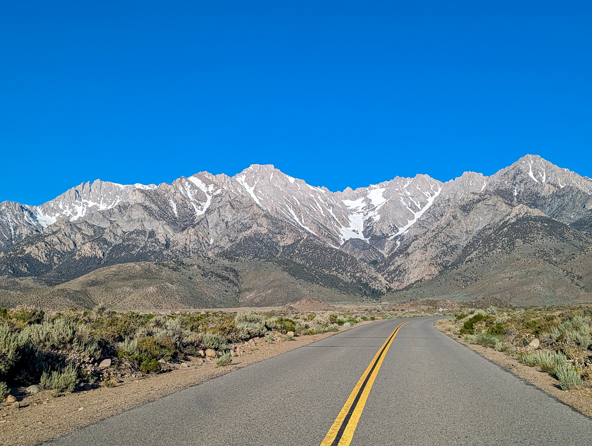
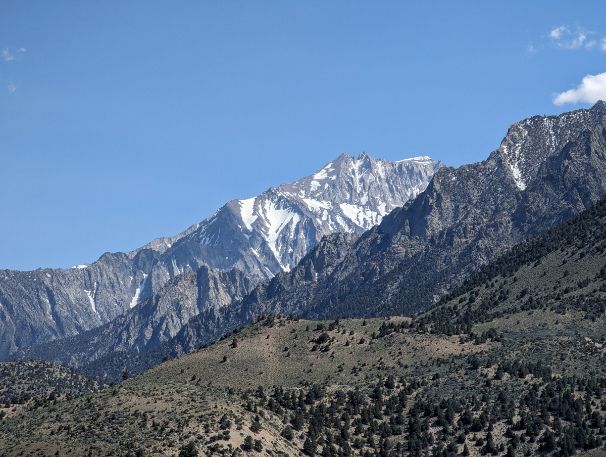
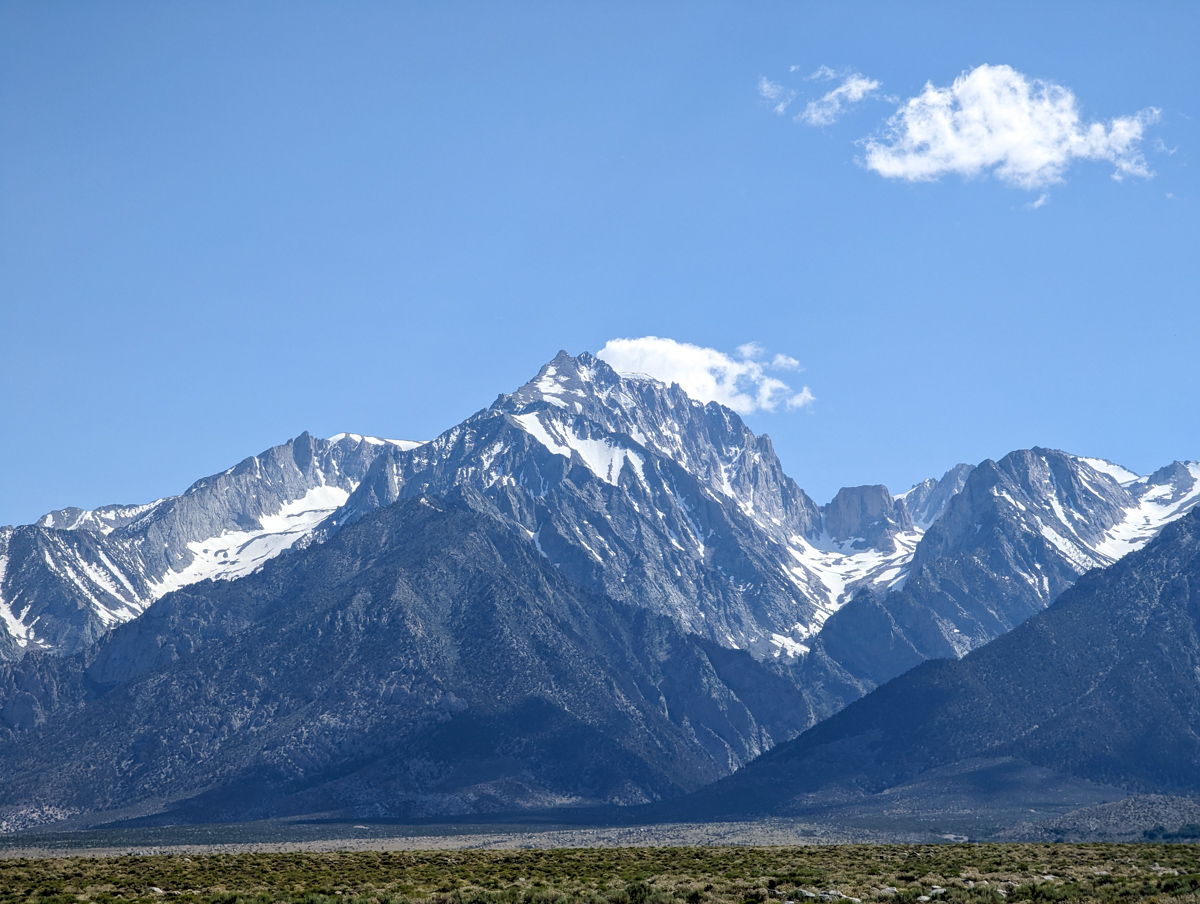
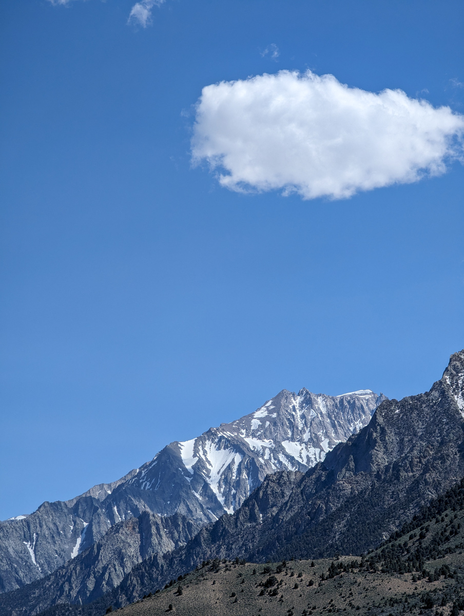
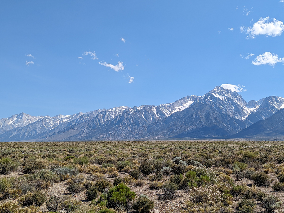
The 2-hour drive to the trailhead was spectacular.
The High Sierra south of Bishop is ridiculously impressive.
14,000 and 13,000-foot peaks galore.
The drive up Onion Valley is kinda scary.
Some of the switchbacks are insane with aluminum can thin guardrails…
That road goes 5,000 vertical feet up from the valley floor!
I’d been worried about the cold temps all the previous day and all morning, but it was very pleasant in the morning sun in the parking lot.
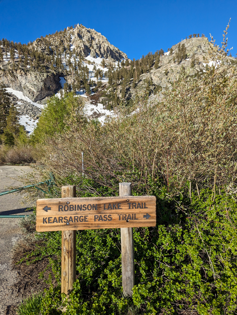
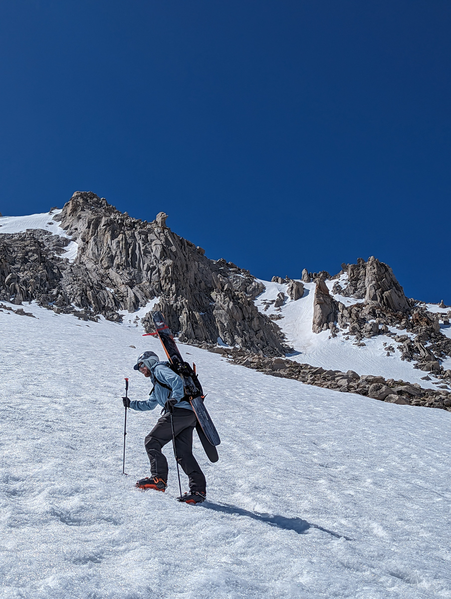
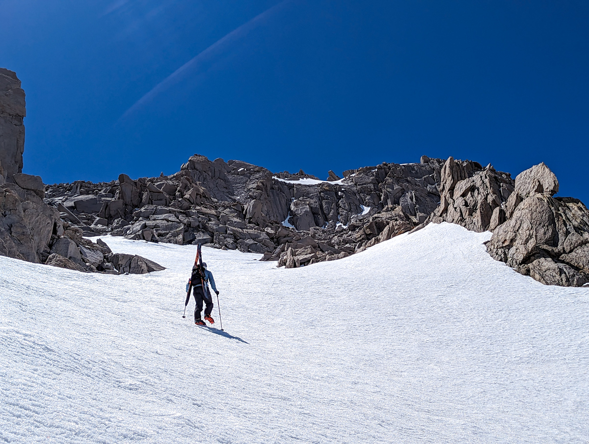
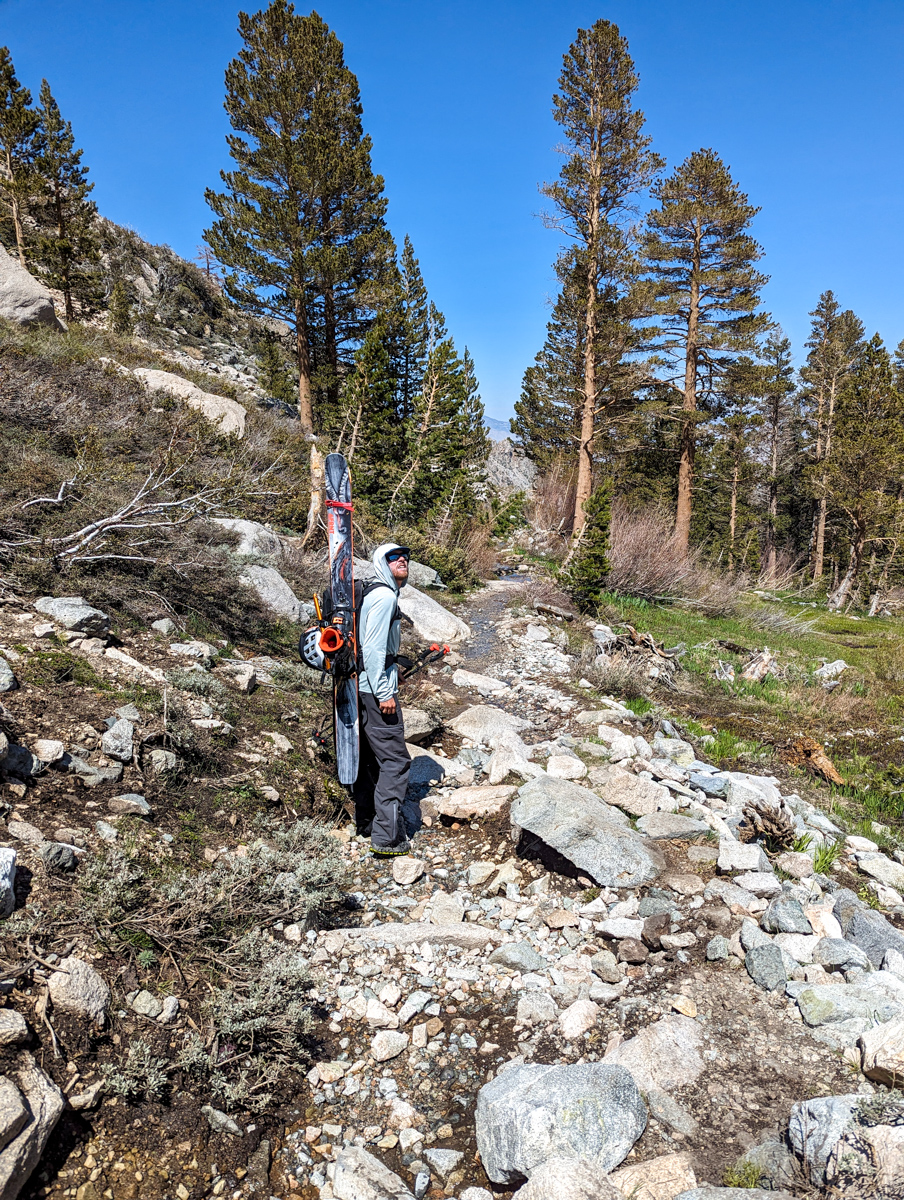
We shoe-hiked up the trail before hitting snow.
About one mile taking 30 minutes of walking.
From there, we switched into ski boots and started kicking our way up the rock-hard sun cups.
Just up from our transition, we ran into a couple sunning themselves on a rock, drinking coffee from reusable Starbucks cups.
Their tents were about 10 feet off the trail next to the raging creek.
The guy explained to us how he’d spent about 48 hours trying to find a good crossing to get up to Matlock Lakes, but none was to be found, and the snow bridge nearby was too thin.
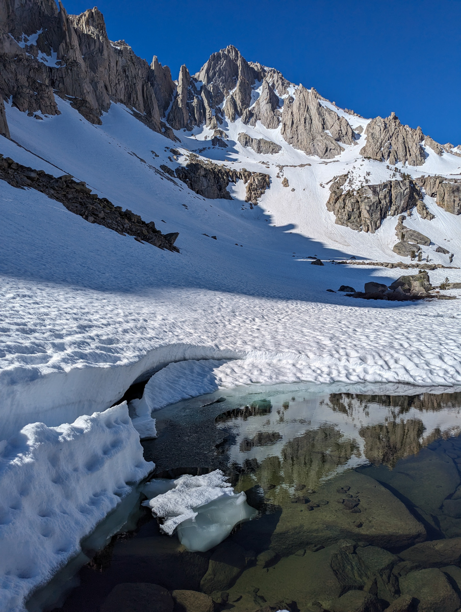
We walked over to the snow bridge that was about 25′ from his tent.
It was clearly thick and bulletproof and long.
We walked across the snow bridge without hesitation and continued on our way up toward University.
We joked about the conversation the couple must have had behind us…
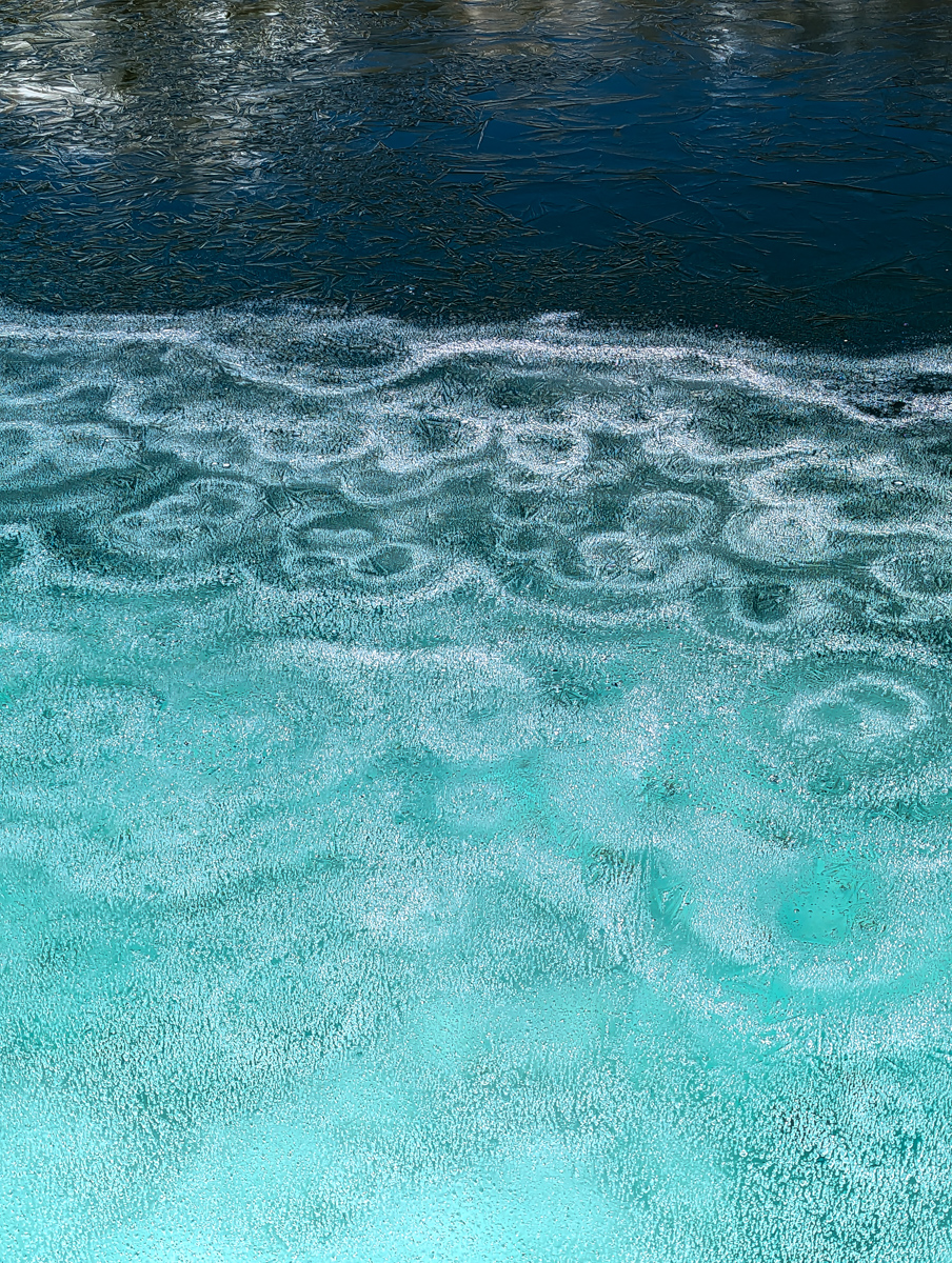
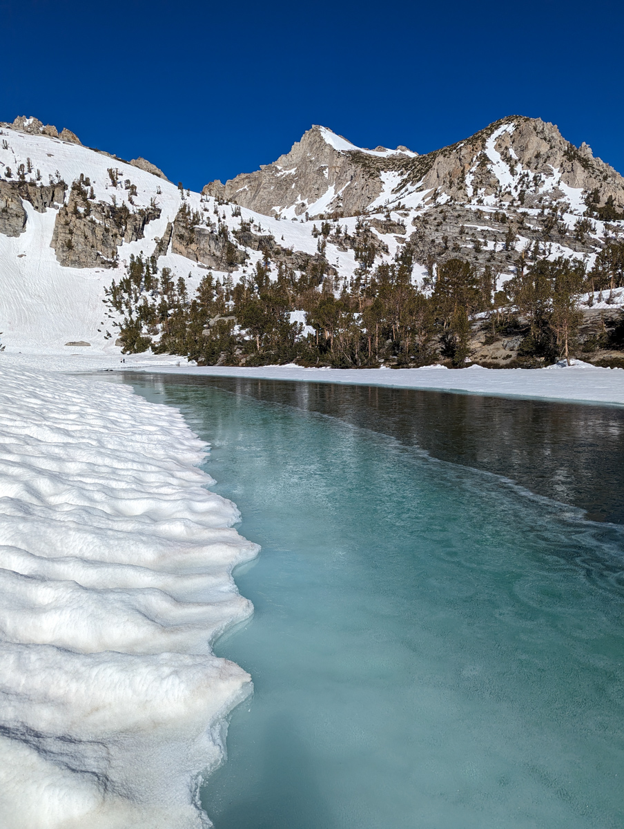
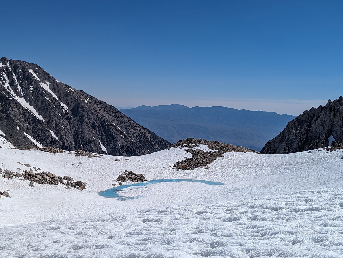
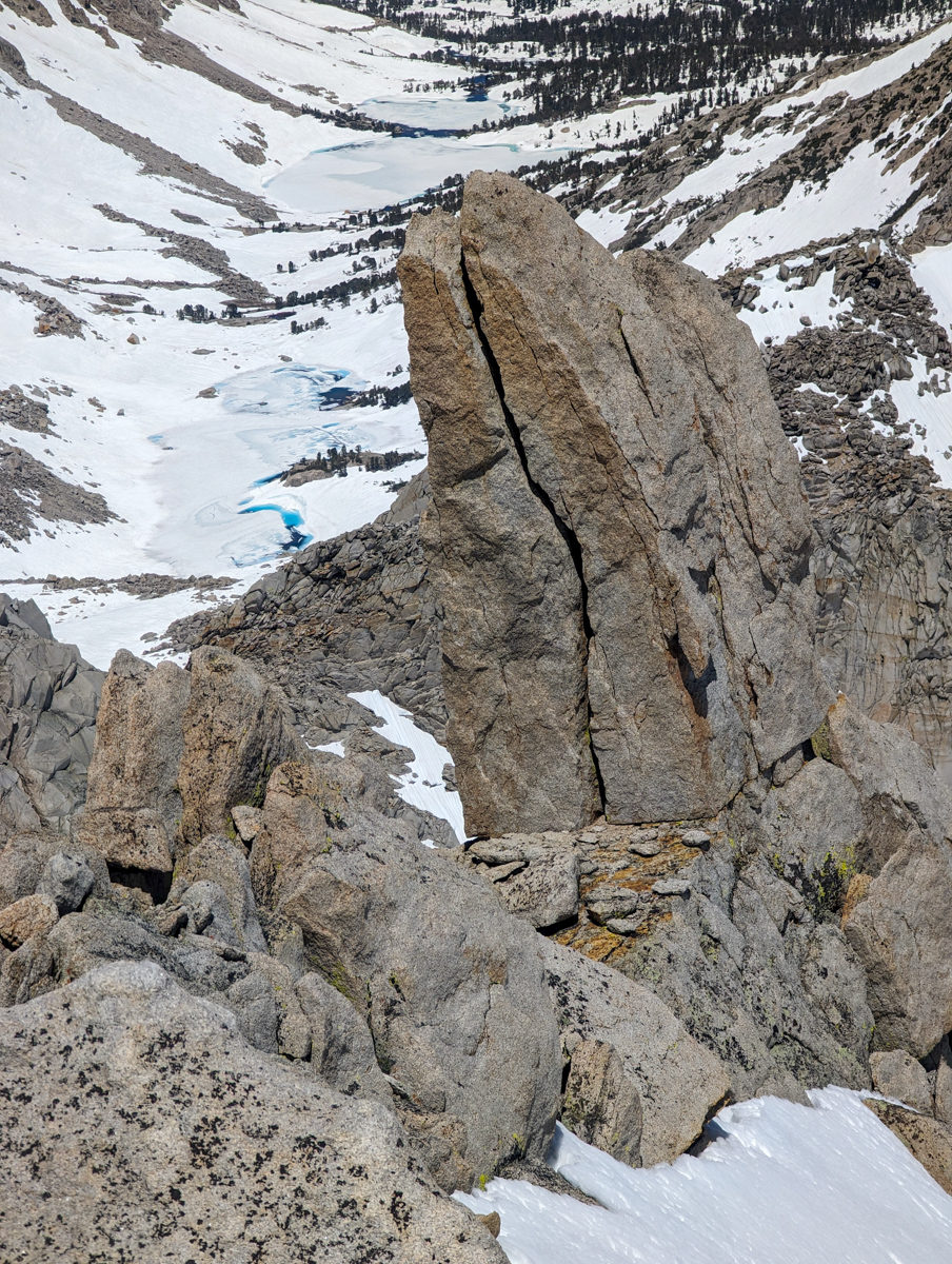
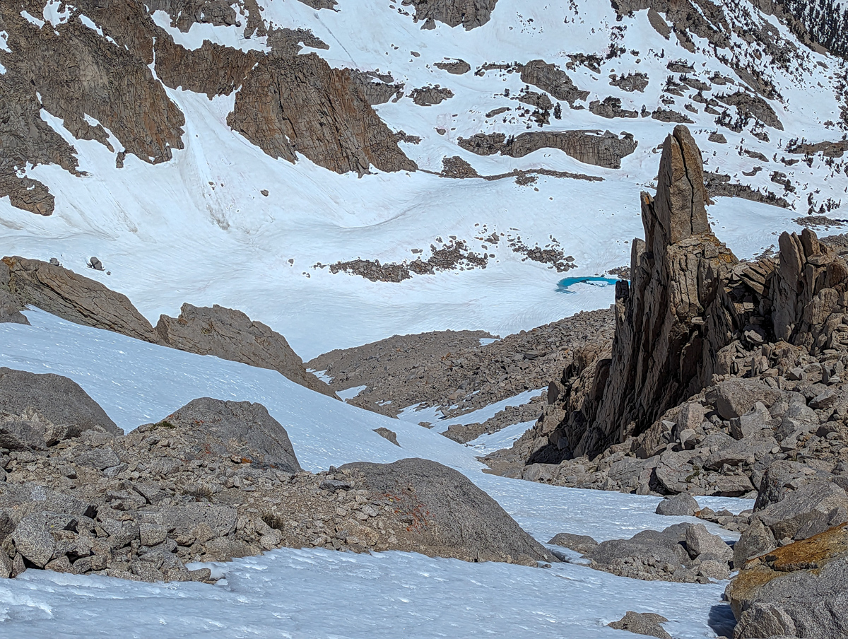
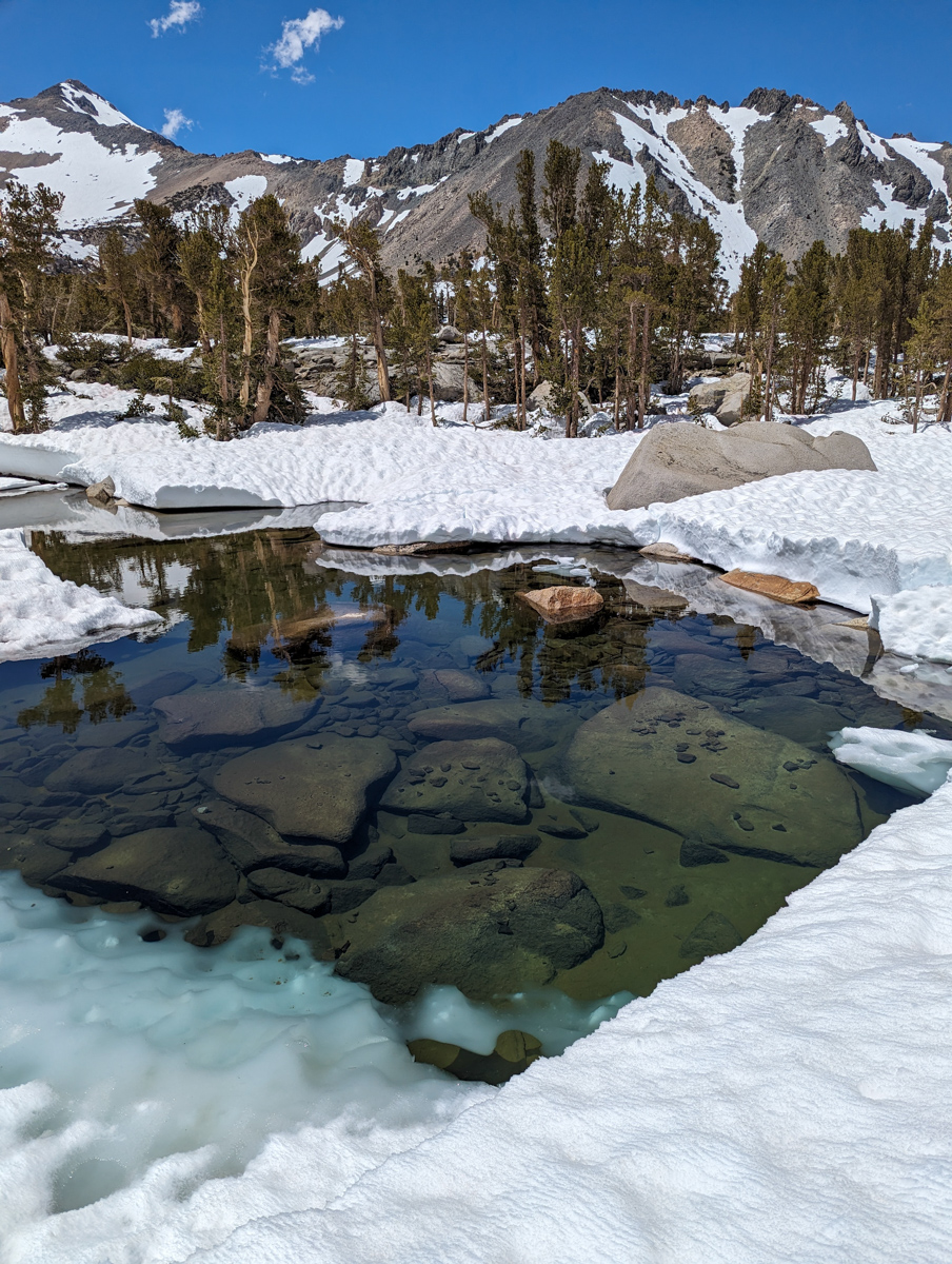
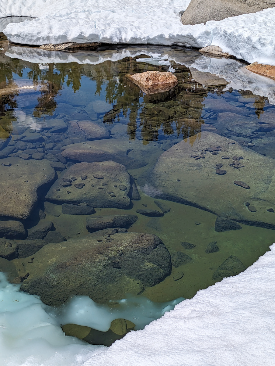
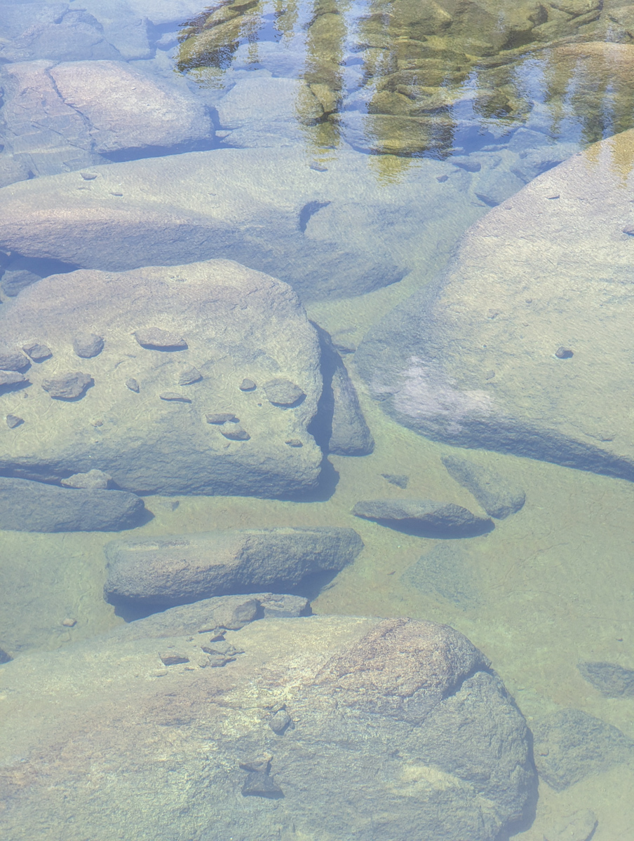
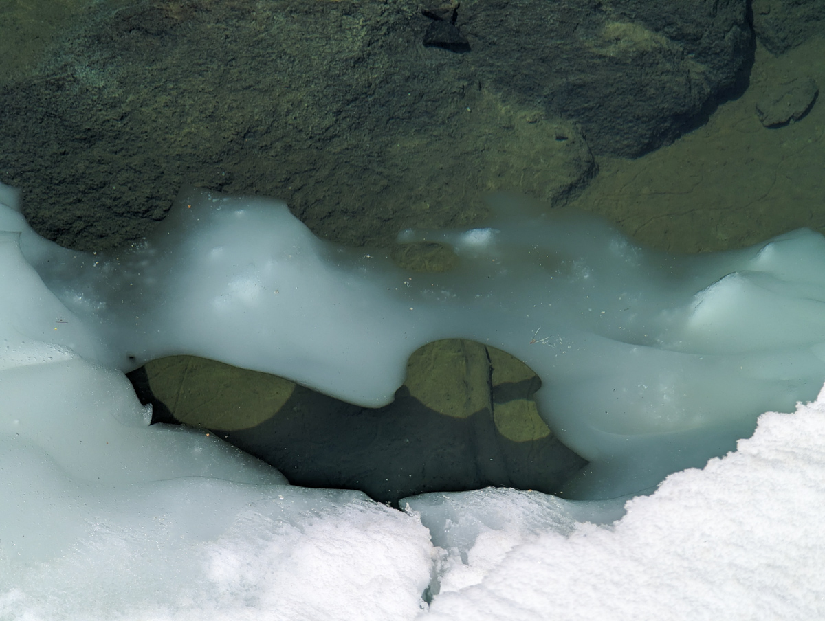
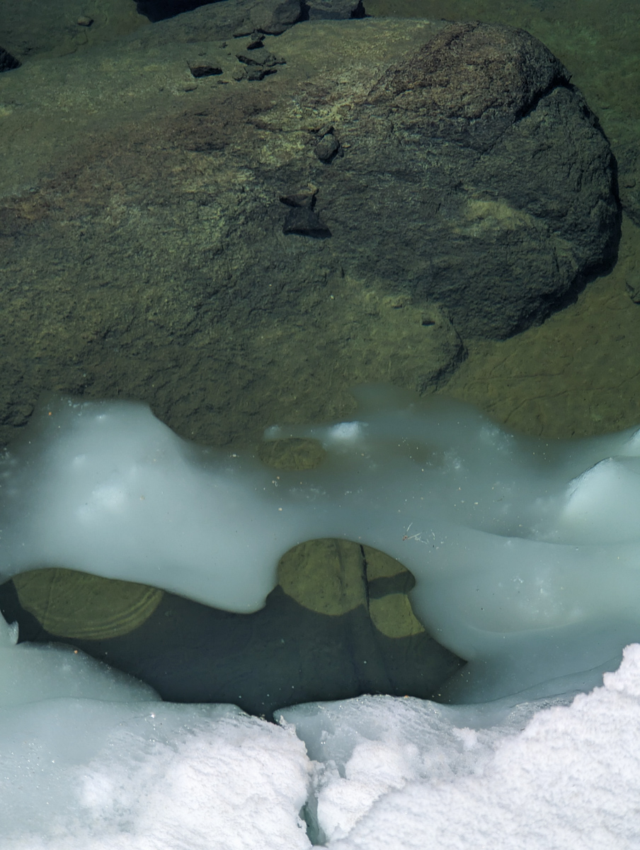
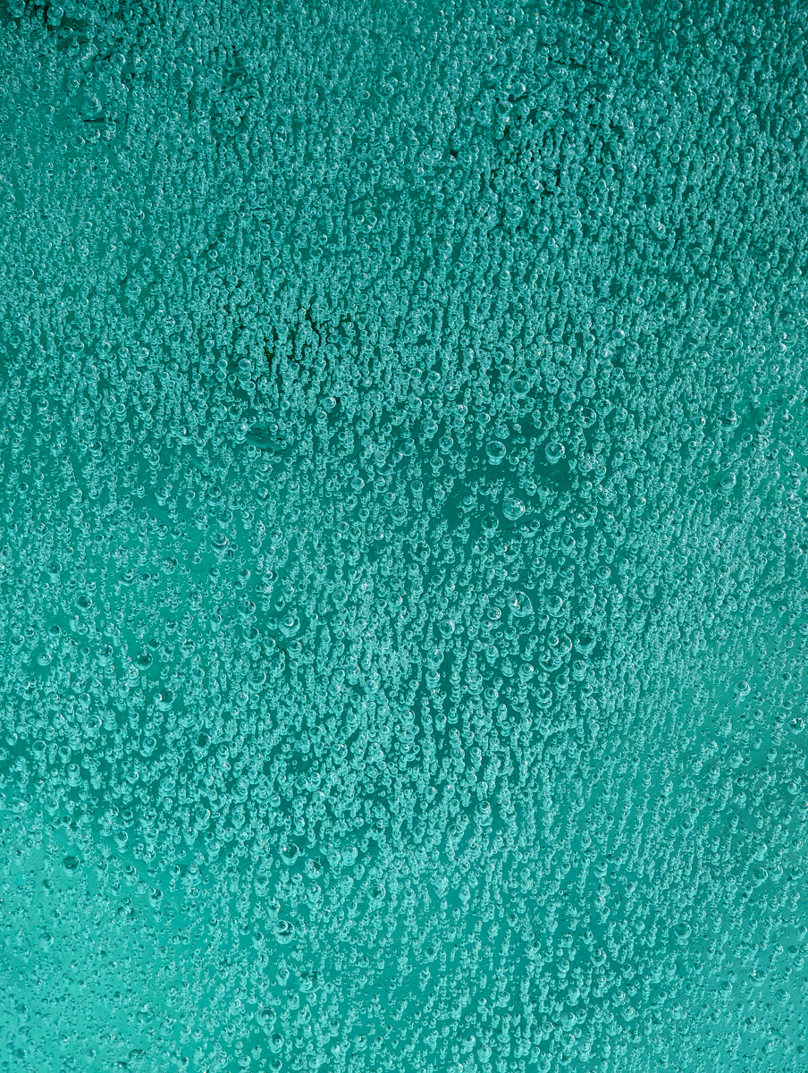
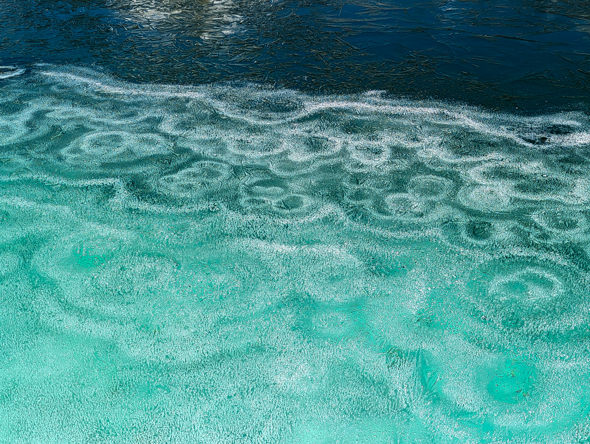
Amiable sun cup strolling brought us to the Matlock Lakes, where we put our skis on, skated, and pushed our way to their far ends.
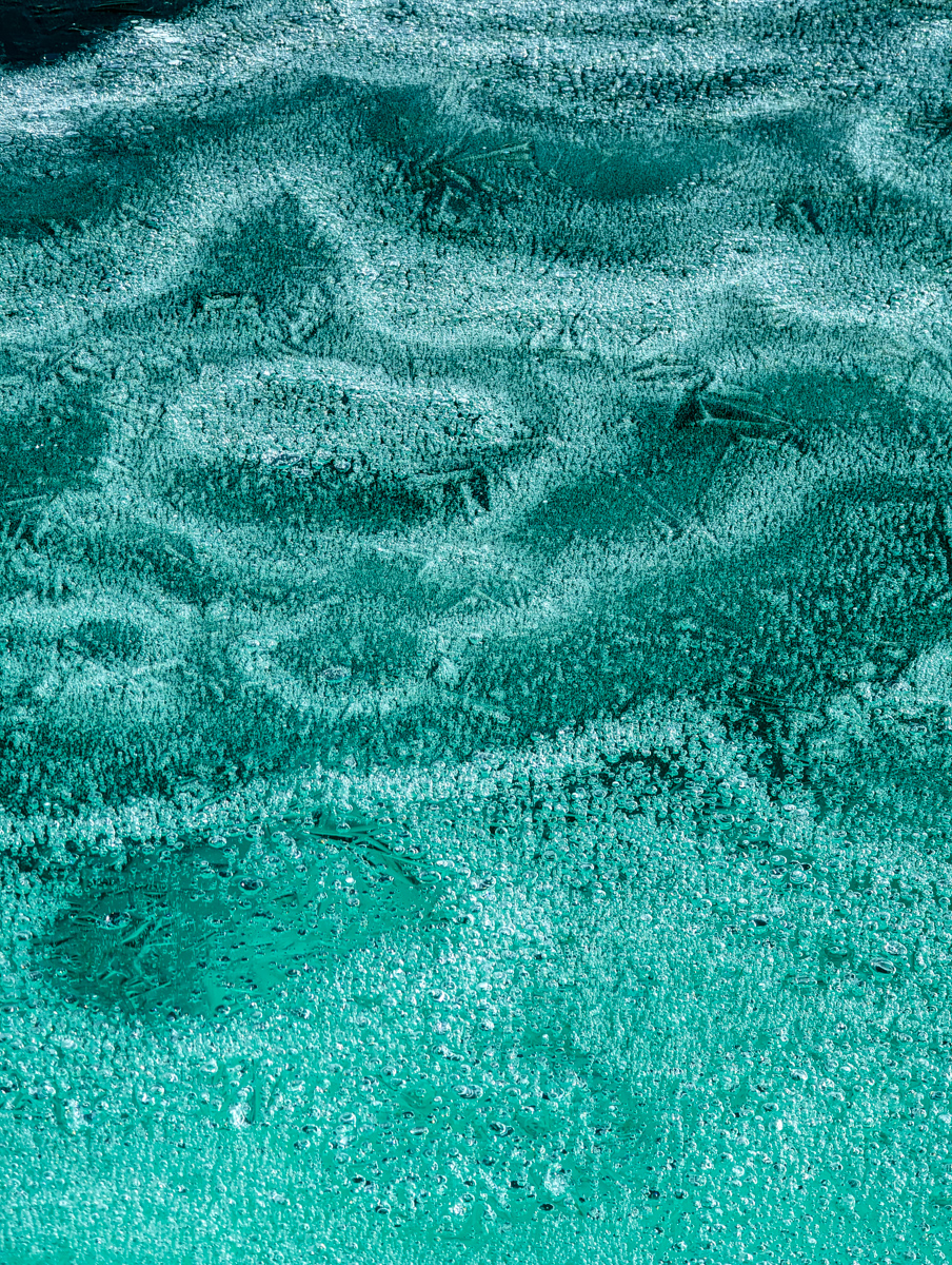
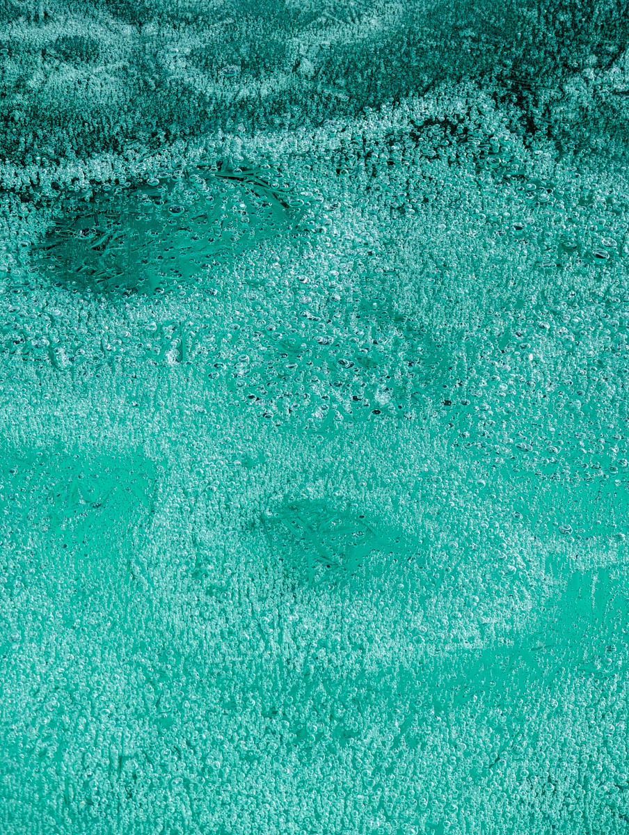
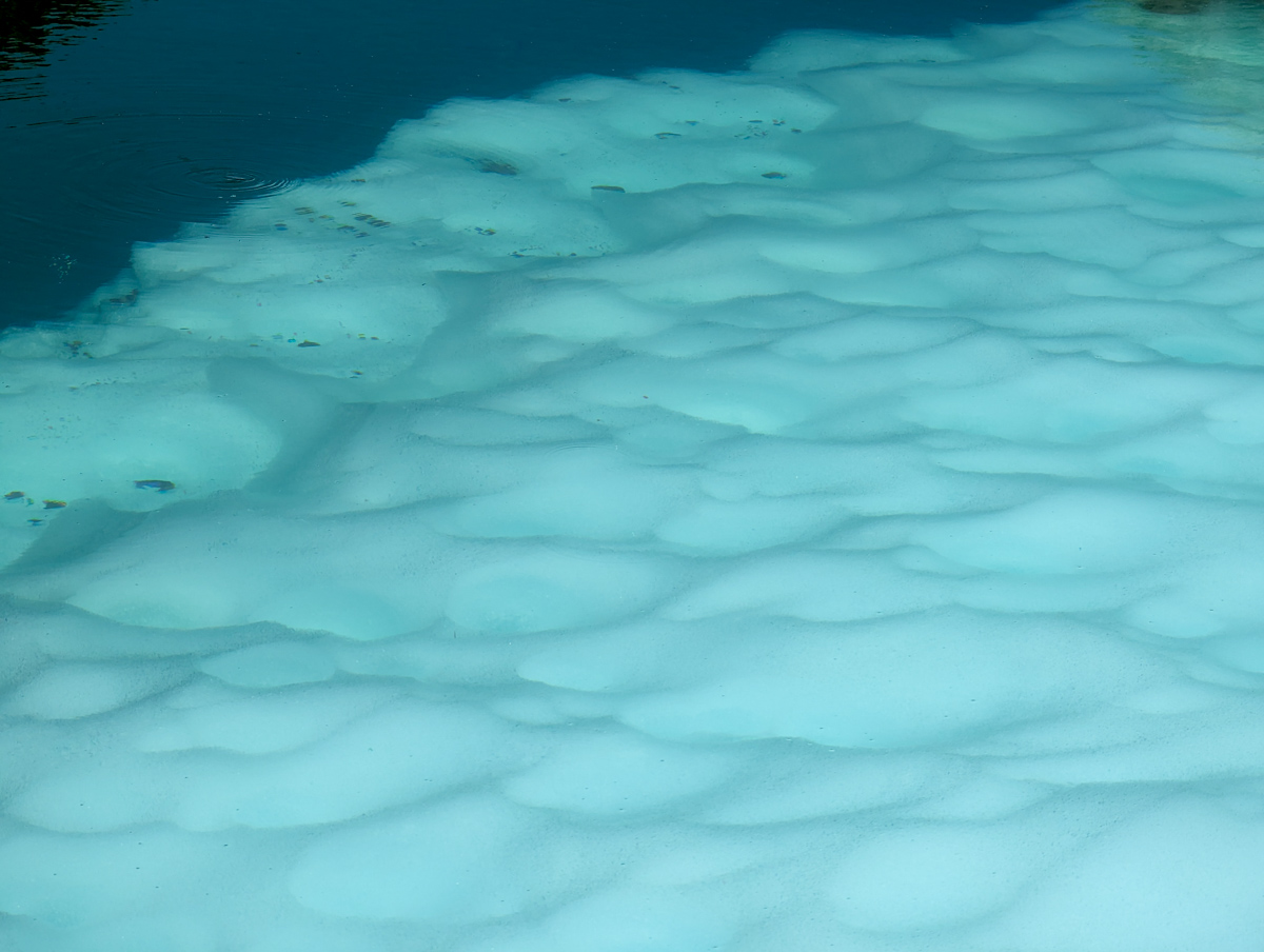
The multi-day ice that had grown on the lake’s edge was otherwordly.
Trapped bubbles, turquoise blues, and alien-formed crop circles littered the edges.
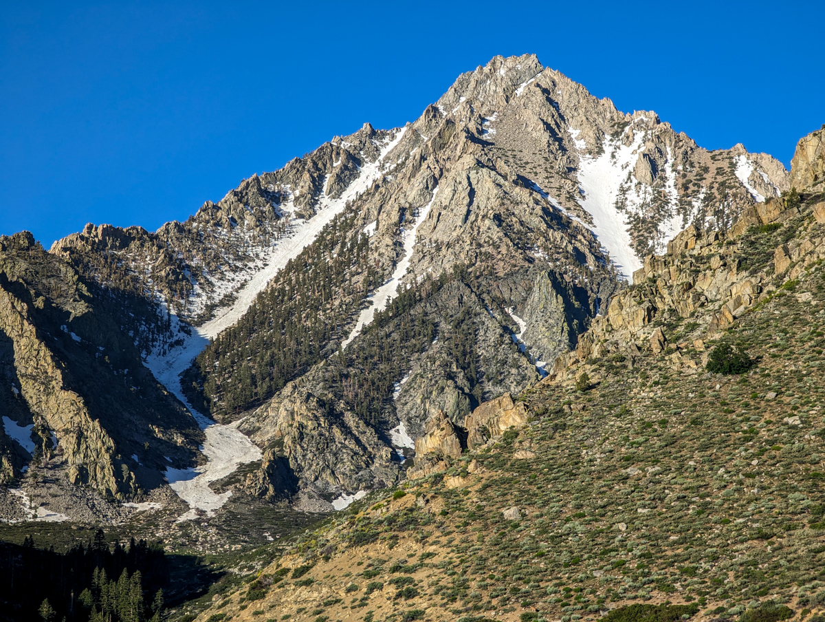
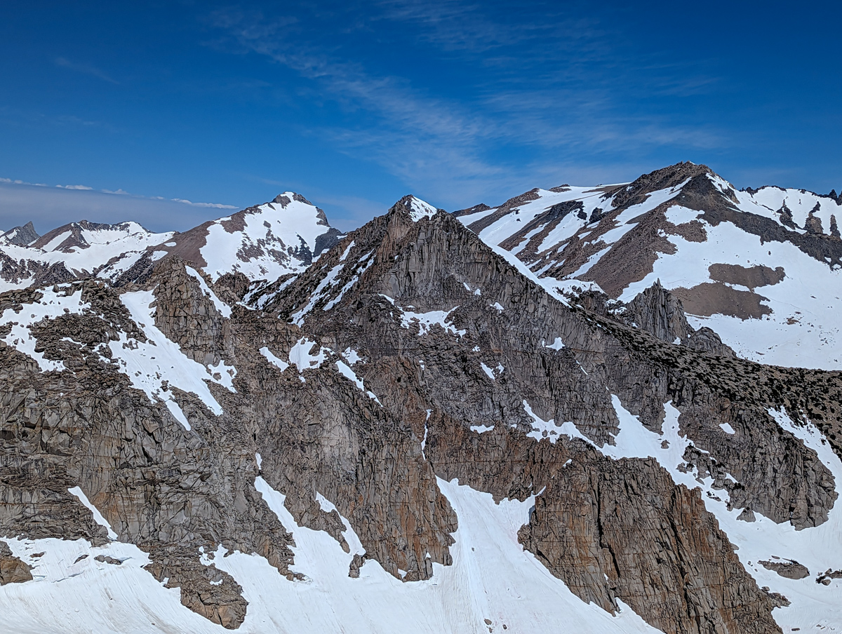
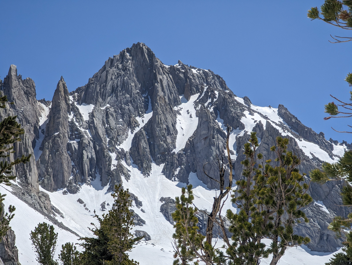
The Northeast Face of University Peak is commanding from that perspective.
We contemplated coming back for a chute that slithered across that face.
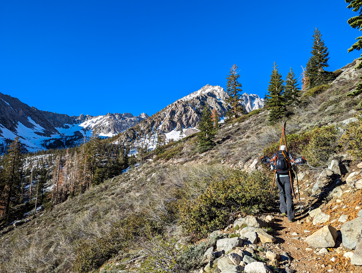
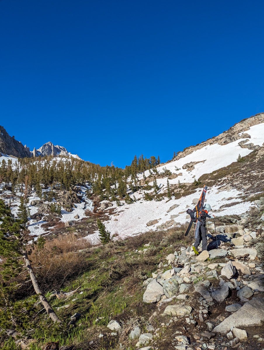
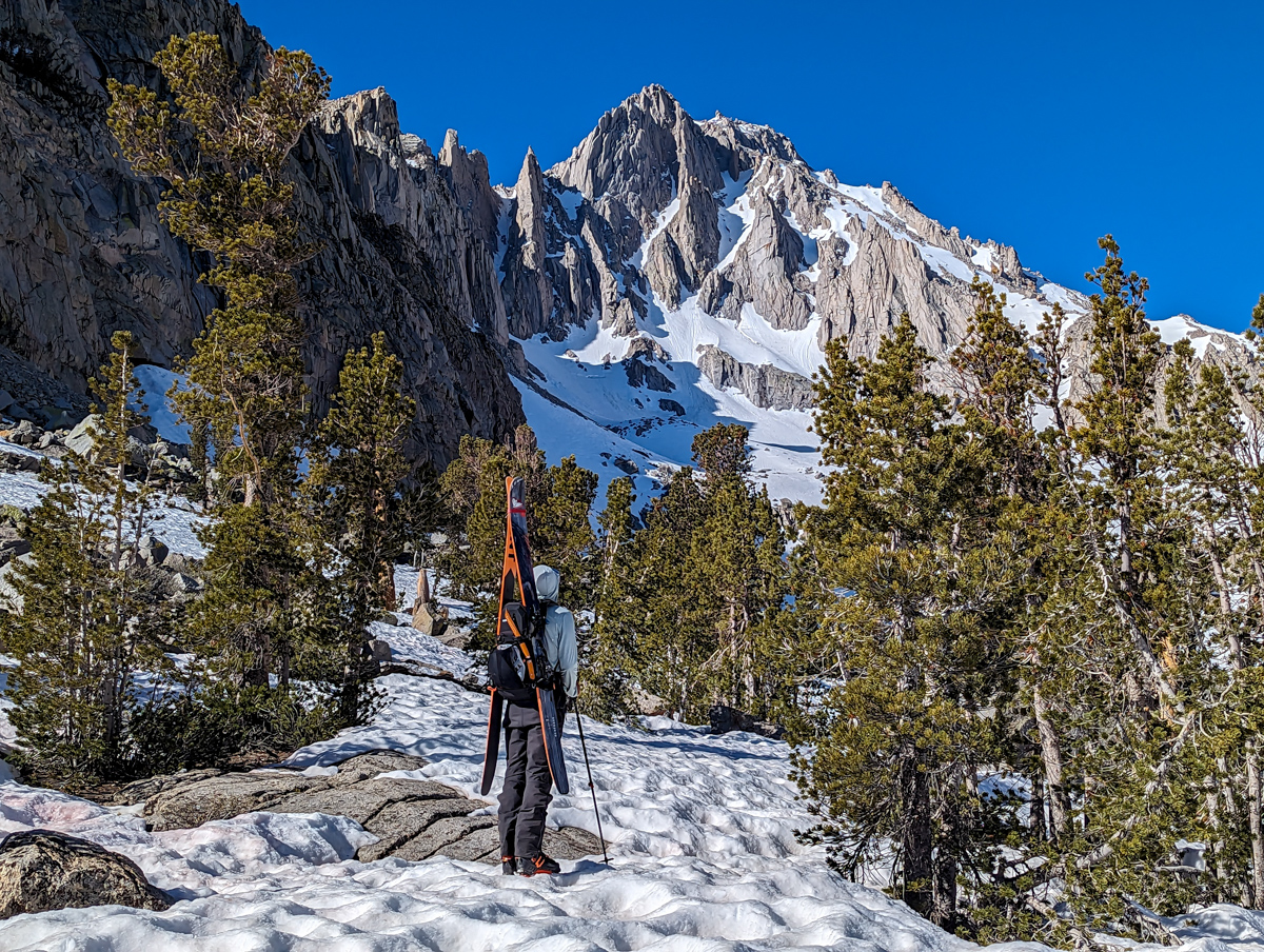
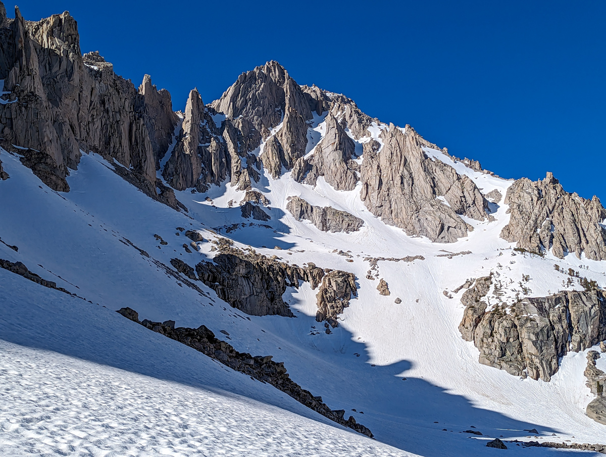
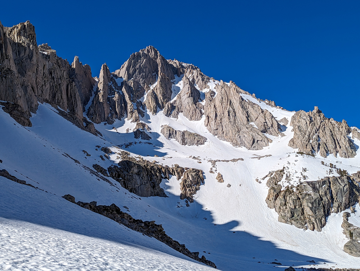
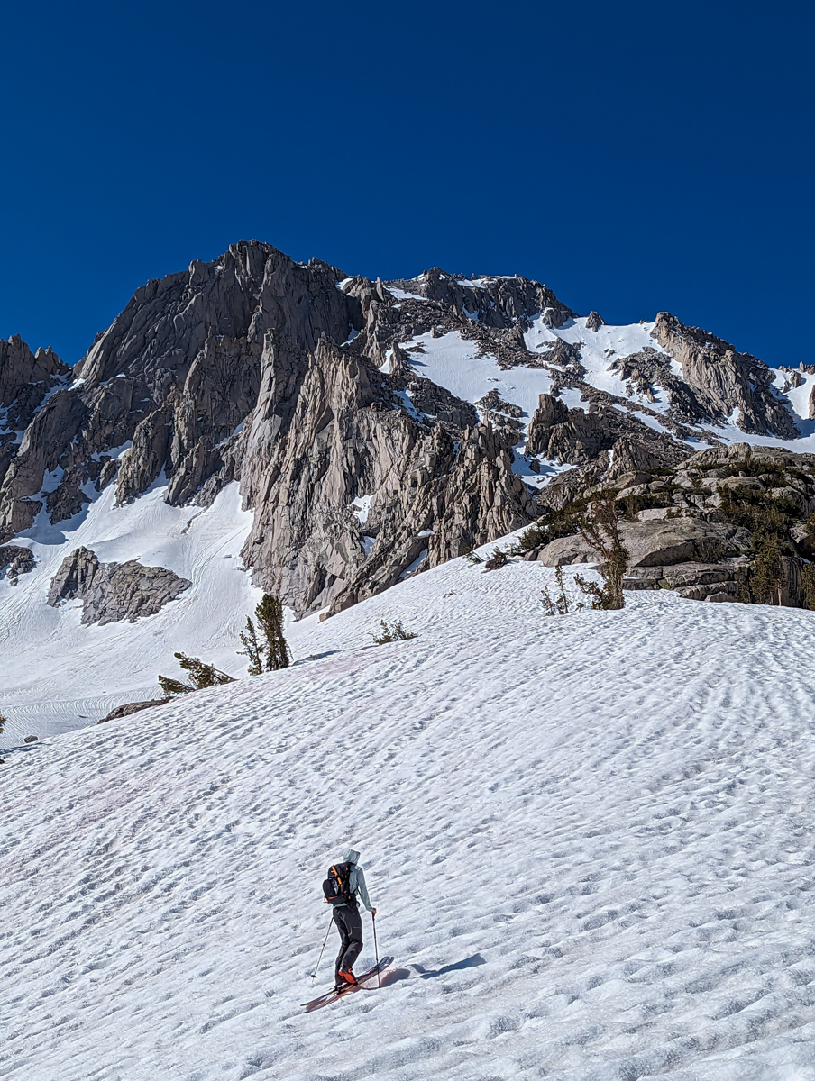
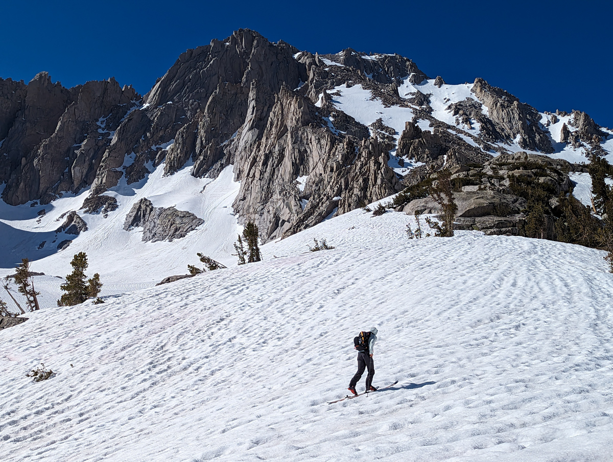
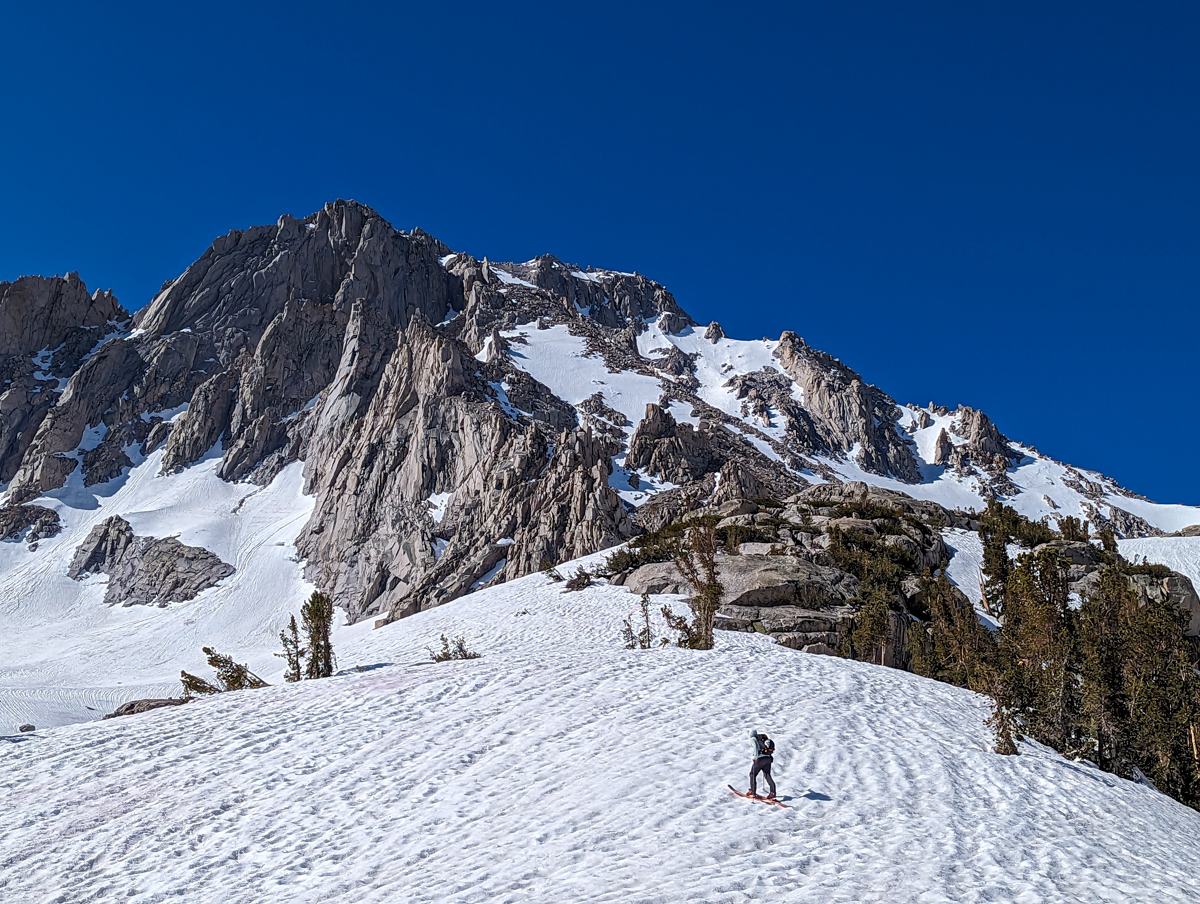
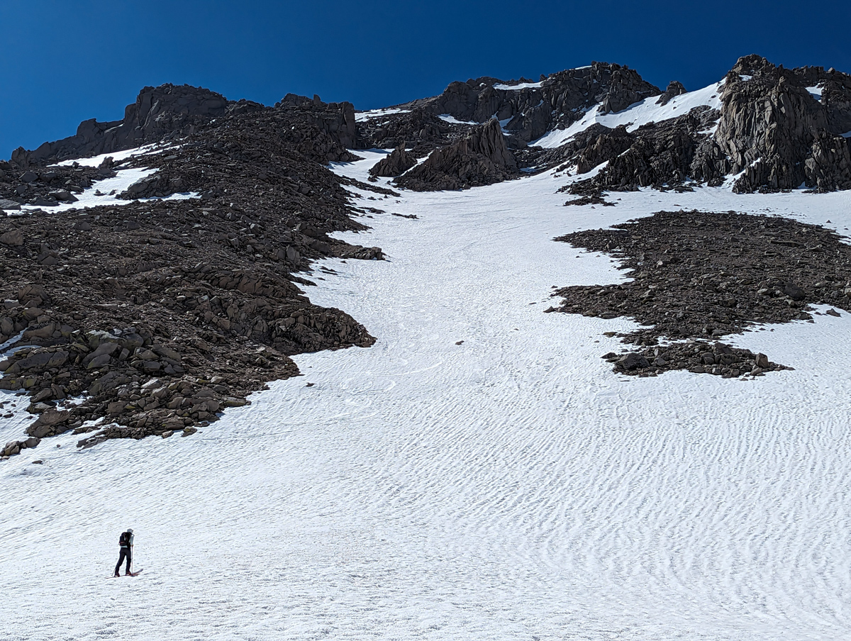
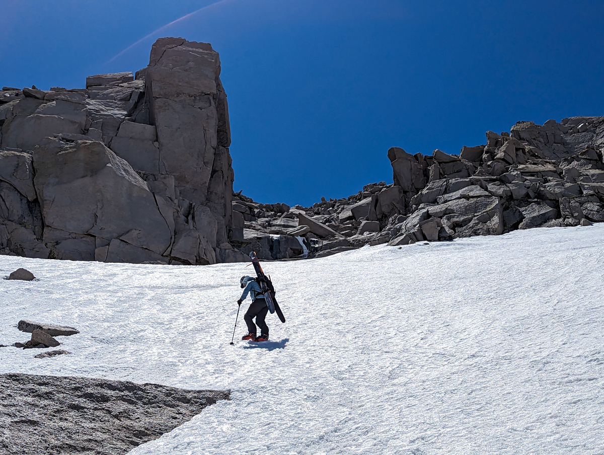
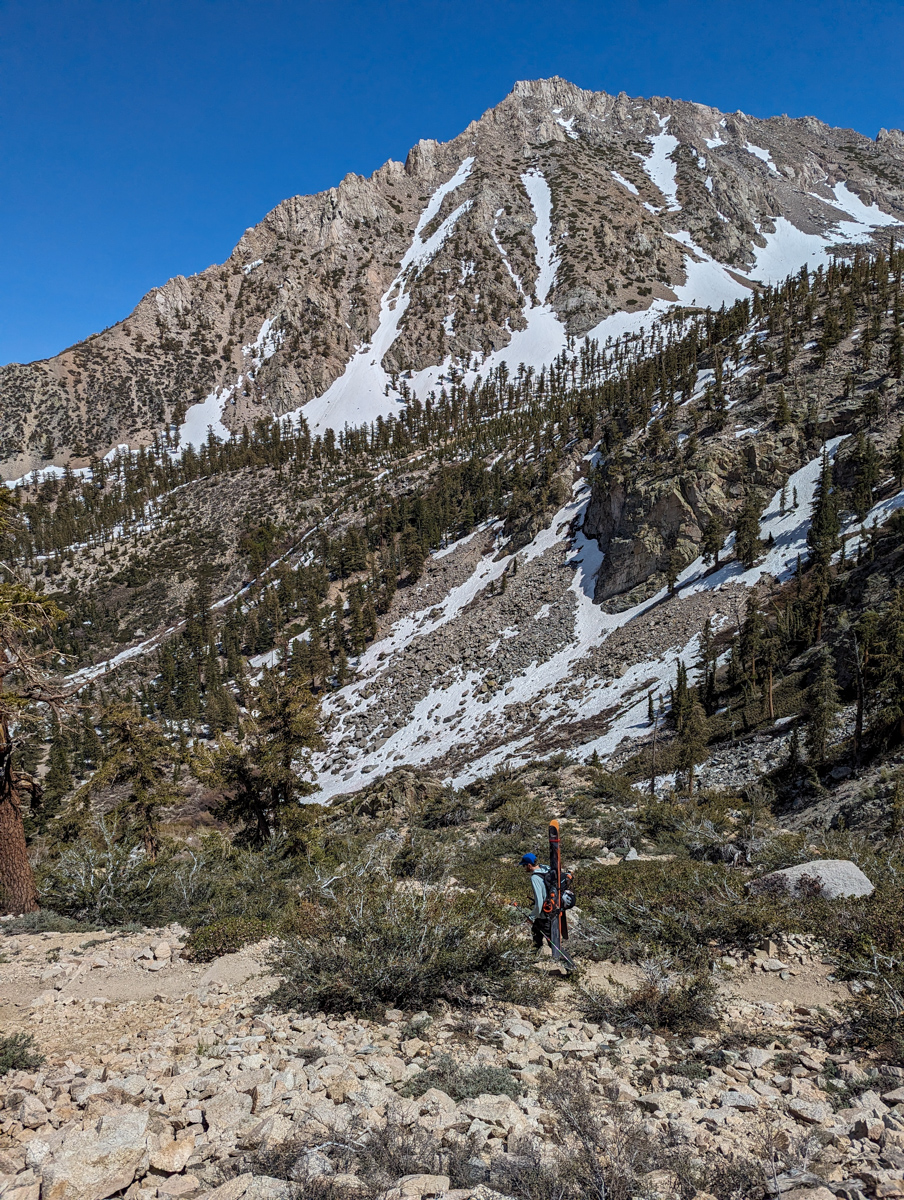
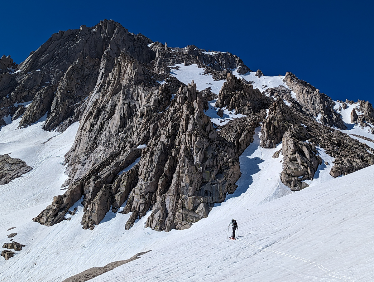
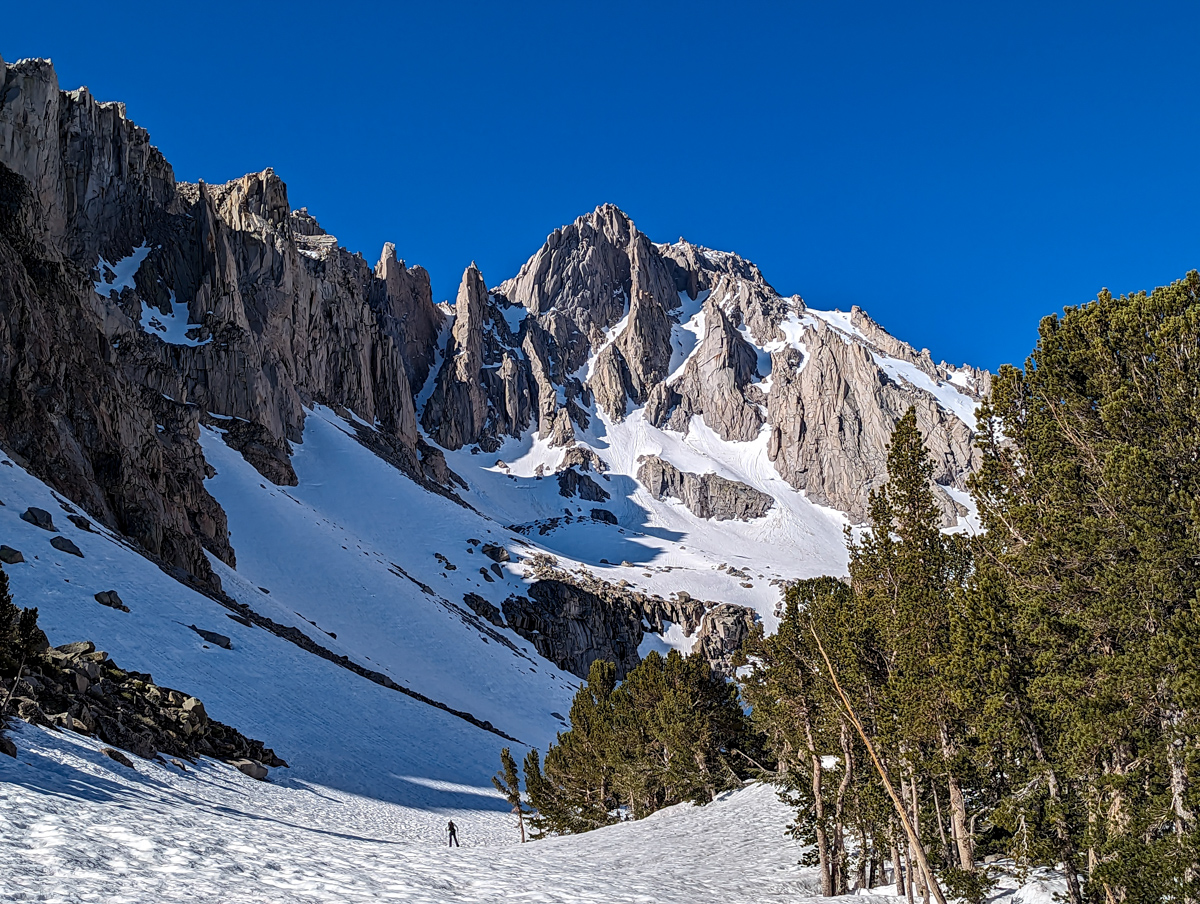
From there, we put on skins and did one big zig-zag up to the bench at the bottom of the “North Face” of University.
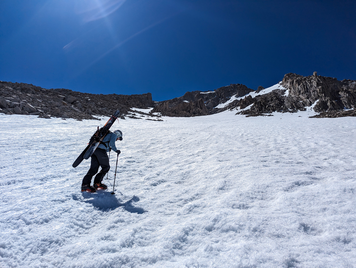
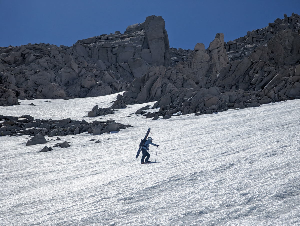
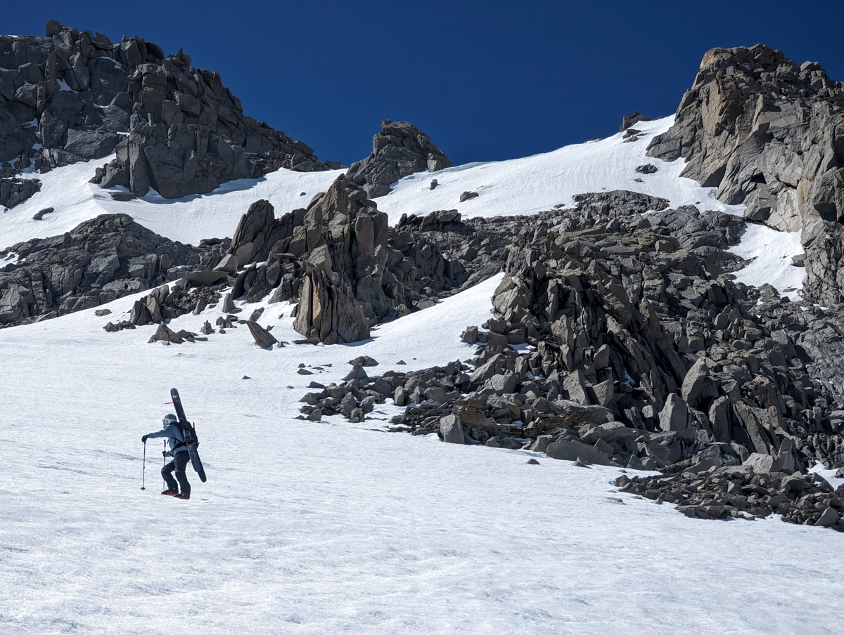
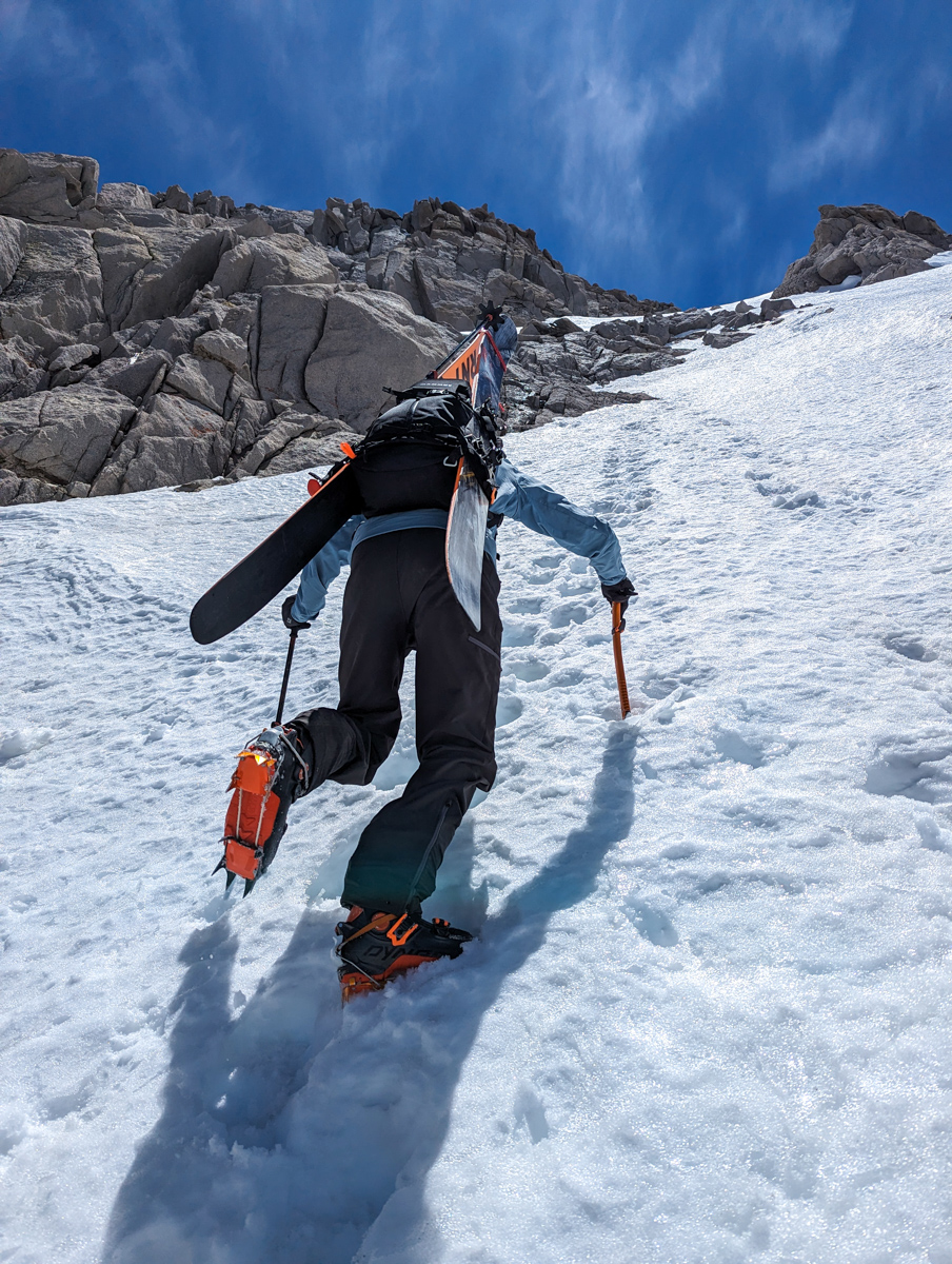
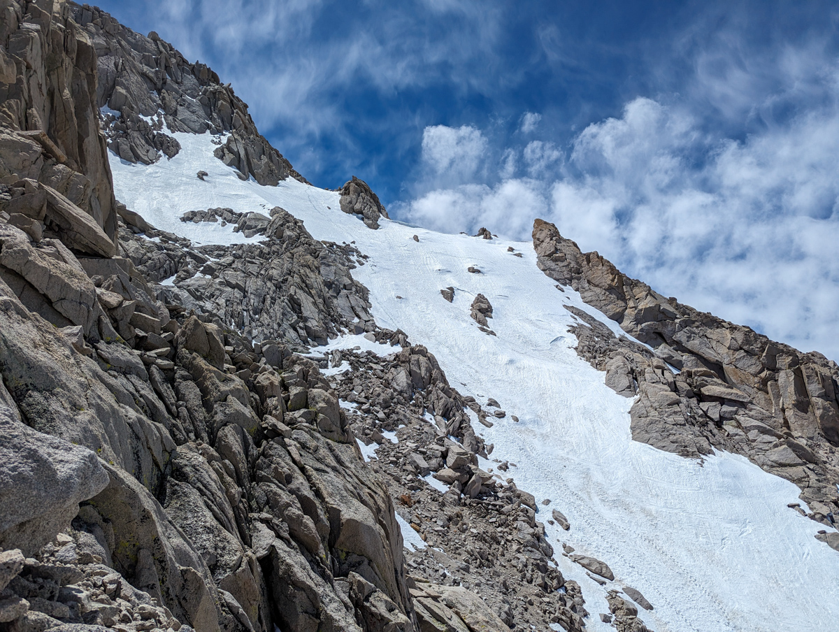
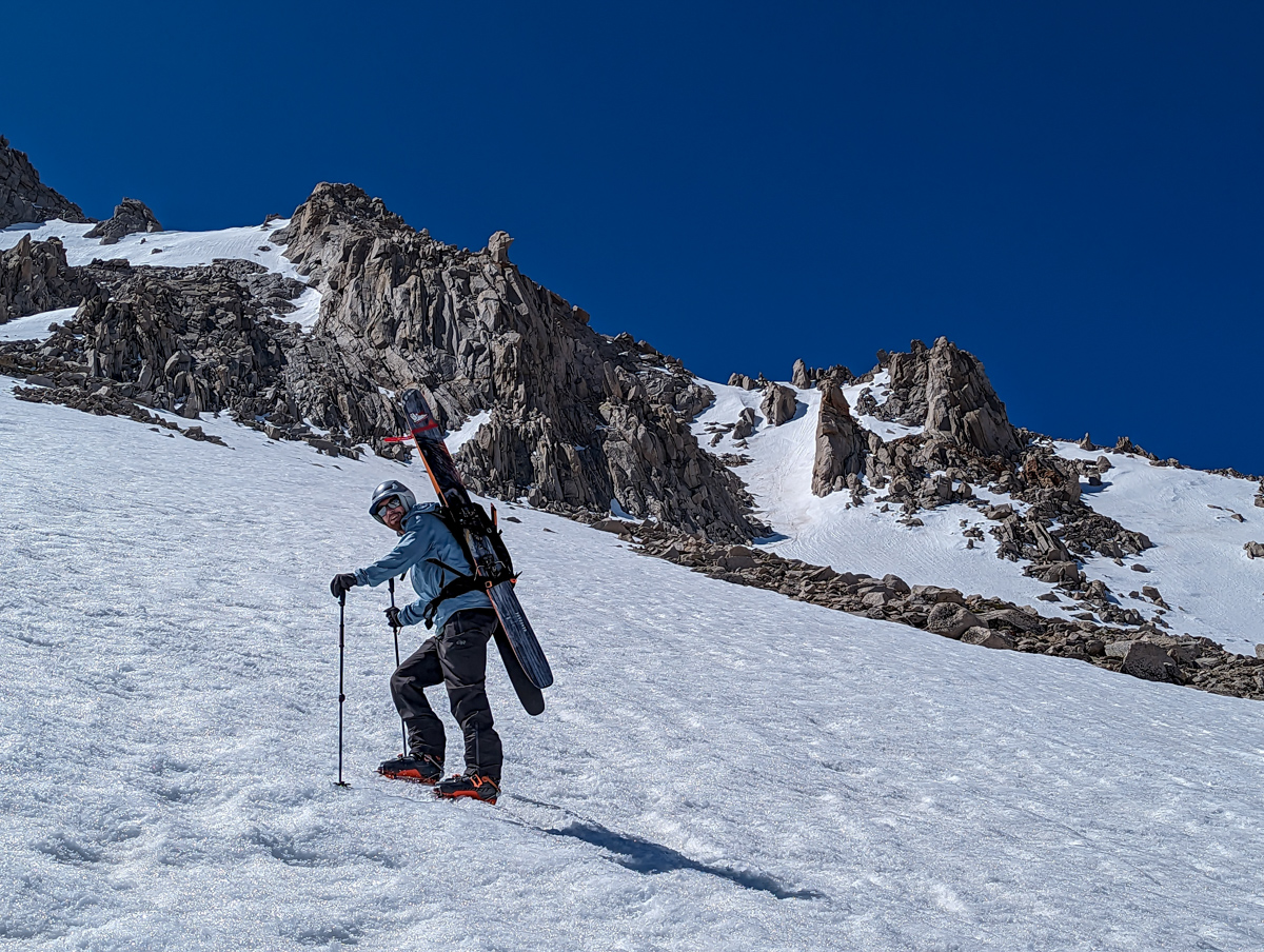
At the base of the big gully, we switched to crampons and started switchbacking up.
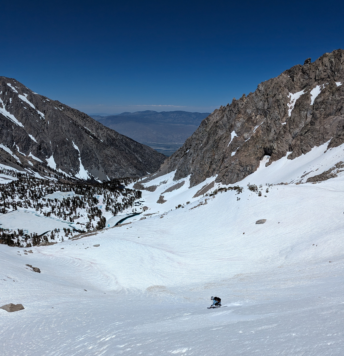
The run didn’t look very impressive from the bottom.
A big, long, flat gully to the summit ridge.
Meh.
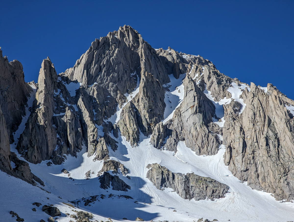
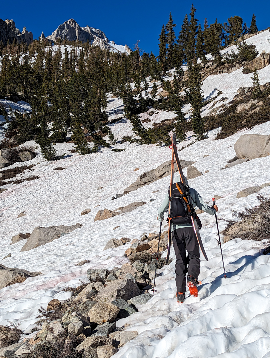
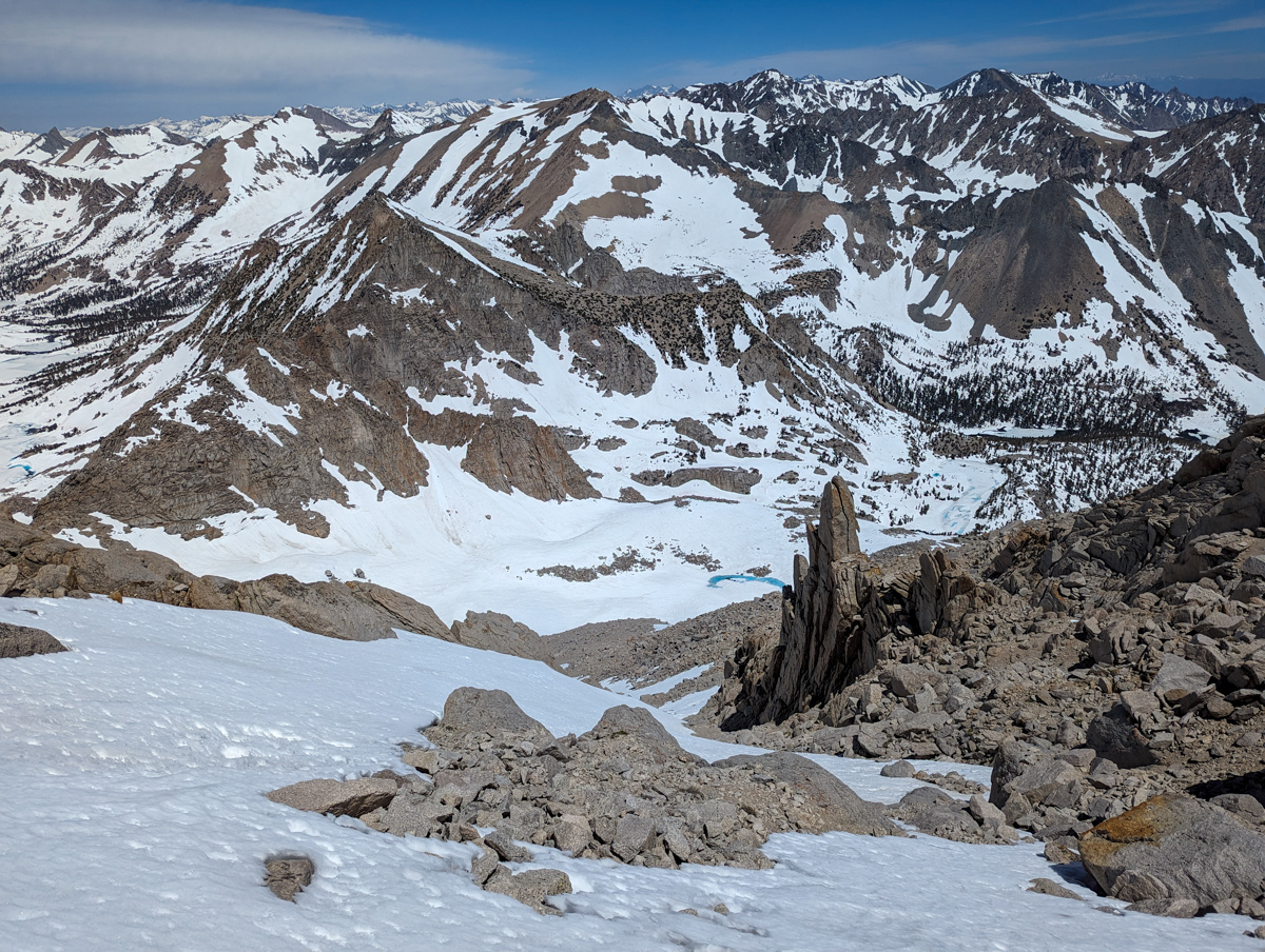
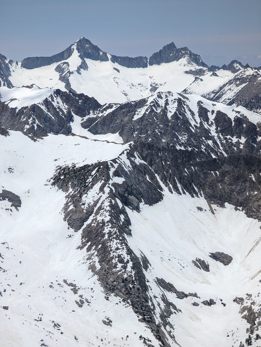
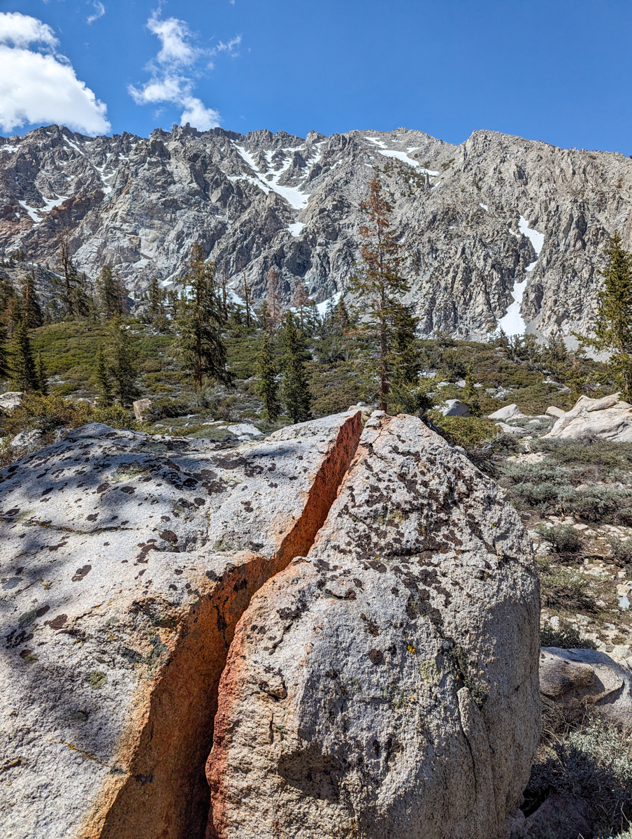
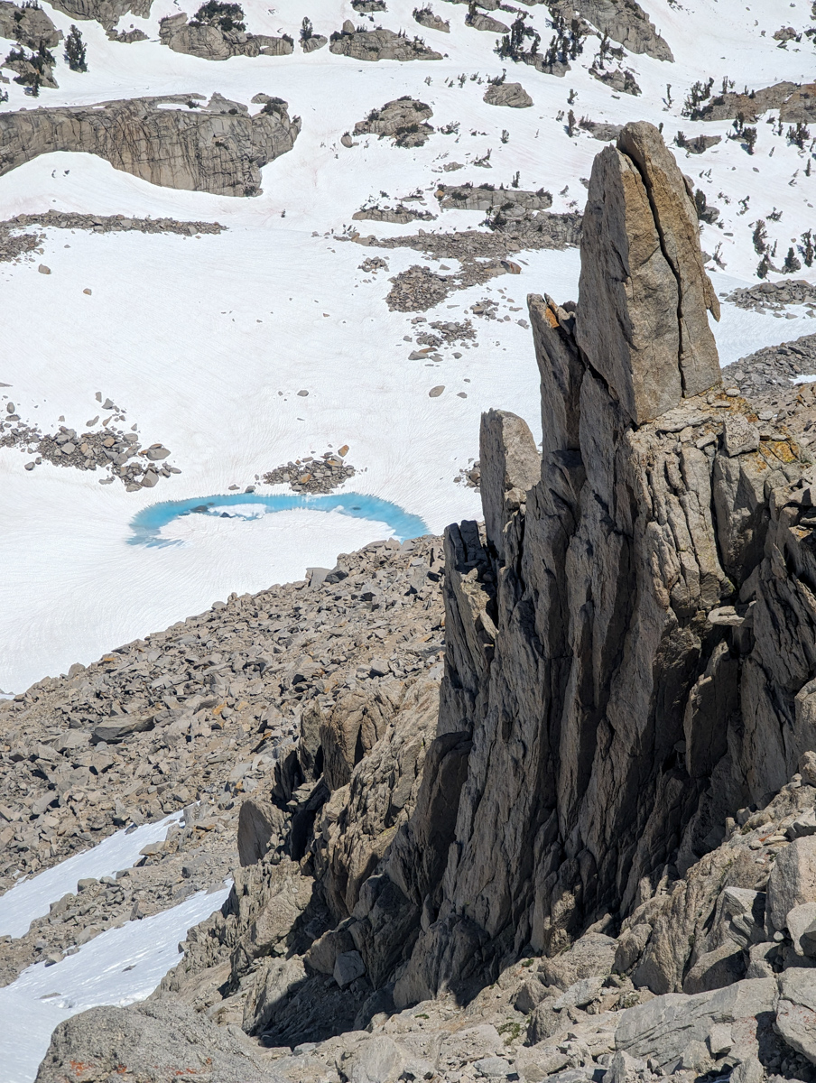
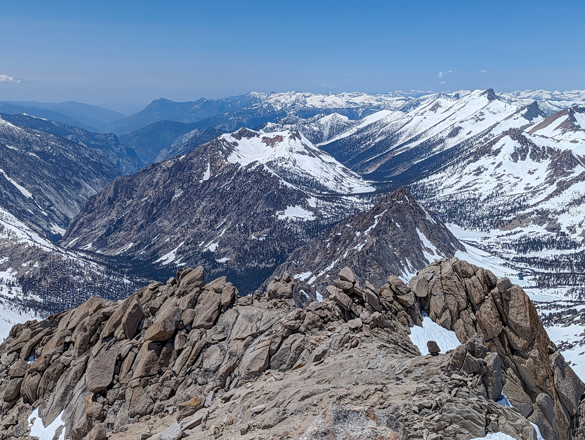
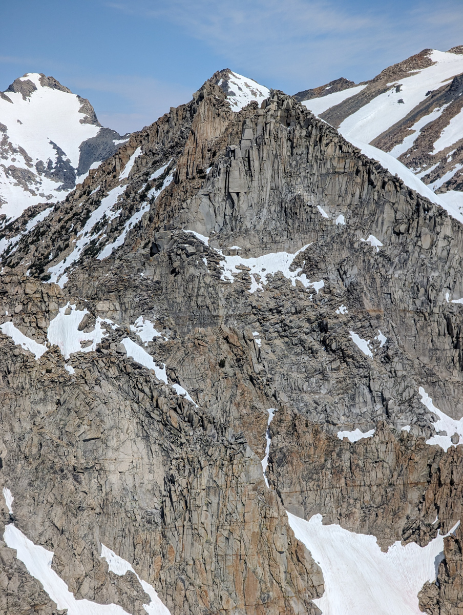
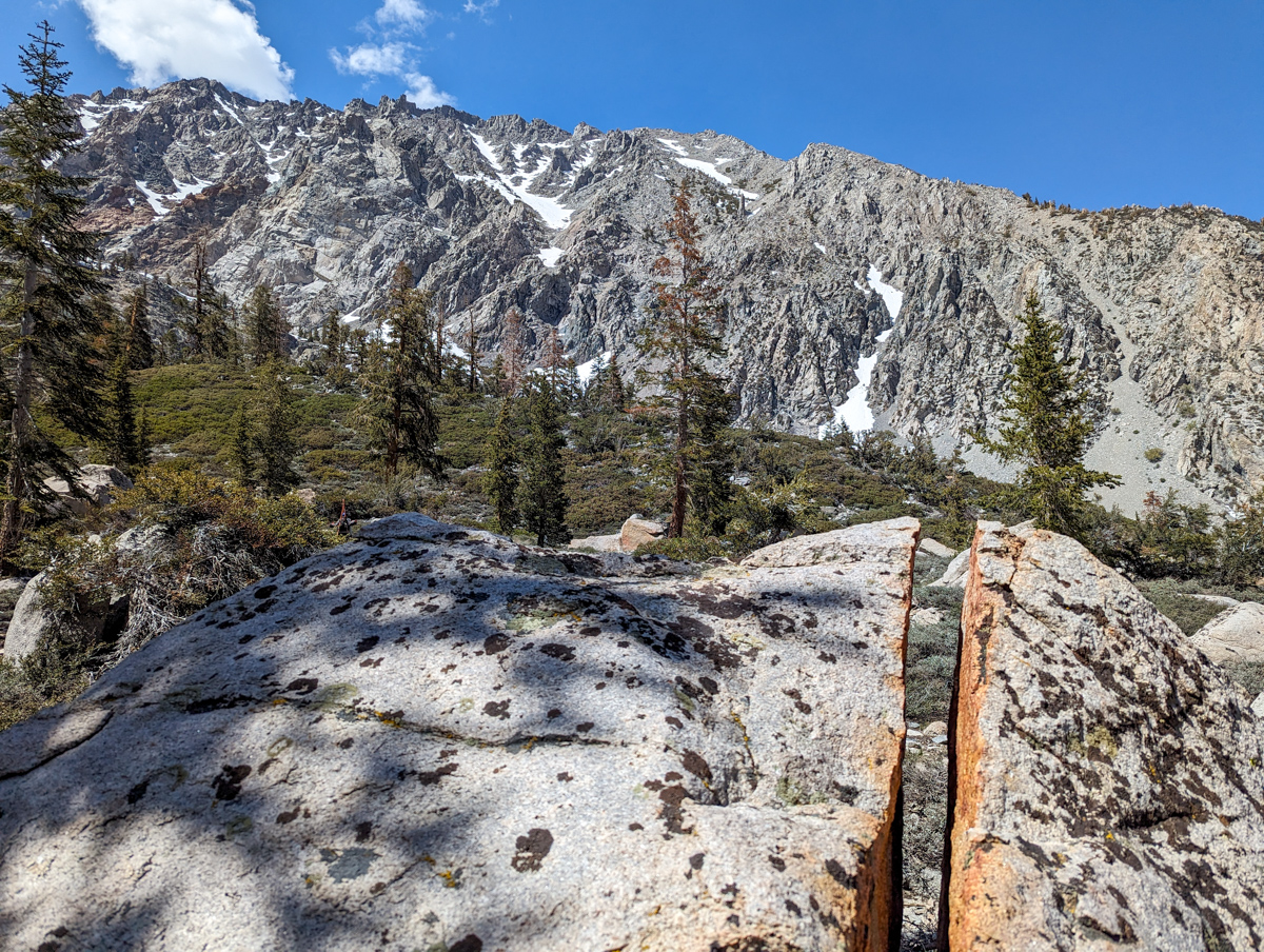
As we ascended, the views began to become delirious.
Huge granite faces, impossibly sharp peaks, and unnatural relief.
This was by far the most “High Sierra” zone we’d entered.
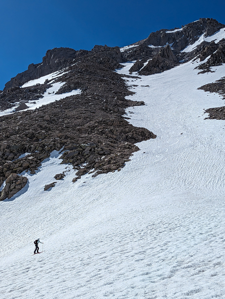
As the big lazy gully ran on, we had to choose left or right.
We chose left as we thought it went higher.
Wrong.
Oh, and did I mention it was cold and windy and firm?
It was cold and windy and firm.
It didn’t seem realistic for the snow to soften this day.
I had flashbacks from my frightening experience with bulletproof steep skiing on Mt. Thompson two days prior.
We took the looker’s left branch of snow until it ended and pulled over for a nap.
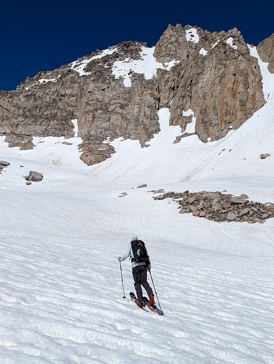
We chilled there for one hour.
The temp seemed to rise, and the wind seemed to stop.
I walked over to the looker’s right snow branch that reached the summit ridge to see if the snow had softened.
It had.
We clambered over loose granite to the right snow branch and started up.
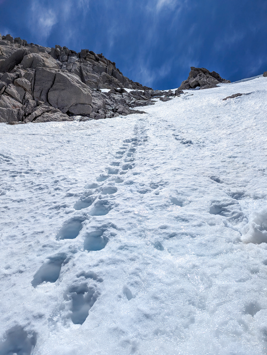
Of course, as we climbed, the snow got firmer.
We ended up full-on ice climbing up 51º frozen corn snow to the summit.
We were both a bit gripped, but at least it was softer and not as scary as my time on Thompson…
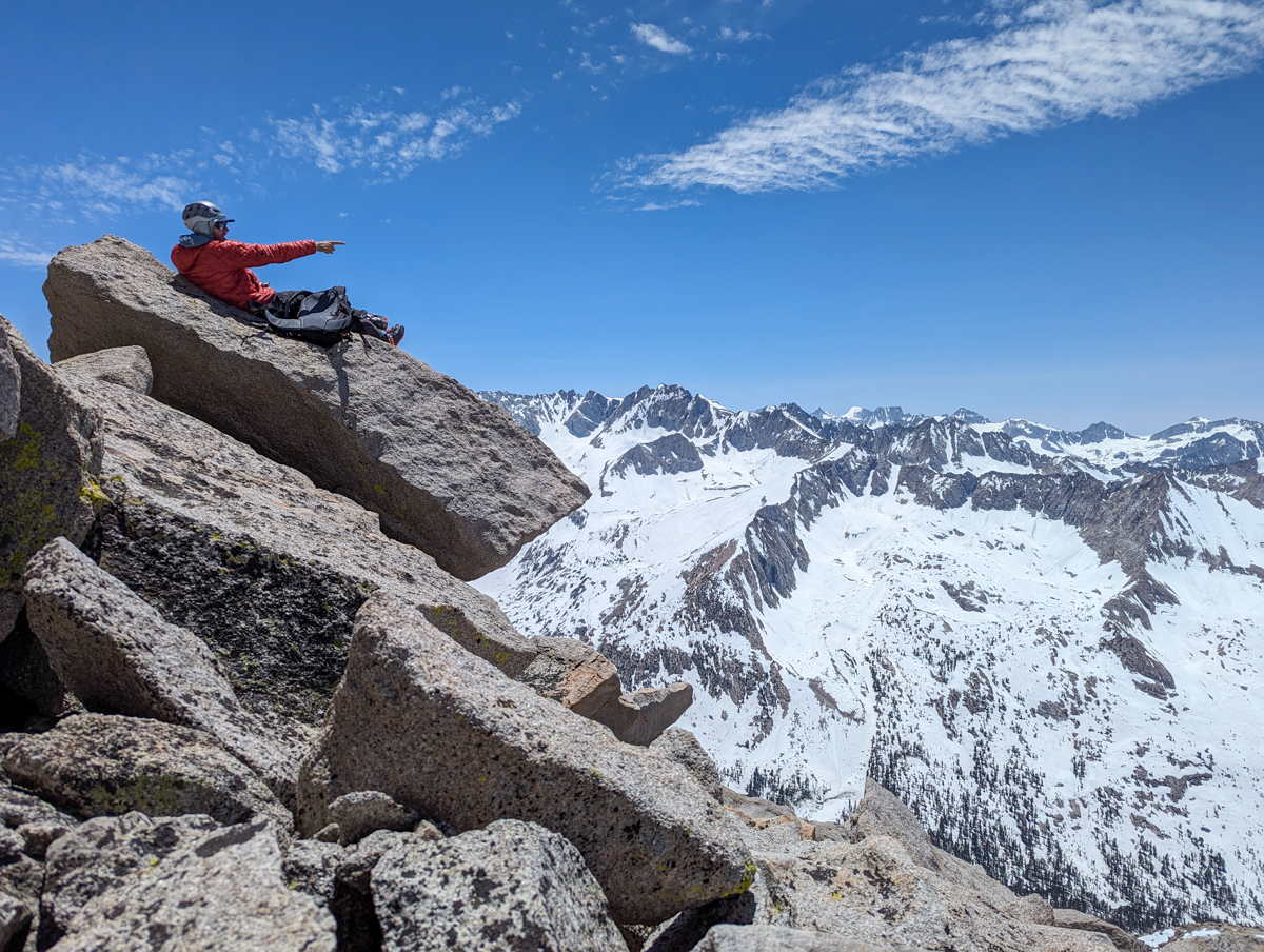
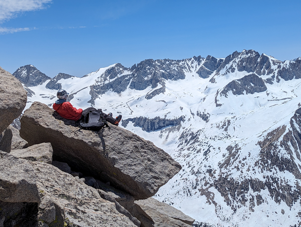
We chilled for 30 minutes on top, hoping for more softening.
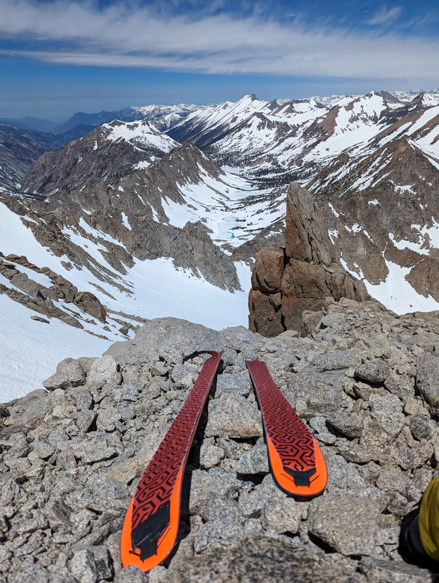
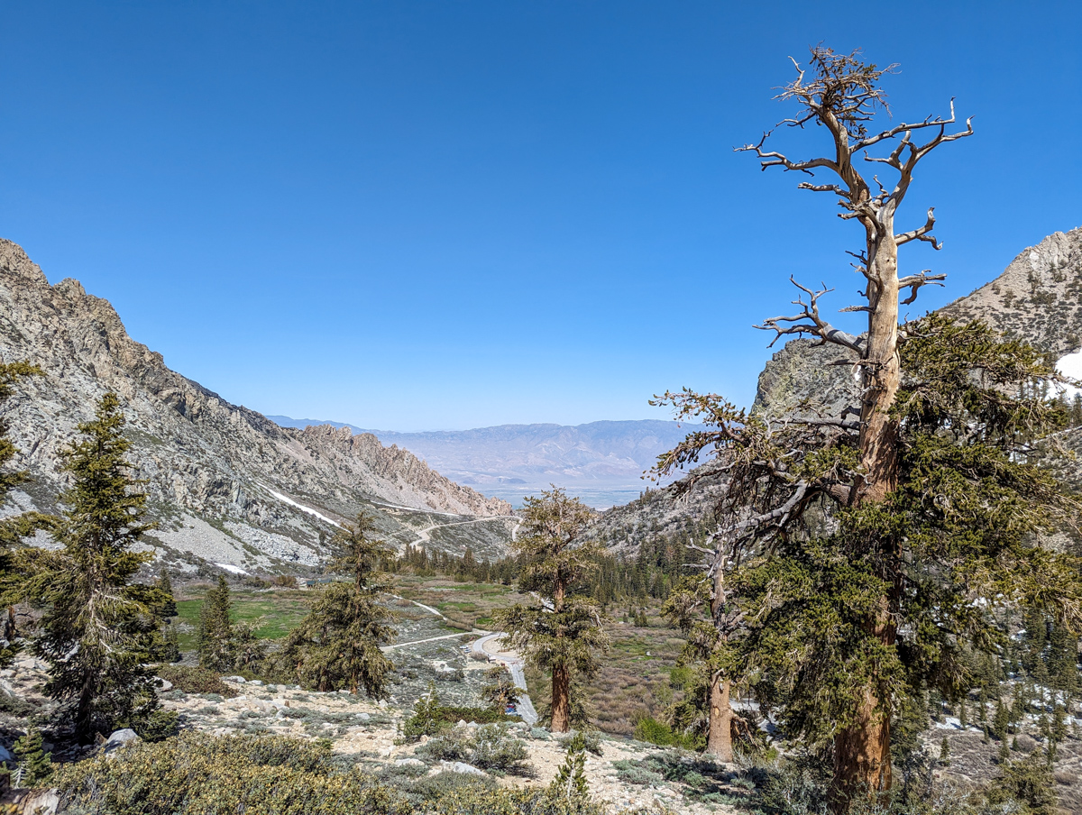
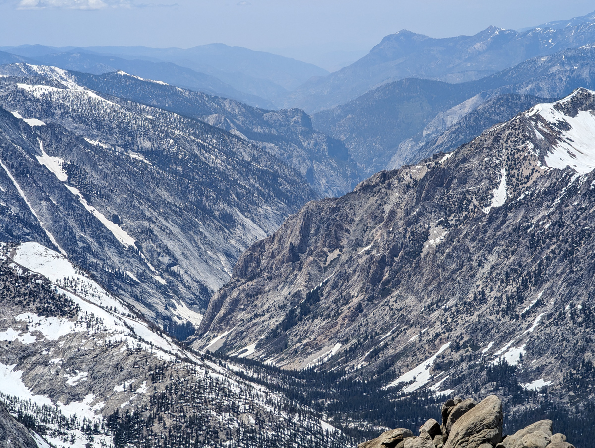
The views into Kings Canyon were gorgeous – literally.
The best summit views of the spring thus far.
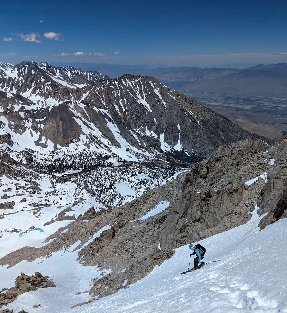
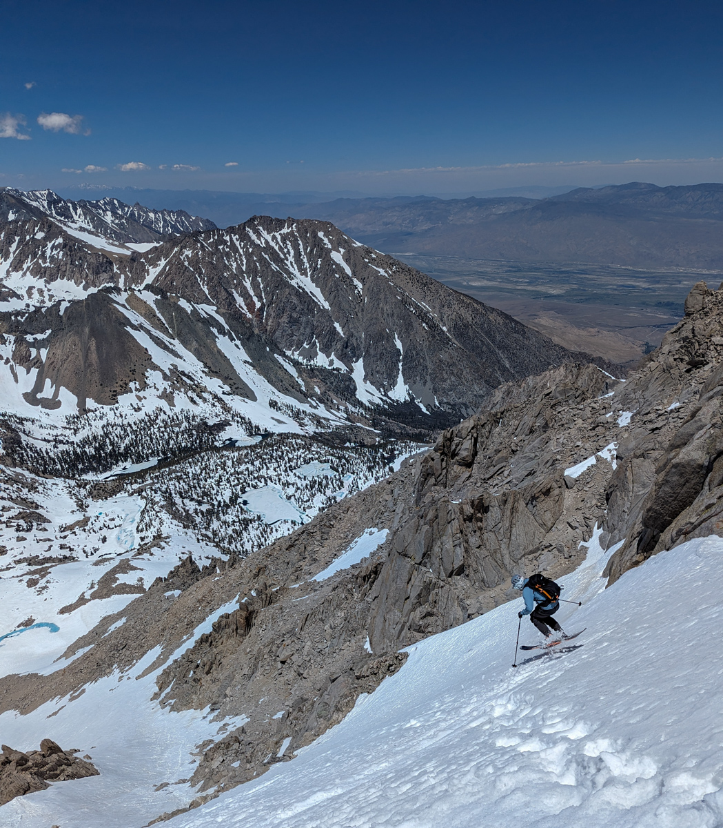
At 2 pm, it was time to drop.
Lee went first, and it was clearly rock-hard and scary.
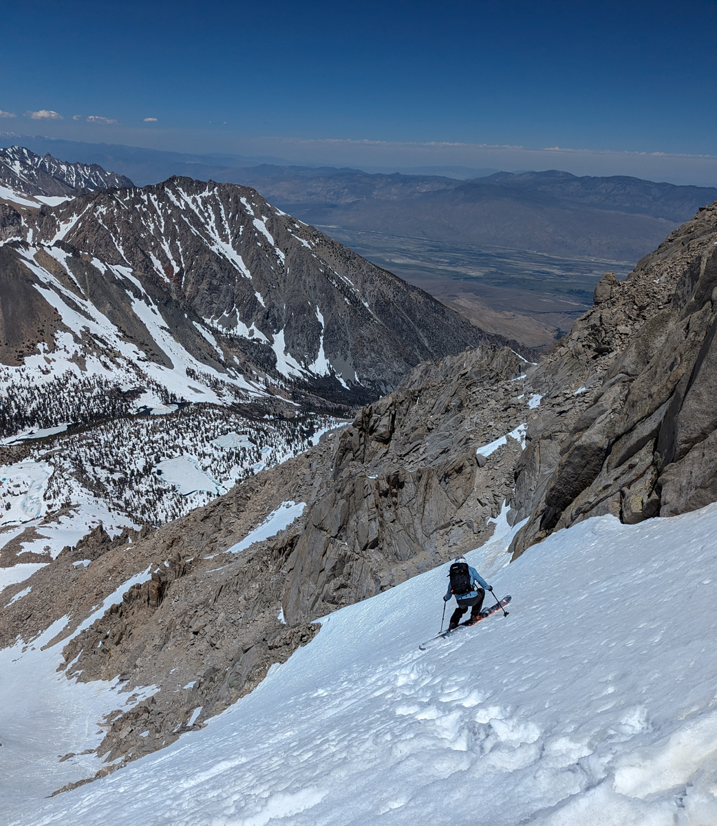
I waited for him to clear to a safe zone, then tried to ski the fall line.
I couldn’t.
Too firm.
I hacked my way down for about 12 turns before the snow softened, and I was able to link turns and have fun.
The skiing got good!
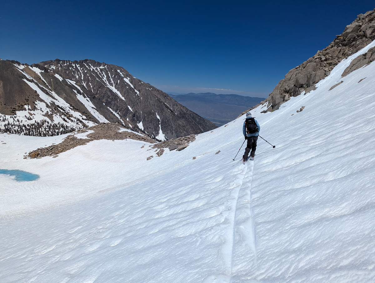
I ski-sauntered down the complex slope until my lungs gave out.
Lee caught up to me, and we party-skied the entire big gully to the bench below.
I was smoked.
Lee is a beast, and I wouldn’t have skied that whole thing had he not done it non-stop.
After not being impressed by the run from the bottom, it was an epic ski with many smiles.
From there was traversed over to slopes above the Matlock Lakes and skied a well-walled chute in great corn.
Best skiing of the day for sure!
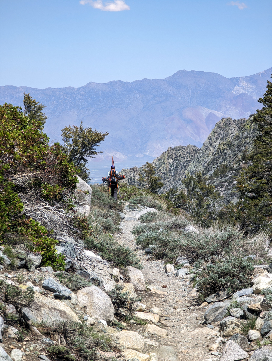
A traverse and some goofy tree skiing brought us back to our tent friends’ creek crossing, and we were back to our shoes.
30-minutes of trailing, hiking, and signing plugged us right into the car.
We met Don from Monroe, UT, looking for bear tracks in the brush by the cars.
This week, he broke his wrist when he awoke a bear while walking to his spring down valley.
He owns and operates the pack station there: Sequoia Kings Pack Station.
His hand felt like wood when I shook it.
Not like hewn wood.
Like an old gnarly branch that had been frayed by the baking sun.
A real cowboy.
The drive down the Onion Valley road was treacherous and awesome.
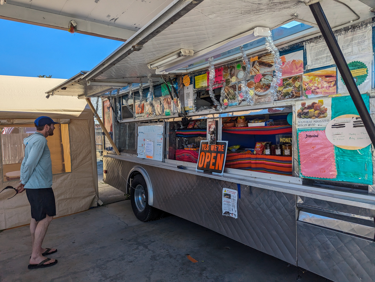
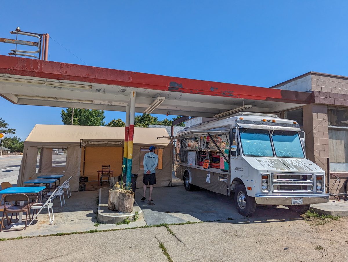
Lee found us Glenn’s Taqueria truck in Independence, and we feasted in a hot, swirling roadside wind.
Birria was the special of the day.
The drive home was filled with painfully inspiring views and stories about Mt. Williamson’s “Giant Steps.”
Yesterday was the biggest adventure we’ve had out here, even if most of the adventure was really just how impressive the views were.
Thanks, California!
SPRING 2023 REPORTS
- 6/20/23:Trip Report: 13,494′ Mt. Thompson, CA – “Trident Couloirs”
- 6/15/23: Trip Report: 12,871′ Mount Johnson, CA – “North Couloir”
- 6/9/23: Trip Report: 13,366′ Point Powell, CA – “Point Powell Couloir”
- 6/8/23: Trip Report: 12,219′ Hurd Peak, CA – “North Face”
- 6/4/23: Trip Report: The Incredible Hulk, CA – “Hulk Left Couloir”
- 6/2/23: Trip Report: 13,187′ Basin Mountain – “Basin Couloir Alternate”
- 5/31/23: Trip Report: 12,808′ Four Gables, CA – “Tungstar Bowls”
- 5/27/23: Trip Report: 11,160′ Mt. Scowden – Lundy Canyon – “North Face Chute”
- 5/24/23: Sierra Nevada, CA Report: Skiing Through A Lava Tube Cave
- 5/23/23: Trip Report: 13,118′ Mt. Emerson – The 45º Steep “North Couloir”
- 5/20/23: Trip Report: 12,200′ Mt. Esha, CA – “2nd Chute”
- 5/18/23: Trip Report: McGee Creek Peak, CA – 2,800-Vertical-Foot “Wineglass Couloir”
- 5/16/23:Trip Report: 10,908′ Carson Peak, CA – 45º Steep “Pete’s Dream”
- 5/5/15/23: Trip Report: 11,812′ Mt. Laurel, CA – 3,500-Vertical-Foot “Pinner Couloir”
- 5/10/23: Trip Report: 13,005′ Mt. Morgan, CA – Nevahbe Ridge Gullies
PHOTOS IN CHRONOLOGICAL ORDER