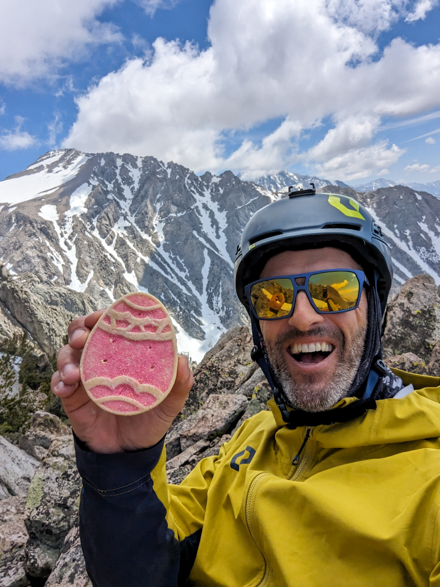
Report from June 27, 2023
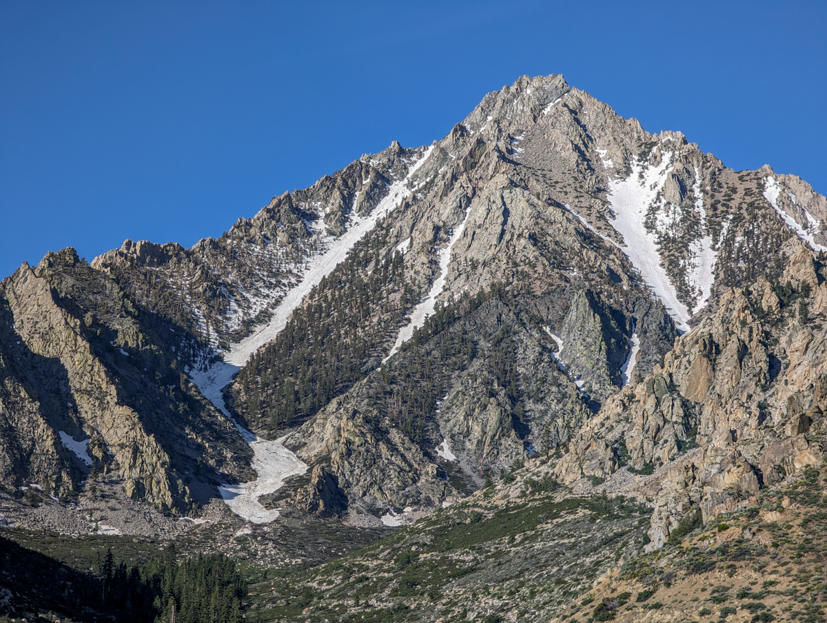
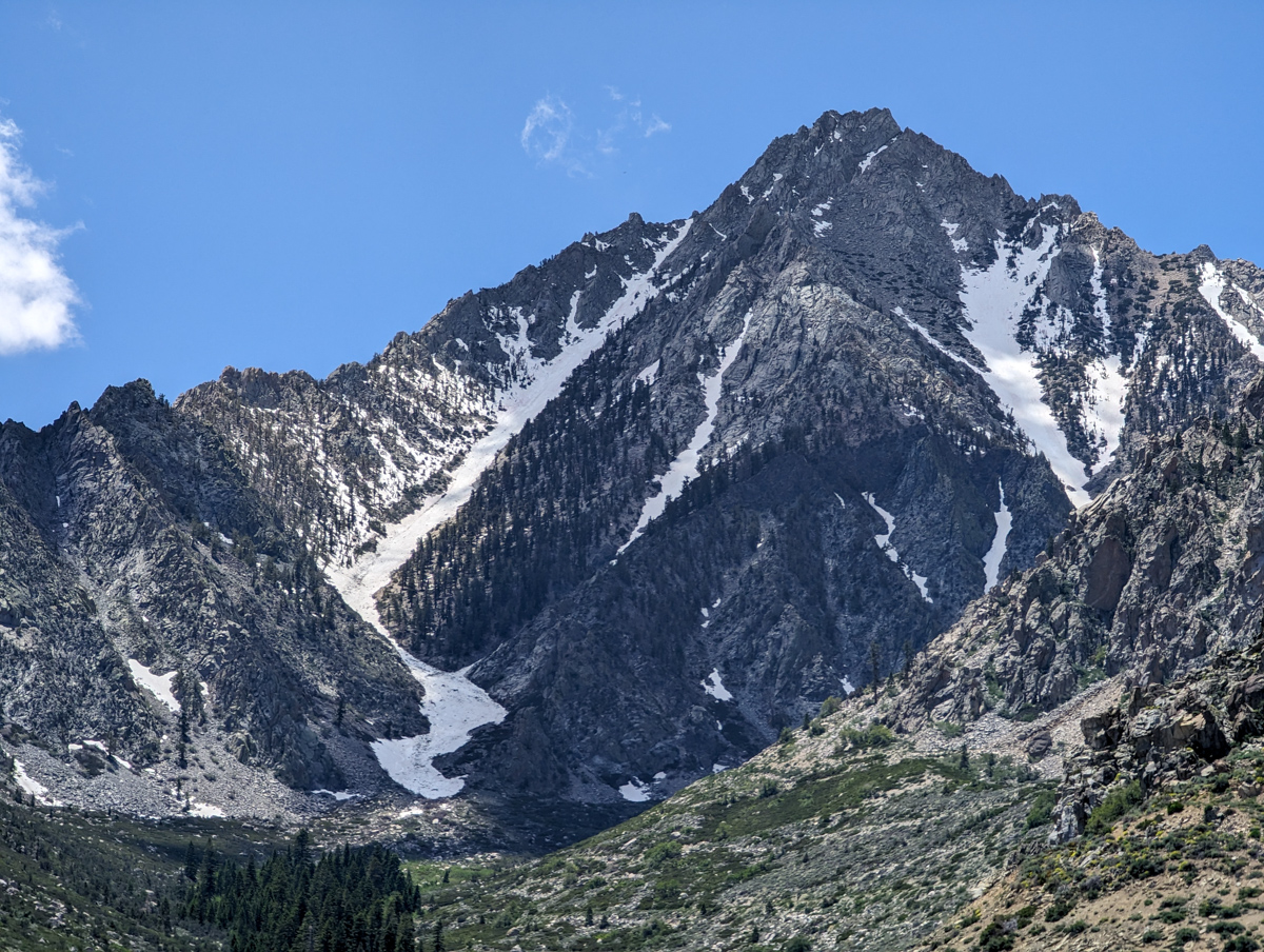
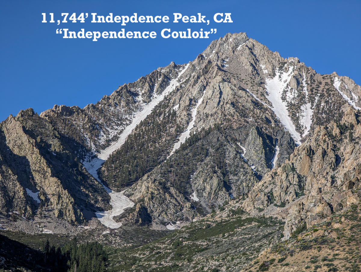
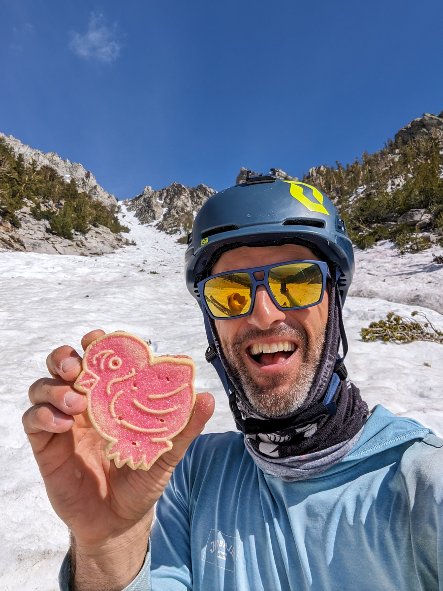
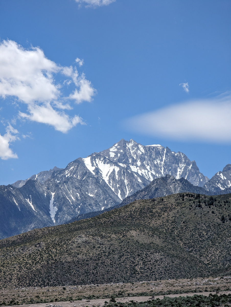
11,744′ Independence Peak, CA’s “Independence Couloir” yesterday was a mind-bender!
This was #18 of our 20 “new-to-us” ski mountaineering lines Eastern Sierra project 2023.
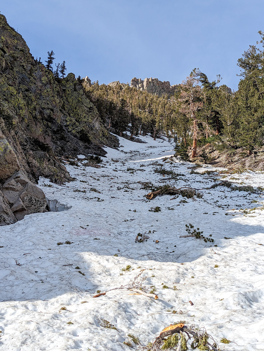
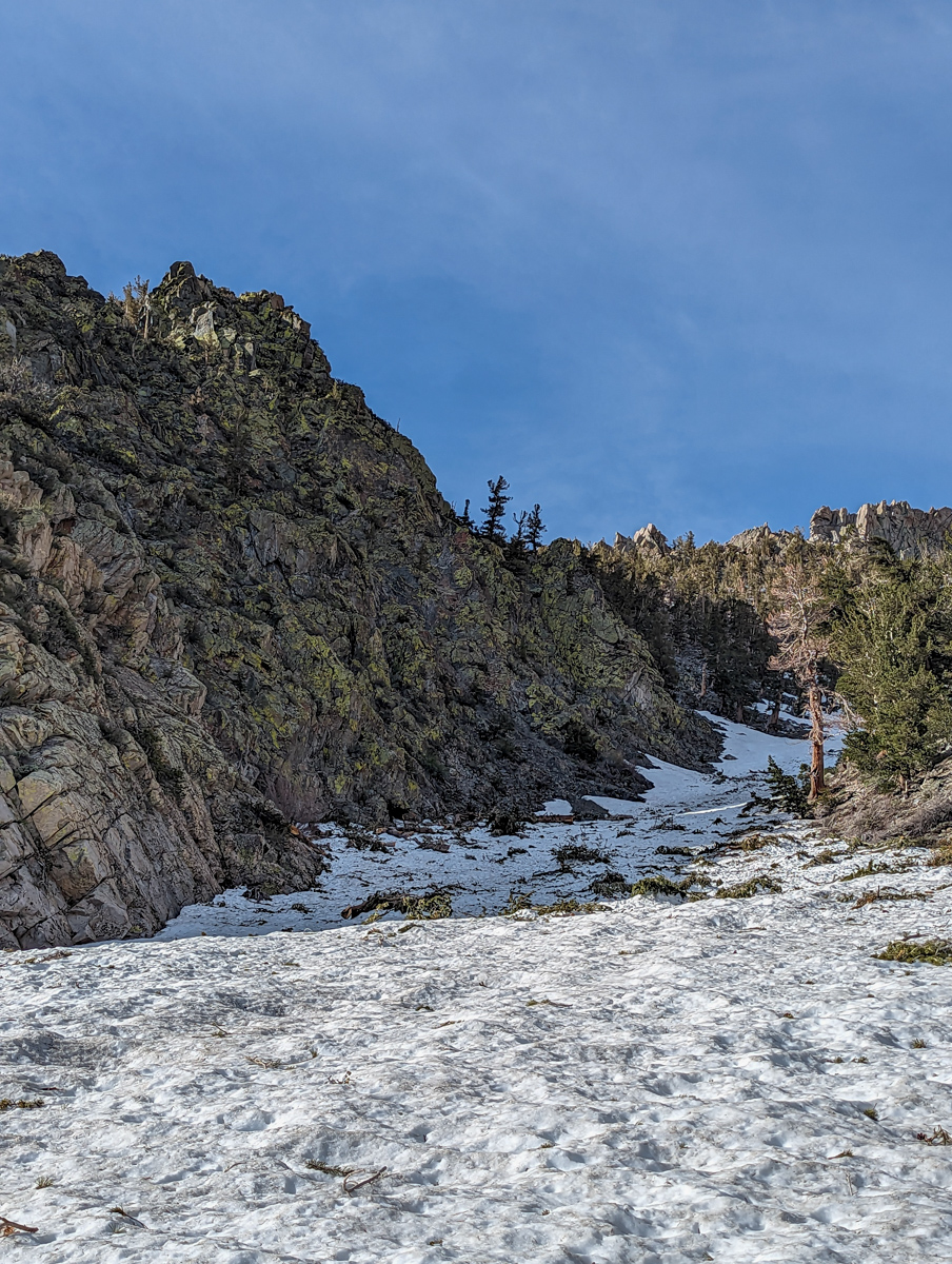
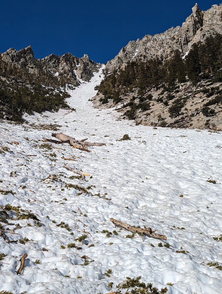
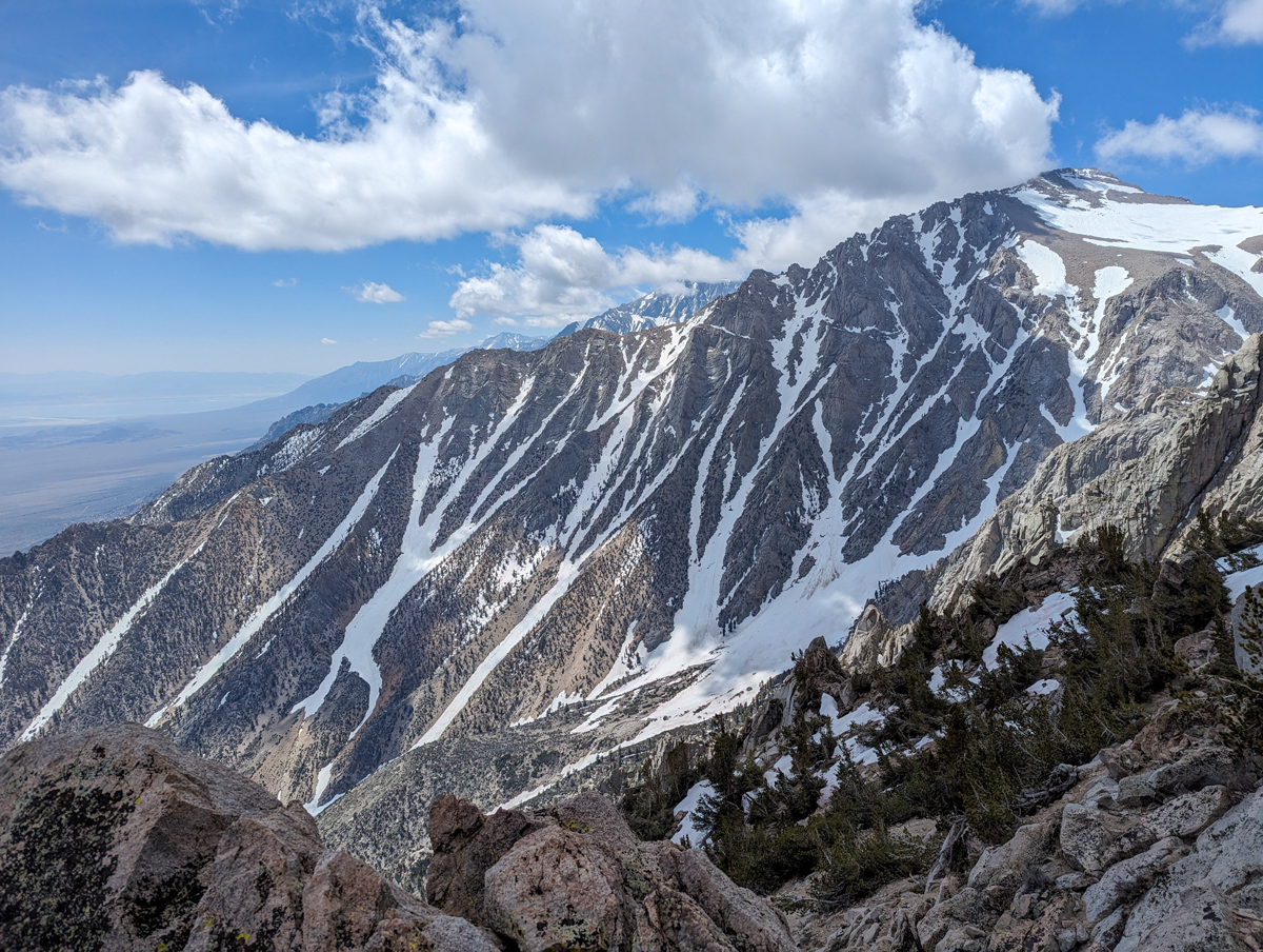
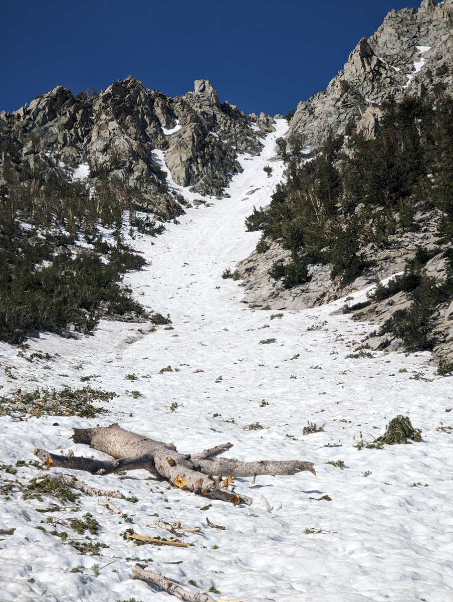
We knew this chute would be sun-cupped and bumpy, but we just couldn’t resist this 2,500-vertical-foot, in-your-face, dazzling Eastern Sierra couloir.
The top was recklessly fun.
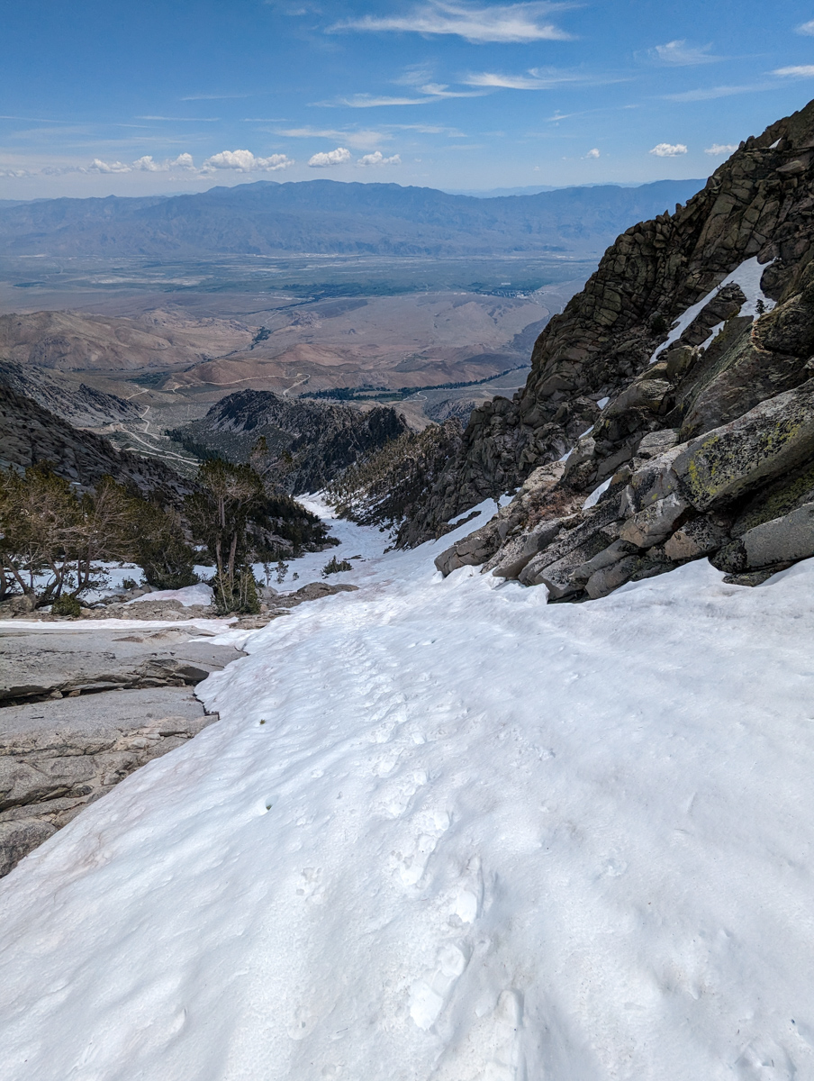
The middle was pretty heinous in spots…
Then the bottom was a groovy orange peel texture that was very skiable.
About halfway up the chute, I thought I was almost on top. 2-hours later, I finally topped out and realized how deceiving this legendary chute truly is.
We’ve only gotta get two more ski mountaineering lines to complete our Eastern Sierra project, and Tioga Pass isn’t even open yet.
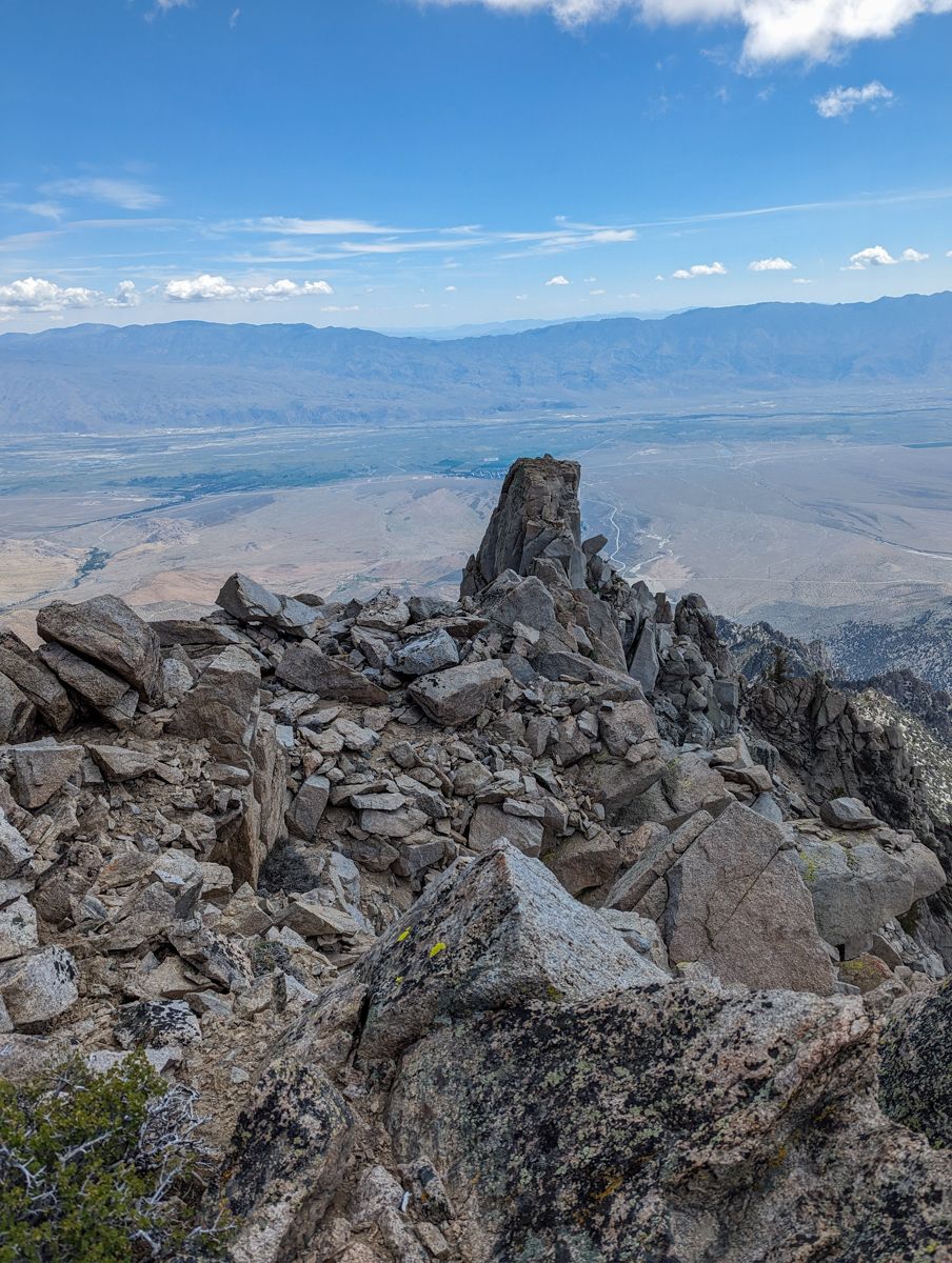
11,744′ Independence Peak, CA – “Independence Couloir” Details
- Summit (actually a notch): 11,400′
- Car: 9,200′
- Vertical From Car: 2,900′ (some up and down on road)
- Vertical skied: 2,800′
- Max Pitch: 40+º
- Avg Pitch: 30º
- Aspect: Northeast
- Distance: 3.4-miles round trip
- Time From Car to Top: 3 hours & 27 minutes
- Car to Car Time: 4.5 hours
- Recommended Equipment: Crampons, Ice Axe x 2, Skins, Ski Crampons
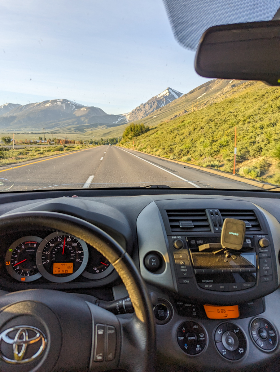
Slept in until 5 am.
On the road by 6 am.
Hiking by 8 am.
It was already 55ºF where I parked…
I was a little worried about the snow being too soft due to the fact that the chute is east facing, but I wasn’t too concerned.
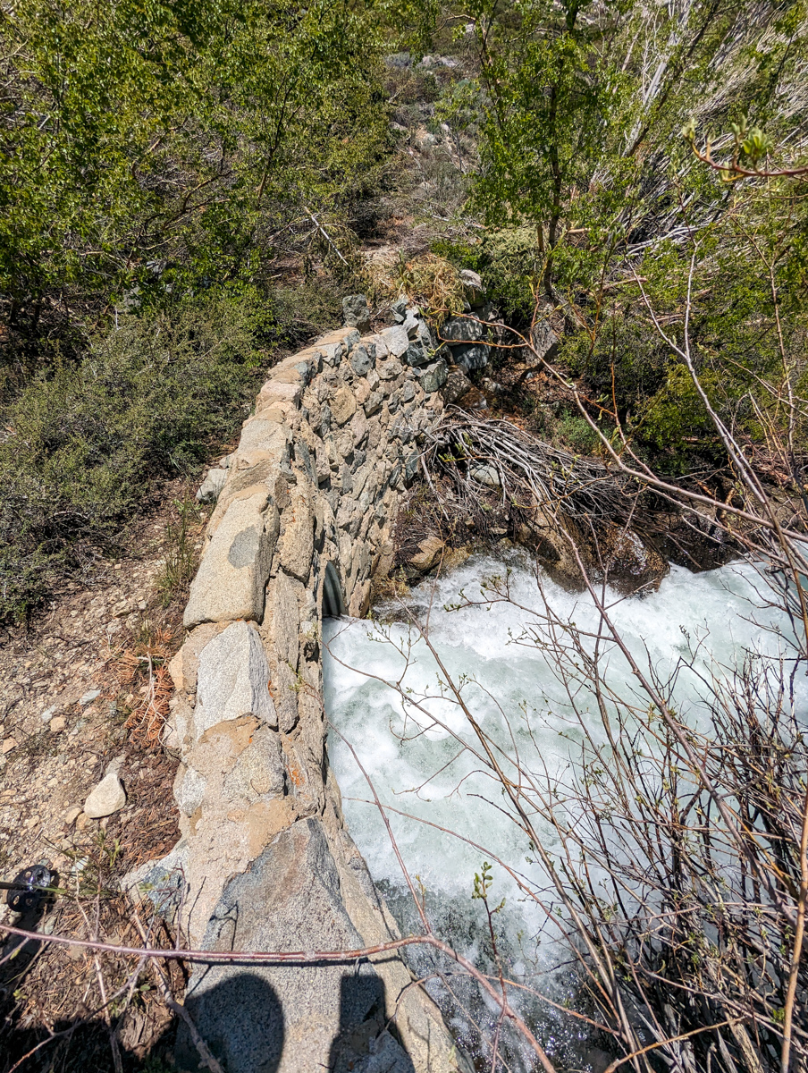
I parked in the exact right spot and crossed the creek on the secret bridge thanks to a SnowBrains fan’s beta (thanks, Chad!).
- There are two old roads that travel from the bottom of Independence Couloir to the Onion Valley Rd switchbacks
- The higher of the two goes to the secret bridge
- Park on the switchback just above the secret bridge and there’s a faint trail from the parking spot (a pullout) down to the secret bridge
I bushwhacked over the secret bridge and walked along the old road to the snow at the base of the chute.
I threw my skins on and started up the bumpy, avalanche debris-ridden snow (mostly dissected trees).
I was able to skin the first 1,100 vertical feet, and it was easy, fluid-going.
It only took 55 minutes!
It looked to me like I’d be on top in the next half hour.
Easy-peasy.
I switched to crampons and started booting up.
I immediately felt how tired I was and how much harder booting is than skinning.
An hour later, I was nowhere near the top.
The chute had fooled me well.
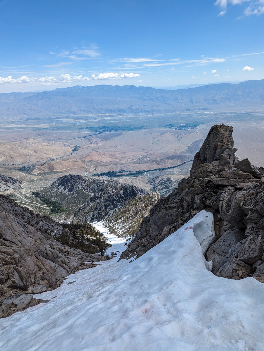
It took another hour to get to the top of the chute.
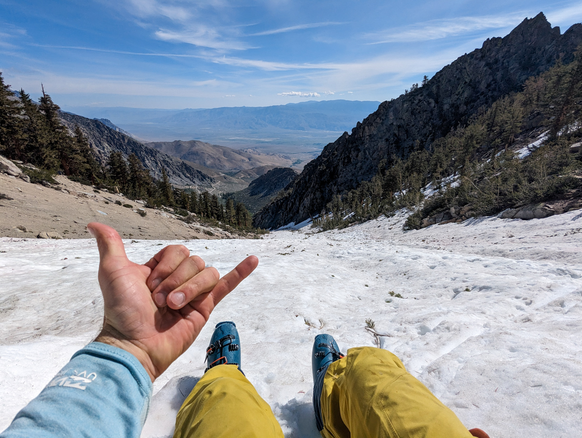
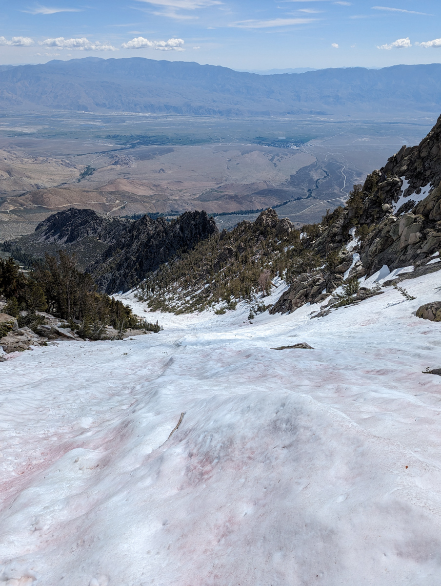
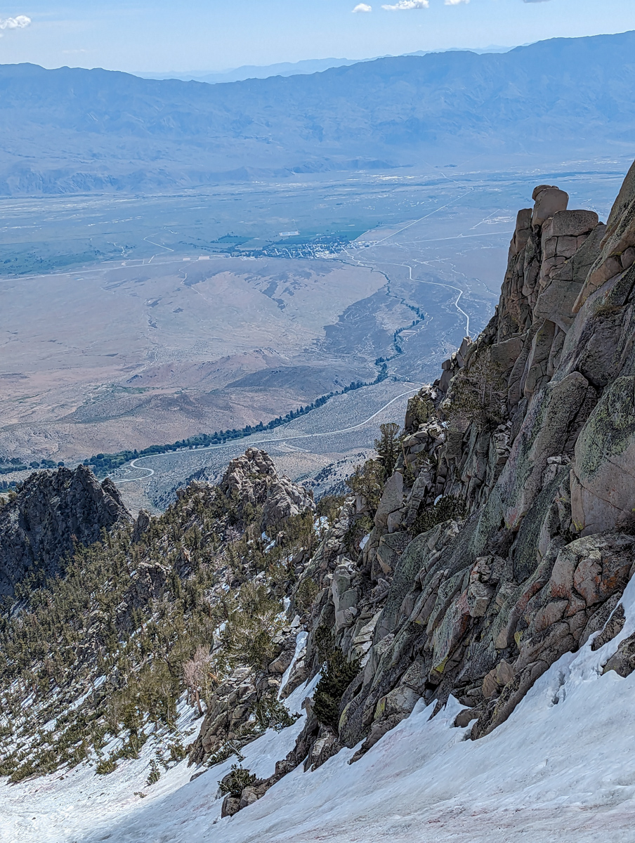
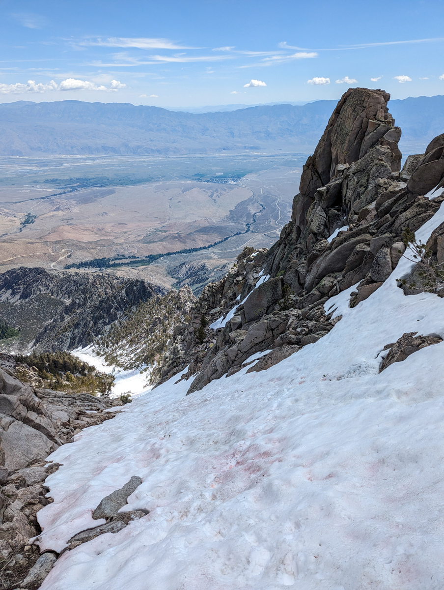
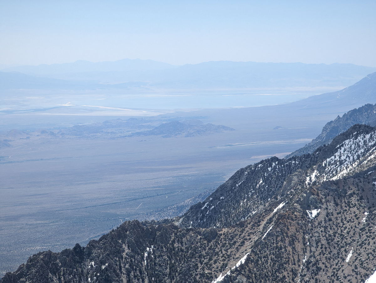
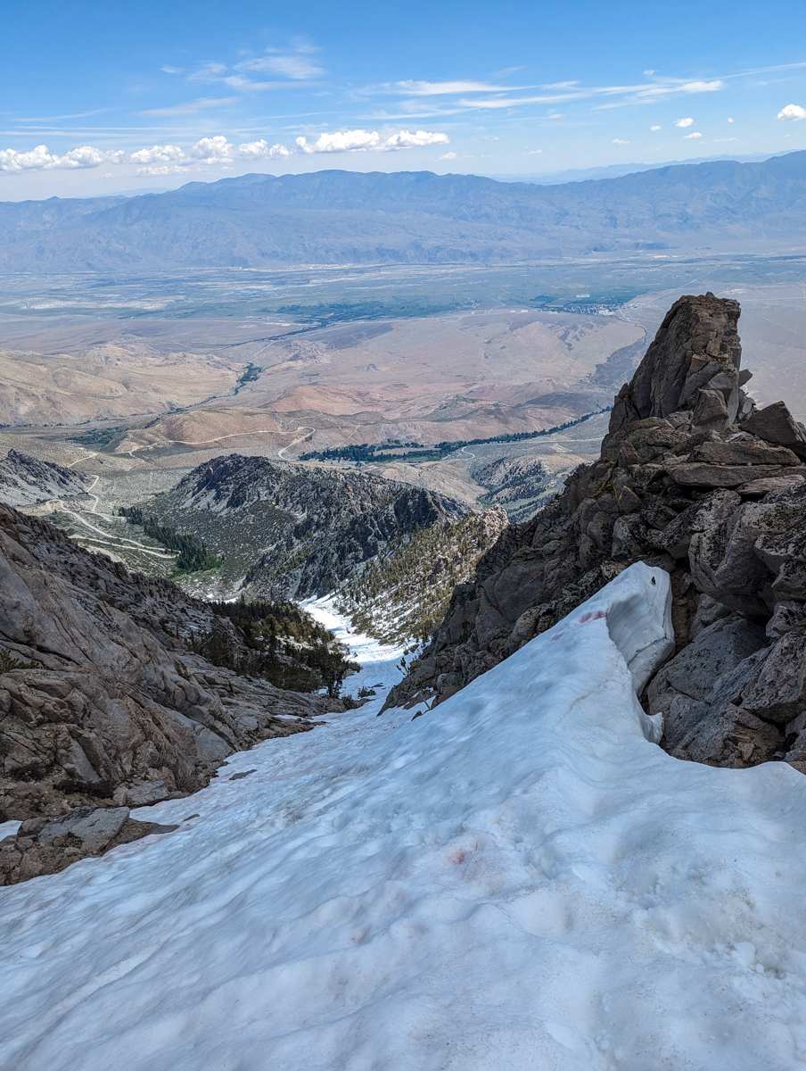
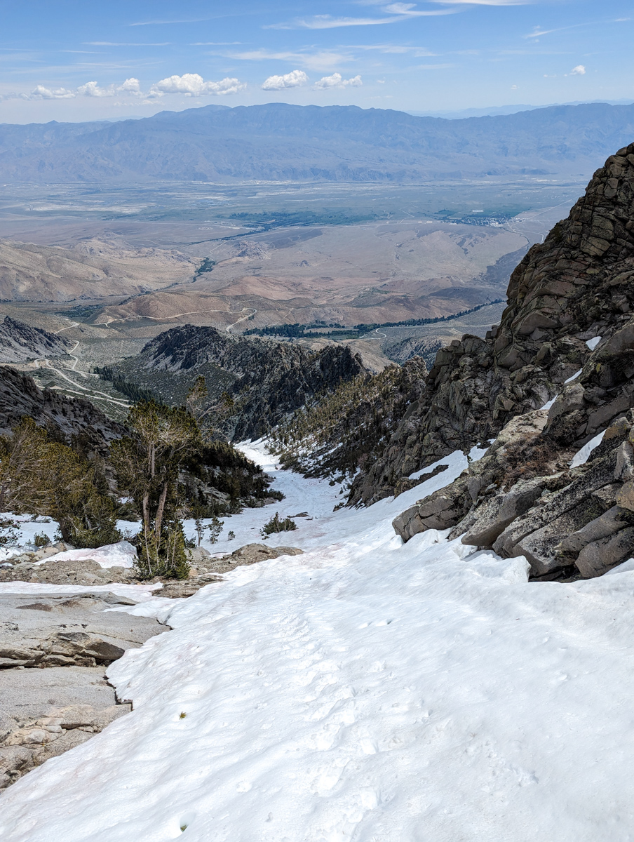
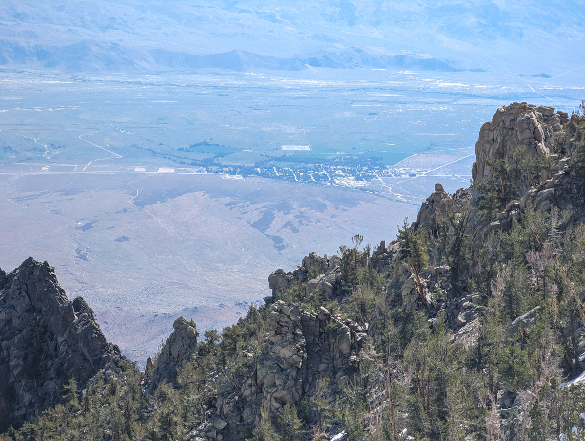
The views were ravishing.
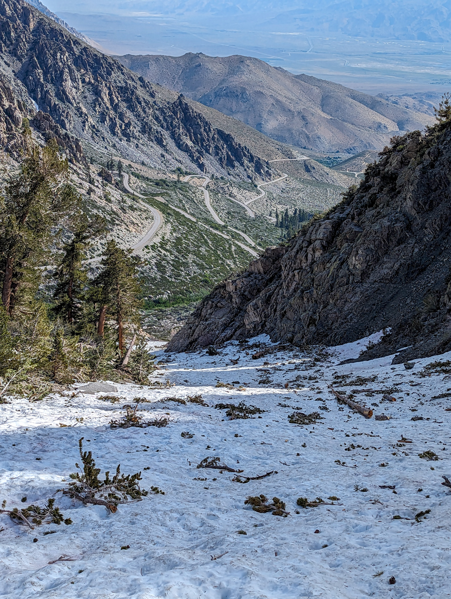
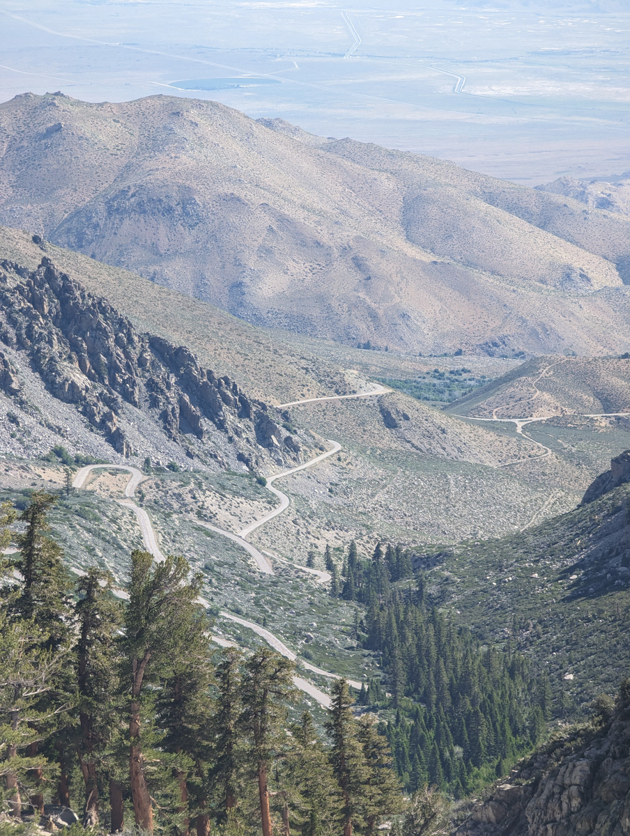
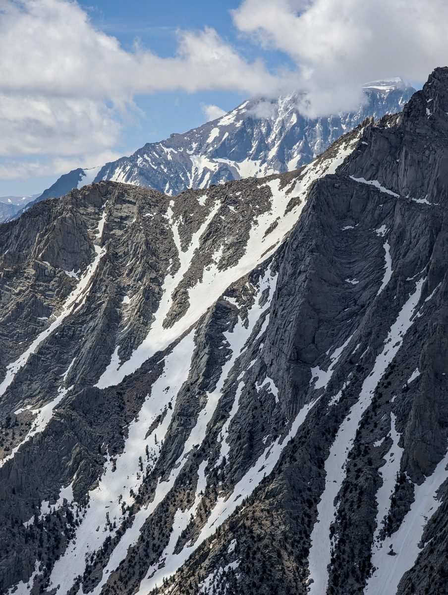
The desert floor, the town of Independence, the jagged southern edge of the chute, 14,000′ Mt. Williamson and friends, and Owens Lake (Owens Lake, which dried up in the 1920s after its streams were diverted to quench the thirst of Los Angeles, has re-emerged).
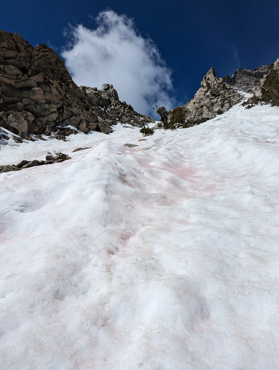
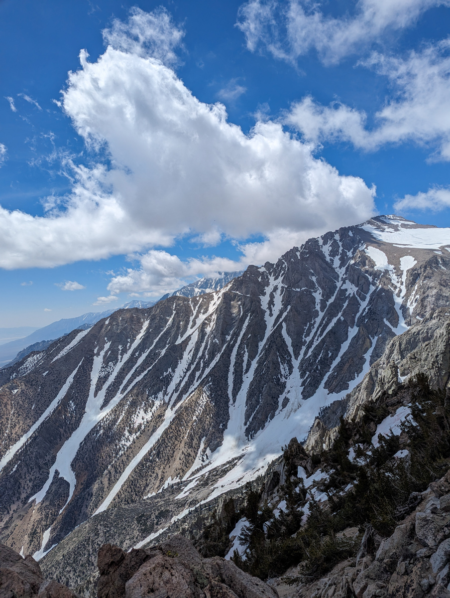
Stationary clouds had formed over the mountain, giving me fits.
I waited for them to part, but they had no such intention.
After waiting about 30 mins, a twisting break in the clouds appeared, and I went for it.
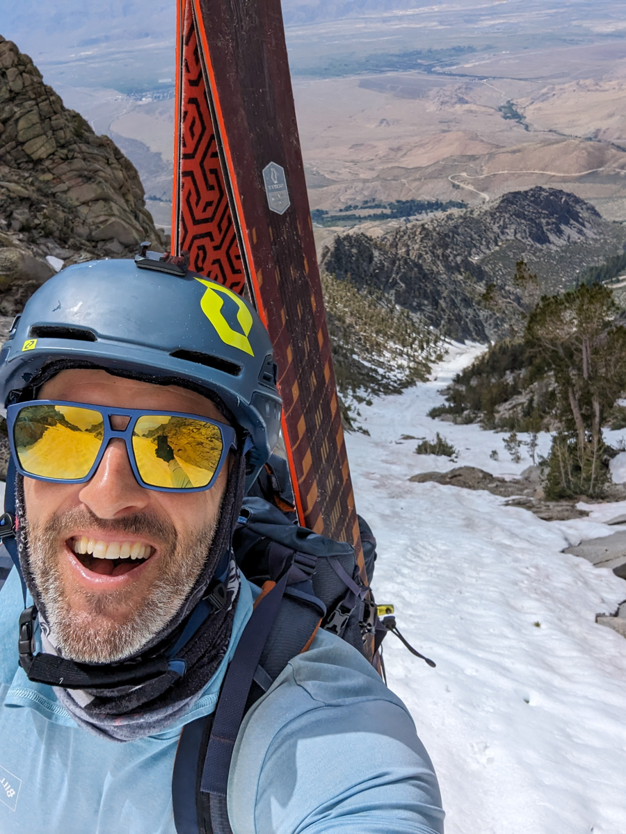
I was able to ski the entire upper, skinny part of the chute before I lost the light again.
A narrow win…
I was stoked because the upper chute skied well and was relatively flat.
That fortune was about to end.
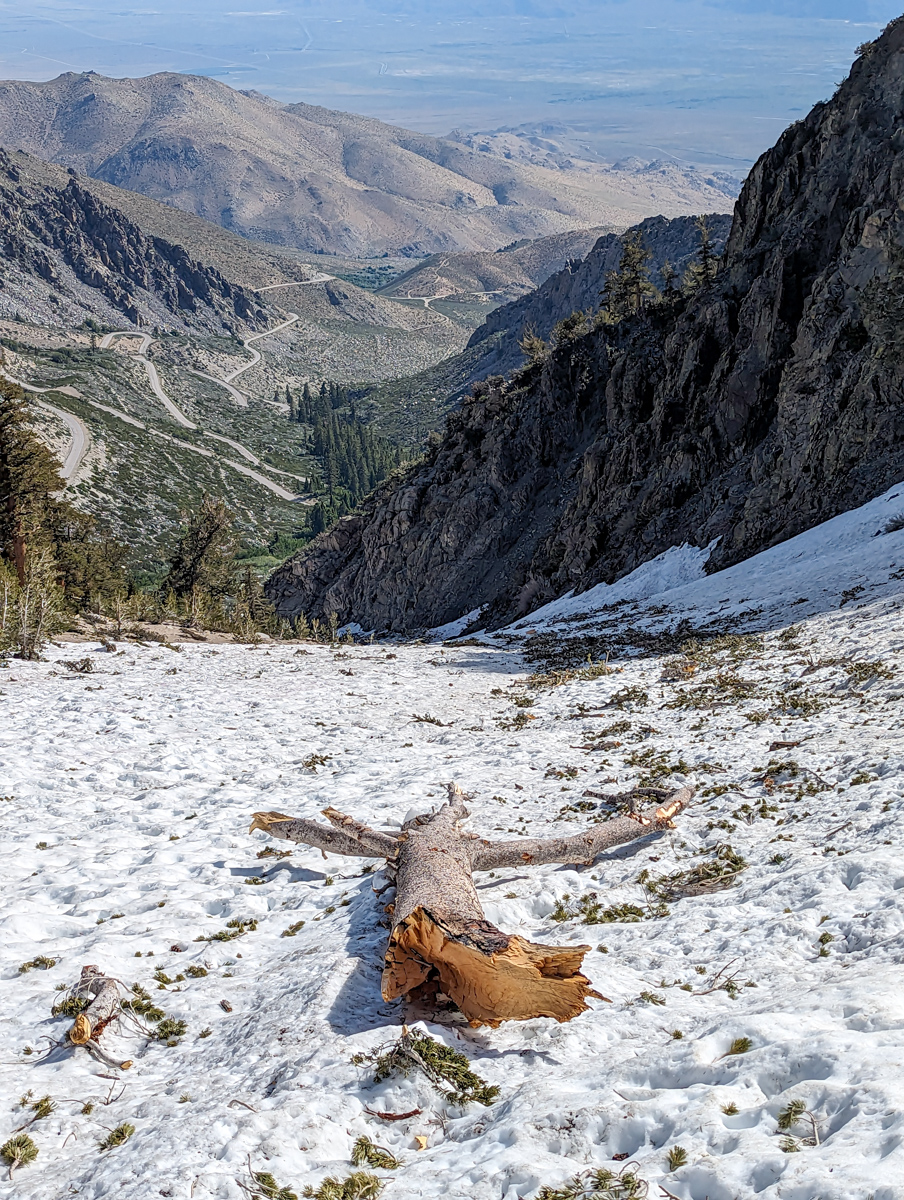
The middle of the chute was rowdy.
Deep suncups, runnels, branches, and tree trunks made turning difficult and taxing.
I stopped frequently to gasp and stuff oxygen back into my cellular network.
The bottom third of the chute skied well.
The chute bottom held an orange peel texture that skied fluently compared to the waffle iron above.
Lots of dismembered trees to avoid, but that was fun in good snow.
I hit the bottom of the chute in ecstasy.
Ski mountaineering line #18 is complete!
I was done with this zone after three distinct, highly rewarding lines (University Peak’s “North Face” &“Northeast Face,” & Independence Couloir).
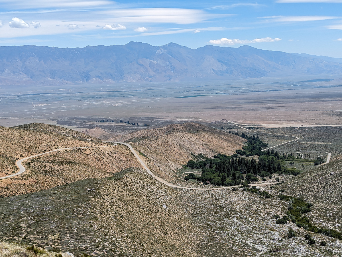
The stroll back to the car was free and easy.
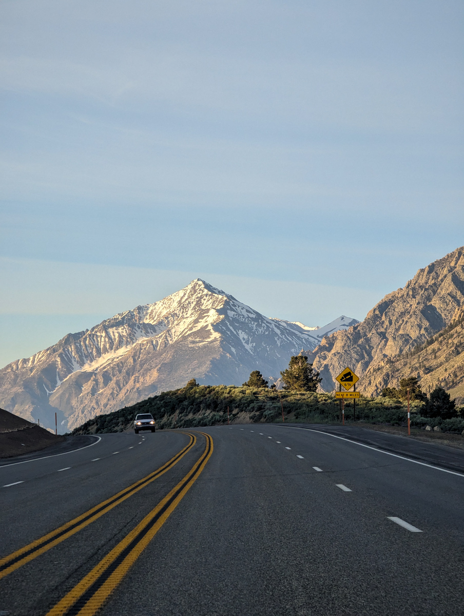
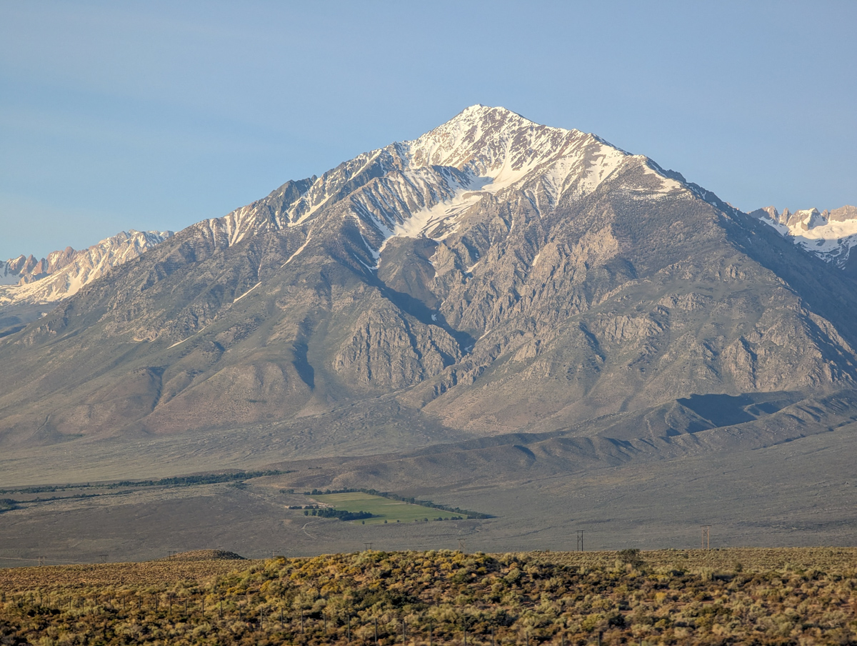
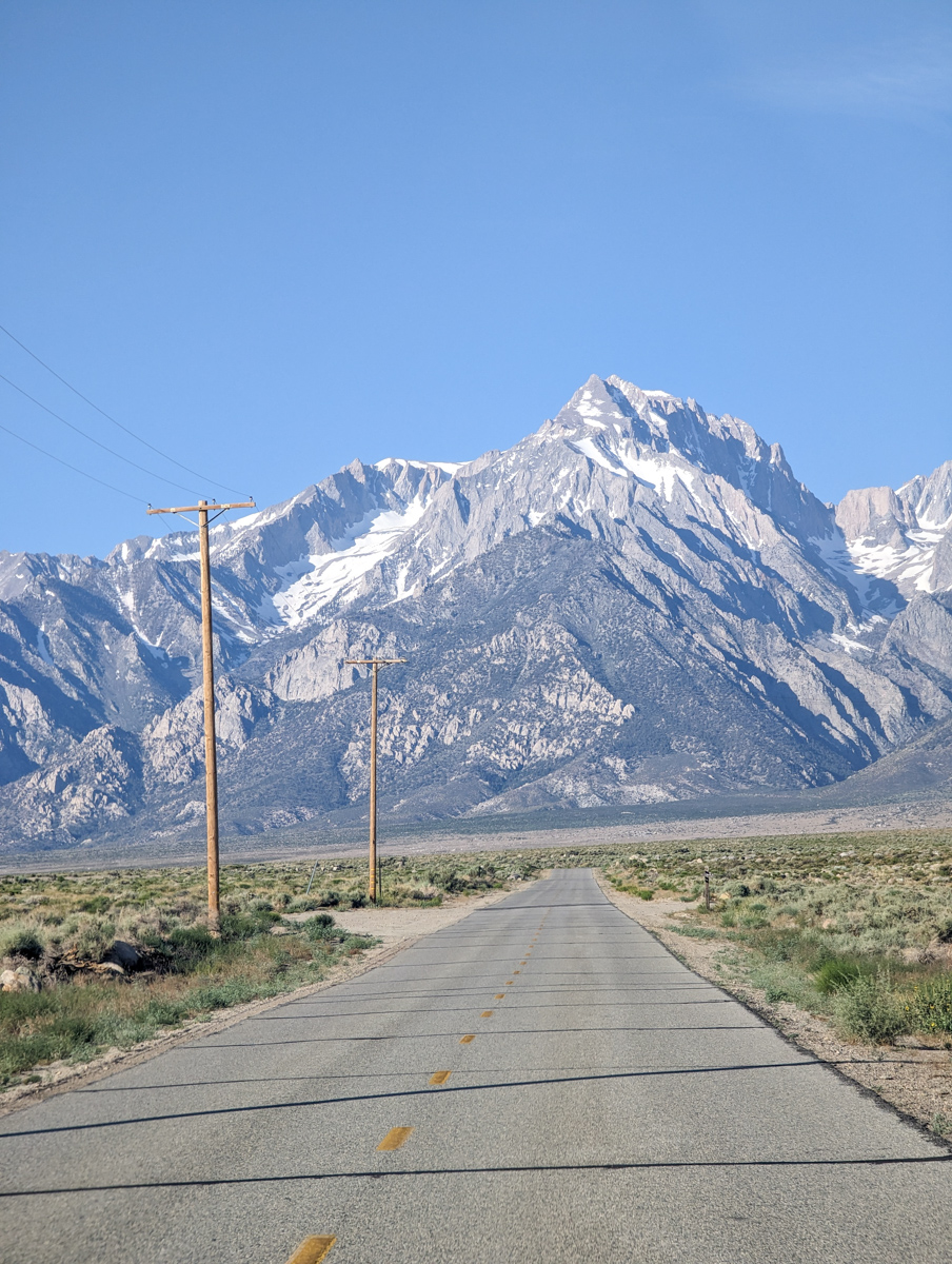
The drive down to the valley and back up to Mammoth was stunning.
The Southern Sierra is a thing of beauty and awe.
Thanks, California!
SPRING 2023 REPORTS
- 6/25/23: Trip Report: University Peak, CA – “Northeast Couloir”
- 6/22/23: Trip Report: 13,632′ University Peak, CA – “North Face”
- 6/20/23: Trip Report: 13,494′ Mt. Thompson, CA – “Trident Couloirs”
- 6/15/23: Trip Report: 12,871′ Mount Johnson, CA – “North Couloir”
- 6/9/23: Trip Report: 13,366′ Point Powell, CA – “Point Powell Couloir”
- 6/8/23: Trip Report: 12,219′ Hurd Peak, CA – “North Face”
- 6/4/23: Trip Report: The Incredible Hulk, CA – “Hulk Left Couloir”
- 6/2/23: Trip Report: 13,187′ Basin Mountain – “Basin Couloir Alternate”
- 5/31/23: Trip Report: 12,808′ Four Gables, CA – “Tungstar Bowls”
- 5/27/23: Trip Report: 11,160′ Mt. Scowden – Lundy Canyon – “North Face Chute”
- 5/24/23: Sierra Nevada, CA Report: Skiing Through A Lava Tube Cave
- 5/23/23: Trip Report: 13,118′ Mt. Emerson – The 45º Steep “North Couloir”
- 5/20/23: Trip Report: 12,200′ Mt. Esha, CA – “2nd Chute”
- 5/18/23: Trip Report: McGee Creek Peak, CA – 2,800-Vertical-Foot “Wineglass Couloir”
- 5/16/23:Trip Report: 10,908′ Carson Peak, CA – 45º Steep “Pete’s Dream”
- 5/5/15/23: Trip Report: 11,812′ Mt. Laurel, CA – 3,500-Vertical-Foot “Pinner Couloir”
- 5/10/23: Trip Report: 13,005′ Mt. Morgan, CA – Nevahbe Ridge Gullies
PHOTOS IN CHRONOLOGICAL ORDER